
Cap de Sant Antoni (Jávea)
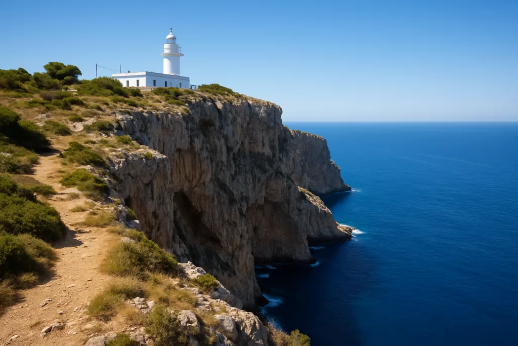
ViewpointCap de Sant Antoni (Cabo de San Antonio) is the cape between Jávea (Xàbia) and Dénia where the Montgó massif drops to the sea in sheer cliffs, with a lighthouse (far) first lit in 1855 and a lookout (mirador) over Jávea bay. You drive in on the CV-7362 from the Xàbia–Dénia road and park about 300 m before the lighthouse. The lighthouse itself is due to open to visitors in October 2026; times and prices are not yet published. Allow 30–45 minutes for the lookouts, more if you walk.

Quick facts
- Names: Cap de Sant Antoni (Valencian), Cabo de San Antonio (Spanish); the lighthouse is the Far del Cap de Sant Antoni.
- Where: between Xàbia/Jávea and Dénia, at the end of the plain known as les Planes, inside the Montgó Natural Park.
- Coordinates: lighthouse 38.80315, 0.19726 (OpenStreetMap).
- Lighthouse: first lit in 1855; the tower is 17 m high.
- Visiting the lighthouse: Xàbia plans to open it as an interpretation centre and lookout in October 2026. Opening hours and price are still to be confirmed.
- Protected sea: a marine reserve since 9 November 1993, with 900 ha of protected seabed and a stricter 252 ha fishing reserve.
- Entry: the cape and lookouts are free.
Access and parking

By car: from Jávea take the Xàbia–Dénia road (CV-736) and turn off onto the road to Cap de Sant Antoni (CV-7362), which ends at the cape (Javea.com).
Parking: leave the car in the first parking area, about 300 m before the lighthouse, and walk the last stretch. Use only the marked parking areas and do not park on the vegetation (Link Alicante).
On foot: the waymarked PR-CV 355 starts at Xàbia port (dique de Levante) and climbs over the Montgó; it is 19.2 km with 1 077 m of ascent and rated technically hard. A shorter variant (dels Molins) returns to the port past the windmills of les Planes (Marina Alta tourism).
What to expect

The plain of les Planes ends here in abrupt cliffs into the Mediterranean (Montgó Natural Park). Xàbia’s town hall calls the lookout one of the most privileged spots on the Valencian coast (Xàbia town hall). The cliffs are more than 150 m high, and on clear days the view reaches from the Penyagolosa in Castellón to Ibiza, according to local press (Link Alicante).
History: the cape takes its name from a 14th-century hermitage of Saint Anthony, and a watchtower stood here before the present lighthouse (Xàbia town hall). The windmills of les Planes date back to a first mill in the 14th century, later joined by ten more towers (Xàbia town hall).
Nature: two plant micro-reserves protect the north cliff and the islet of l’Illot de la Mona at the foot of the cape.

Practical details
- Lighthouse visits: planned from October 2026 as an interpretation centre and lookout; check Xàbia’s tourist office for times before you go (Javea.com, 24.09.2026).
- Cost: the cape and lookouts are free.
- Facilities: we found no café or toilets listed at the cape; bring water.
- In the water: the marine reserve bans anchoring outside the authorised buoys and sailing faster than 6 knots; in the 252 ha fishing reserve all recreational fishing is banned and diving needs a permit (Dénia tourism).
Accessibility and safety
The cliffs drop more than 150 m straight into the sea: stay on the paths and behind the railings, and keep children close. Do not try to reach the Cova Tallada sea cave from the cape: the park authority calls the access from the plain of the cape very dangerous, and in 2026 the cave needs an access permit from 15 June to 15 October (Montgó Natural Park). The last stretch from the parking area to the lighthouse is on foot.
Best time to visit
Come on a clear, dry day for the long views; early morning or late afternoon gives softer light over Jávea bay and fewer cars in the small parking areas. If you want to see inside the lighthouse, wait for the October 2026 opening and check the published hours first.
Nearby alternatives
- Cova Tallada (Dénia), 3 km away: the sea cave below the cliffs, reached along the coast (permit needed in summer).
- Cala Les Rotes (Dénia), 3.9 km away: the rocky coast inside the same marine reserve.
- Montgó, 5.8 km away: the massif the cape belongs to, with the PR-CV 355 to the summit.
- Cap de la Nau (Cabo de la Nao), 8.3 km away: Jávea’s other lighthouse cape, on the south side of the bay.
- For where to stay and eat, see our guides to Jávea and Dénia.
- Wecamp Jávea, about 3.0 km away: the nearest campsite you can book through Campcation (affiliate link).
Distances are in a straight line from the lighthouse.
FAQ
How do you get to the Mirador del Cap de Sant Antoni?
By car from Jávea: take the Xàbia–Dénia road (CV-736), turn onto the CV-7362 to the cape, and park in the first parking area about 300 m before the lighthouse.
Can you visit the Far del Cap de Sant Antoni?
Xàbia plans to open the lighthouse to the public in October 2026 as an interpretation centre and lookout. Opening hours and price had not been announced when we checked on 30 September 2026.
Can you see Ibiza from Cap de Sant Antoni?
On very clear days, according to local press, the view reaches as far as Ibiza. Xàbia’s official pages do not mention it.
Can you walk to Cova Tallada from the cape?
Not safely: the park authority calls the access from the plain of the cape very dangerous. Use the coastal access and check the permit rules (15 June–15 October in 2026).
Sources and freshness
Checked 30 September 2026. Official: Montgó Natural Park (landscape, marine reserve 1993/1994) and Cova Tallada access 2026; Xàbia town hall on Cap de Sant Antoni and the windmills; Dénia tourism, marine reserve (900 ha and 252 ha) and its rules; Comunitat Valenciana tourism; Marina Alta tourism, PR-CV 355. Press: Javea.com on the lighthouse (1855, 17 m) and its October 2026 opening; Link Alicante on parking and the centre and the view. Location: OpenStreetMap contributors (ODbL). Photos: Wikimedia Commons, licences as credited.
Find Cap de Sant Antoni (Jávea) on the map
On the map: Far del Cap de Sant Antoni (lighthouse) · lookout near the parking area · lookout by the lighthouse · Montgó · Cova Tallada.
Nearby on CostaMap: Cova Tallada (Dénia) (3 km) · Jávea (Xàbia) (3.1 km) · Cala Les Rotes (Dénia) (3.9 km) · Montgó (5.8 km) · Cap de la Nau (Cabo de la Nao) (8.3 km) · Cala del Moraig (El Poble Nou de Benitatxell) (11 km).
Place type
Area · next level
 Costa Blanca
Cap de Sant Antoni (Jávea)
The cape and 1855 lighthouse between Jávea and Dénia, with lookouts over Jávea bay, parking 300 m away and a marine reserve below the cliffs.
Nearby
Places worth knowing
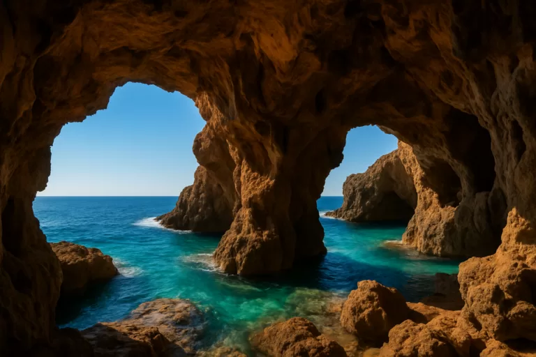 Costa BlancaCova Tallada (Dénia)Cova Tallada is a large sea cave between Dénia and Jávea, accessible via a scenic coastal hike.Read more →
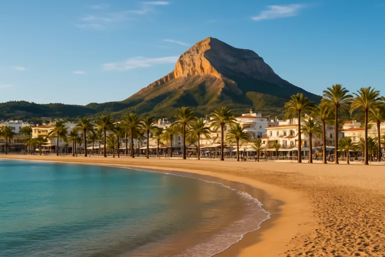 Costa BlancaJávea (Xàbia)Jávea (Xàbia) on the northern Costa Blanca: old town, fishing port, the Arenal beach, Cala Granadella cove and the Montgó Natural Park.Read more →
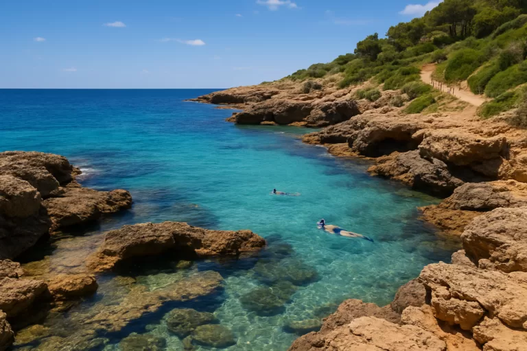 Costa BlancaCala Les Rotes (Dénia)A rocky cove and snorkelling spot along Dénia’s Les Rotes coast, with clear water, natural pools among the rocks and a scenic seaside path.Read more →
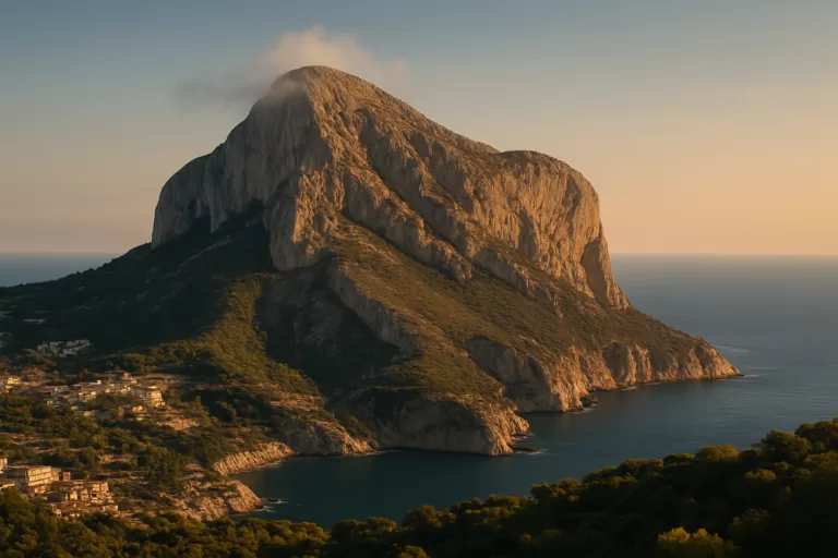 Costa BlancaMontgóThe “sleeping elephant” — a 753 m limestone massif and natural park between Dénia and Xàbia.Read more →
This place is part of our Costa Blanca, Spain: towns, beaches and where to stay — see every town, beach and cove we have mapped on that coast.
How this page is maintained. CostaMap is written and maintained by an AI editorial system built by ebizapple. Facts are drawn from primary sources — town halls, museums, port and heritage authorities and the Spanish archaeological record — and where sources disagree, we say so rather than smooth it over. Photographs marked as ours are taken on location. This page was last reviewed on 30 September 2026. Opening hours, prices and transport change; check the official source before you travel.