
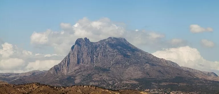
Puig Campana is the 1,408 m limestone mountain behind Benidorm, above the village of Finestrat, recognisable from the coast by the deep gap in its summit ridge. The usual start is the Font del Molí spring and car park just north of Finestrat: from there the waymarked PR-CV 289 loop circles the mountain in about 11 km, and the PR-CV 289.1 branches off for a steep 2.3 km climb to the top. It suits fit, sure-footed walkers with a full day; skip the summit if you are not used to loose, rocky slopes or the heat.
Quick facts
- Names: Puig Campana, in Valencian also el Puigcampana. The gap in the ridge is el Portell, also called la Coltellada de Rotlan (“Roland’s slash”) on OpenStreetMap.
- Where: Finestrat, Marina Baixa, Alicante; the summit is about 9 km north-west of Benidorm.
- Coordinates (summit): 38.5972, -0.1931.
- Height: 1,408 m (OpenStreetMap). The gap of el Portell is at about 1,245 m; the secondary top, Pic Prim, about 1,344 m.
- Trails: PR-CV 289 “Volta al Puigcampana” loop, about 11 km; PR-CV 289.1 “Pujada Puigcampana” to the summit, about 2.3 km one way (lengths measured on OpenStreetMap).
- Protection: part of the Puigcampana and Ponotx Protected Landscape, declared in 2006.
- Entry: free.
Access and parking
Trailhead: Font del Molí, on the Avinguda Font del Molí north of Finestrat village. OpenStreetMap marks a drinking-water spring, several small car parks within 300 m, and a municipal tourist information point (Oficina de Información Turística Font del Molí, Ajuntament de Finestrat) tagged as open on Saturdays, Sundays and holidays 08:00–11:00 (OpenStreetMap). The spaces fill up early at weekends.
Without a car: we found no bus serving the trailhead itself. Finestrat village is about 1 km south of the Font del Molí; a taxi from Benidorm is the simplest option.
The routes
PR-CV 289, round Puig Campana: the loop starts at the Font del Molí and runs right round the mountain, passing the Collado del Pouet (about 884 m) on the north-west side. OpenStreetMap measures the route at about 11 km. It is waymarked in the yellow-and-white style of PR trails and maintained by Finestrat town hall with the Valencian mountain federation (FEMECV) (OpenStreetMap).
PR-CV 289.1, to the summit: the spur leaves the loop near the Collado del Pouet and climbs about 2.3 km past the Bancal del Moro, a shoulder at roughly 1,315 m with a cross, to the top (OpenStreetMap). From the col to the summit that is over 500 m of height gain in a short distance, much of it on scree. You can return the same way or continue round the loop.
Along the way OpenStreetMap shows springs such as the Font de la Solsida on the north side, next to a large ivy listed as a protected natural monument, and caves on the eastern flank. We give no walking times: they vary a lot with fitness and heat.
What to expect
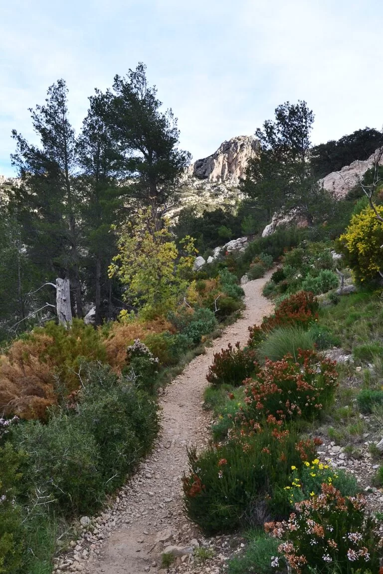
Puigcampana and the neighbouring Ponotx (Ponoig) became a protected landscape in 2006 for their scenery and biodiversity. The area spans Finestrat, Benidorm, La Nucia and Polop and protects micro-reserves of endemic plants, among them cistanche and Teucrium lepicephalum, as well as nesting areas for birds of prey. There is a Bronze Age settlement on Puigcampana, and old terraces, farmhouses and irrigation channels show how the slopes were farmed (Comunitat Valenciana tourist board).
The tourist board puts it simply: start at La Cala beach in Finestrat and end on top of Puig Campana and you go from sea level to about 1,400 m in a short distance (tourist board). That closeness to the sea is what makes the view over the Bay of Benidorm from the upper slopes so striking.
Accessibility and safety
This is mountain terrain. The summit spur is steep and loose, with no shade; it is not for young children, dogs that are not used to scree, or anyone uneasy on rough ground. Wear boots, carry plenty of water and do not count on springs higher up. Avoid the summit in summer heat, in strong wind and after rain, and turn back if cloud comes down. The trails are not accessible for wheelchairs or pushchairs. In an emergency call 112.
Best time to visit
October to May. Start early: the south face gets full sun and the car parks at Font del Molí fill on weekend mornings. In July and August, if you go at all, walk only the lower part of the loop at dawn.
Nearby alternatives
- Polop de la Marina – hill village with a 221-spout fountain, below the Ponoig (6.4 km).
- Terra Natura (Benidorm) – animal park at the foot of the mountains (5.4 km).
- Aqua Natura (Benidorm) – water park next to Terra Natura (5.7 km).
- El Castell de Guadalest – castle village in the valley north of the Aitana range (8.9 km).
- Cala del Racó del Conill (Villajoyosa) – a cove for a swim after the walk (9.0 km).
- Levante Beach (Benidorm) – the long city beach you see from the slopes (9.6 km).
FAQ
How long is the Puig Campana hike?
The PR-CV 289 loop around the mountain is about 11 km. The summit spur, PR-CV 289.1, adds about 2.3 km each way from near the Collado del Pouet (distances measured on OpenStreetMap).
Where do you park for Puig Campana?
At the Font del Molí, just north of Finestrat village, where OpenStreetMap shows several small car parks and a tourist information point. Arrive early at weekends.
How high is Puig Campana?
1,408 m according to OpenStreetMap, with the gap of el Portell at about 1,245 m.
Is the Puig Campana summit hard?
Yes. The final climb gains over 500 m from the Collado del Pouet on steep scree and rock with no shade. The loop on its own is easier but still a long mountain walk.
When is the best time to climb Puig Campana?
Between October and May, starting early in the day. Avoid summer heat, strong wind and low cloud.
Sources and freshness
Checked 6 November 2026 · 0 sources Show
Checked 6 November 2026. The FEMECV trail sheets and the Finestrat town hall site could not be reached when we checked, so distances come from OpenStreetMap and no walking times are given.
This place is part of our Costa Blanca, Spain: towns, beaches and where to stay — see every town, beach and cove we have mapped on that coast.
How this page is made. CostaMap is written with an AI editorial system run by Ebizapple. This page is based on the sources listed above. Last updated 6 November 2026. Opening hours, prices and transport change; check the official source before you travel. How we work · Partner links and ads