
Costa Blanca · Marina Baixa
Marina Baixa: Altea, Benidorm and Villajoyosa travel guide: the bays of the central Costa Blanca
From the white old town of Altea past the Serra Gelada cliffs and the two beaches of Benidorm to the painted houses of Villajoyosa, with Guadalest and the Algar falls inland.
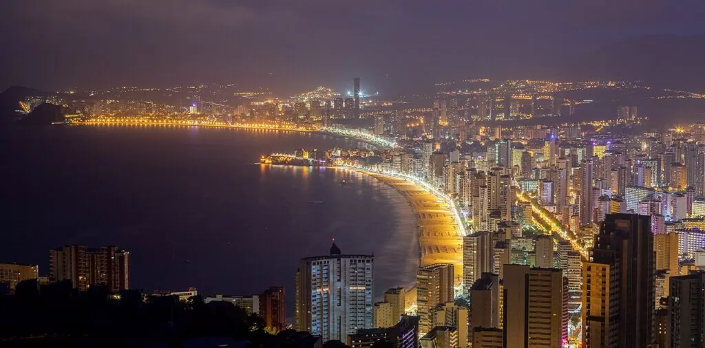
Benidorm at dusk from the Serra Gelada side · Photo: Diego Delso, CC BY-SA 3.0
Part of the Costa Blanca guide · North-centre: Marina Baixa, Altea to Villajoyosa · Interactive map of the comarca →
The Marina Baixa is the comarca in the middle of the Costa Blanca, in Alicante province, whose coast runs about 20 km in a straight line from Altea in the north to Villajoyosa in the south, through L’Alfàs del Pi, Benidorm and Finestrat. The cliffs of the Serra Gelada split the bays of Altea and Benidorm, and Puig Campana, Bèrnia and Aitana rise close behind (Turisme Comunitat Valenciana). Below: each town north to south, Benidorm district by district, beaches, things to do, where to stay, transport and a two-day route.
At a glance
- Where the coast of the Marina Baixa in Alicante province, between the Mascarat cliffs under the Serra de Bèrnia north of Altea and the beaches south of Villajoyosa; Altea and Villajoyosa are about 20 km apart in a straight line (OpenStreetMap).
- Towns Altea, L’Alfàs del Pi and L’Albir, Benidorm, Finestrat and La Cala, and Villajoyosa on the coast; Polop, La Nucia, Callosa d’en Sarrià, El Castell de Guadalest, Sella, Relleu and Orxeta inland.
- Best for city beaches and theme parks in Benidorm, the old town of Altea, Serra Gelada cliff walks, the painted houses of Villajoyosa, and mountain villages and waterfalls inland.
- Getting there Alicante airport is about 48 km from Benidorm in a straight line, with hourly ALSA buses; the TRAM links Alicante with Benidorm and runs on to Altea and Dénia, and the N-332 and the AP-7 run behind the coast.
- On CostaMap every coastal town, Levante, Poniente and Albir beaches, the Serra Gelada, Guadalest, the Algar falls and the five Benidorm parks.
Map of the Marina Baixa coast
Places in the Marina Baixa with a CostaMap page. Tick a type to filter; click a marker to see the place. Also see the interactive map of the Marina Baixa.
Place type
Area · next level
 Area map
Marina Baixa: Altea to Villajoyosa
Click a marker to see the place here. From Altea past the Serra Gelada and Benidorm to Villajoyosa, with Guadalest and the Algar falls inland.
Towns and villagesTowns and villages
North to south along the coast, then the villages inland.
Altea
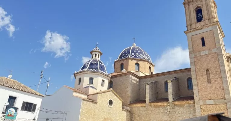
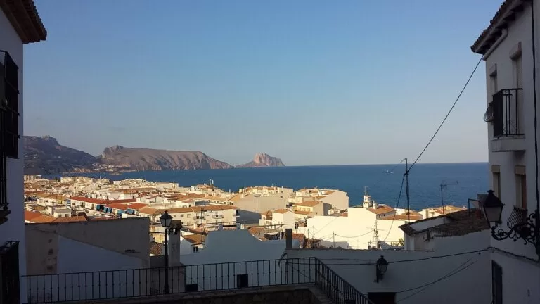
Altea’s white houses and the blue-tiled domes of Nuestra Señora del Consuelo earned it the nickname “dome of the Mediterranean” (Turisme Comunitat Valenciana). Walk the walled old town from the Portal Vell along Calle Salamanca to the Portal Nou and up to the church, rebuilt in Neo-Baroque style in 1900–1910 and free to visit (Turisme Comunitat Valenciana). Below lie the port and about six kilometres of pebble beaches and coves (Spain.info). Read our Altea guide, the old town walk and the Altea place page; the Marina Greenwich lies under Mascarat.
L’Alfàs del Pi and L’Albir
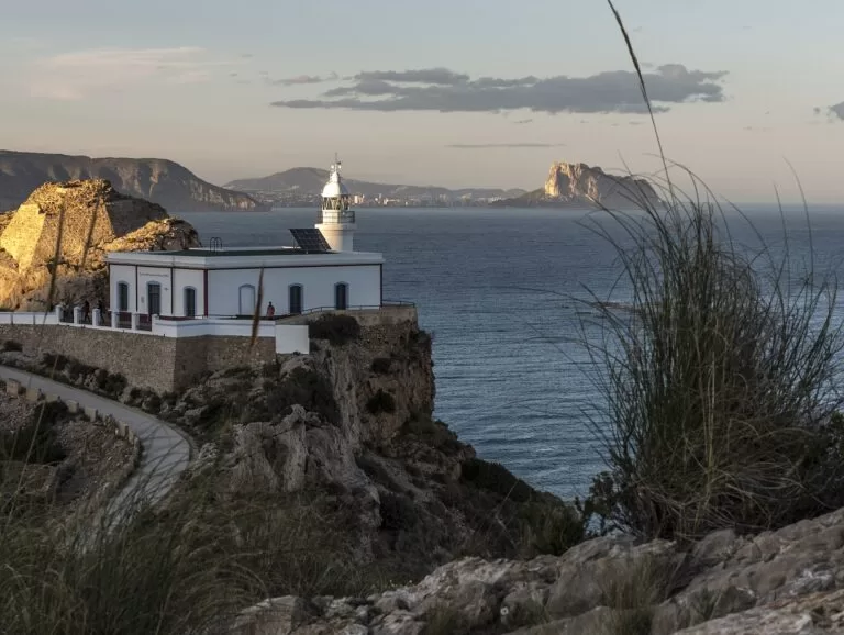
L’Alfàs del Pi has an inland centre with the 18th-century church of San José and the Delso Museum, and a seaside district, L’Albir, facing Altea (Turisme Comunitat Valenciana). L’Albir has a half-kilometre pebble beach, the Paseo de las Estrellas for the town’s annual film festival, a Roman villa with an open-air museum and the accessible trail through the Serra Gelada to the lighthouse. Read our L’Alfàs del Pi guide, Albir Beach and Faro del Albir. Campers have Orange Grove Camper Park and Camping La Media Legua towards Benidorm.
Benidorm
Benidorm, the largest resort on the Costa Blanca, has about five kilometres of coast, an old town on a promontory between two long beaches and avenues of hotels on either side (Spain.info). It is flat enough to cross on foot, and Llorente Bus runs 18 city lines linking beaches, hotels and theme parks (Benidorm tourism). Choose your district before you book. Read our Benidorm guide and the Benidorm place page.
Benidorm: Levante and the Rincón de Loix
Levante has more than two kilometres of fine sand between Punta Canfali and Punta Pinet, the busiest promenade and the nightlife (Turisme Comunitat Valenciana). The Rincón de Loix at its north-eastern end has its own tourist office and many of the hotels. Beyond it, the Tío Ximo and Almadrava coves under the Serra Gelada are reached on foot from the Punta de l’Escaleta viewpoint (Turisme Comunitat Valenciana). See Levante Beach, Aqualandia and Mundomar, both on this side of town.
Benidorm: the old town
The original fishing village keeps narrow streets around the 18th-century church of San Jaime Apóstol, with its blue domes and the image of the Virgen del Sufragio, said to have been found in a boat adrift (Turisme Comunitat Valenciana). Next to it, on the site of a 14th-century castle, the Balcó del Mediterrani looks out to the island. Below, the 120 m Mal Pas beach faces the island’s marine reserve (Turisme Comunitat Valenciana), and boats leave the port for it. See the Balcó del Mediterrani and Benidorm Island.
Benidorm: Poniente and the Tossal de la Cala
Poniente, south-west of the port, is 3,100 m of fine sand with a calmer promenade, two accessible bathing points and the Blue Flag since 1987 (Benidorm tourism). At its far end the Tossal de la Cala holds a Roman fort from the 2nd and 1st centuries BC, open to walk round or by guided tour booked by email (Turisme Comunitat Valenciana). Inland are the parks. See Poniente Beach, the Tossal de la Cala, Terra Mítica, Terra Natura and Aqua Natura.
Finestrat and La Cala
On the coast, La Cala de Finestrat is a 270 m sandy bay between La Barreta and the El Xoriguer ridge, with a cliff path to a watchtower (Turisme Comunitat Valenciana). Up the hill, the old town stands on the foundations of an Arab castle, with a viewpoint over the comarca and the church of Sant Bertomeu; from the beach to the top of Puig Campana you climb to about 1,400 m (Turisme Comunitat Valenciana). Read our Finestrat guide, La Cala de Finestrat and Puig Campana.
Villajoyosa (La Vila Joiosa)
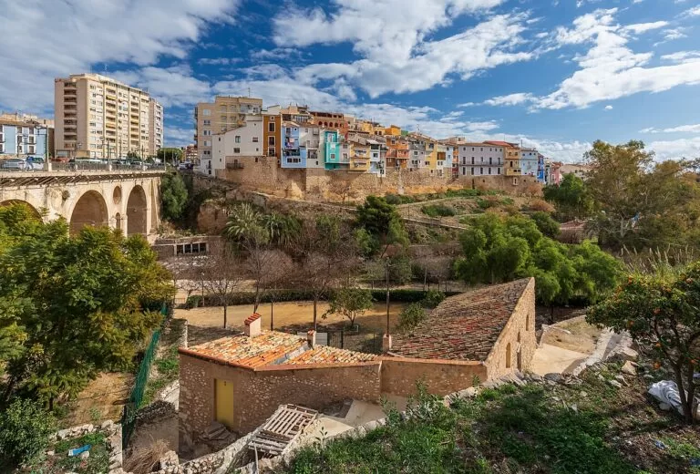
The capital of the Marina Baixa is known for its painted fishermen’s houses. The listed old town keeps a Renaissance wall on Costera de la Mar, with the church of the Asunción built into it (Turisme Comunitat Valenciana). Valor’s Museu Valencià del Xocolate, opened in 1998, ends with a tasting (Turisme Comunitat Valenciana), and Vilamuseu shows Iberian, Roman and Islamic finds. Read our Villajoyosa guide, the painted houses and the place page.
Polop and La Nucia
Polop grew up around its 12th-century castle; in the Plaça dels Xorros the fountain of 1885 has had 221 spouts since 1947, and the Gabriel Miró house museum is nearby (Turisme Comunitat Valenciana). La Nucia, near the Guadalest valley, has a large international community, the Favara fountain and waterfall, and Fiestas Mayores from 14 to 18 August (Turisme Comunitat Valenciana). Read our Polop guide and La Nucia guide.
Callosa d’en Sarrià and the Algar falls
Callosa d’en Sarrià, below the Serra de Bèrnia, is known for its loquats, its last town gate, El Portal, and an 18th-century wash house with twelve spouts (Turisme Comunitat Valenciana). The Fonts de l’Algar, 3 km from town and 15 km from Benidorm, is a Protected Water Area with a 1.5 km riverside path past waterfalls and swimming pools (Turisme Comunitat Valenciana). Read our Algar Waterfalls guide and Camping Fonts de l’Algar.
El Castell de Guadalest
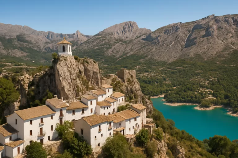
Guadalest is listed among the most beautiful villages in Spain. Its historic centre sits on a sheer rock, topped by the ruins of the 11th-century San José castle, damaged by two earthquakes and an explosion; there is an ethnological museum, several small collections and an easy walk round the reservoir below (Turisme Comunitat Valenciana). Read our Guadalest guide.
Sella, Relleu and Orxeta
Three quiet villages behind Villajoyosa and Finestrat. Sella has the easy Water Route and climbing on the Aitana slopes (Turisme Comunitat Valenciana); Relleu has the El Figueret via ferrata (Turisme Comunitat Valenciana); Orxeta has a castle ruin 45 minutes’ walk away and a viewpoint over the Amadorio reservoir (Turisme Comunitat Valenciana).
Beaches and coves
From north to south. Lengths and services are as the official tourist boards list them, checked November 2026. North of Benidorm the beaches are mostly pebble; Benidorm, Finestrat and the centre of Villajoyosa have sand.
Mascarat to Cap Blanc
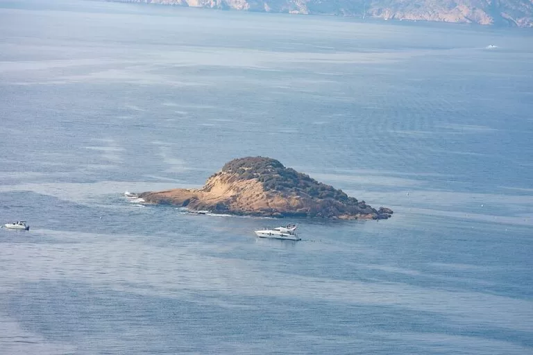
Mascarat is a pebble cove under the Bèrnia cliffs (Turisme Comunitat Valenciana); La Solsida, past Porto Senso, is naturist (Turisme Comunitat Valenciana); La Olla (about 1.5 km) has a dog area and two islets (Turisme Comunitat Valenciana). In town, La Roda (1.4 km) and L’Espigó offer assisted bathing (Turisme Comunitat Valenciana); Cap Blanc borders L’Albir.
See the Illa de l’Olla →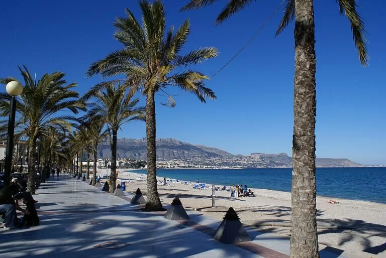
Albir Beach
About half a kilometre of Blue Flag pebbles with lifeguards, footbaths, sunbed hire and play areas, next to the Paseo de las Estrellas (Turisme Comunitat Valenciana). Small coves such as Cala de la Mina lie below the lighthouse trail (OpenStreetMap).
See the Albir Beach guide →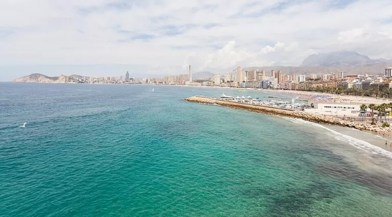
Levante, Mal Pas and Poniente
Levante has more than 2 km of sand and the liveliest promenade; Mal Pas is a 120 m cove under the old town; Poniente runs 3,100 m to the Tossal de la Cala. Both big beaches get sun until after 8 pm in summer (Benidorm tourism).
See the Poniente Beach guide →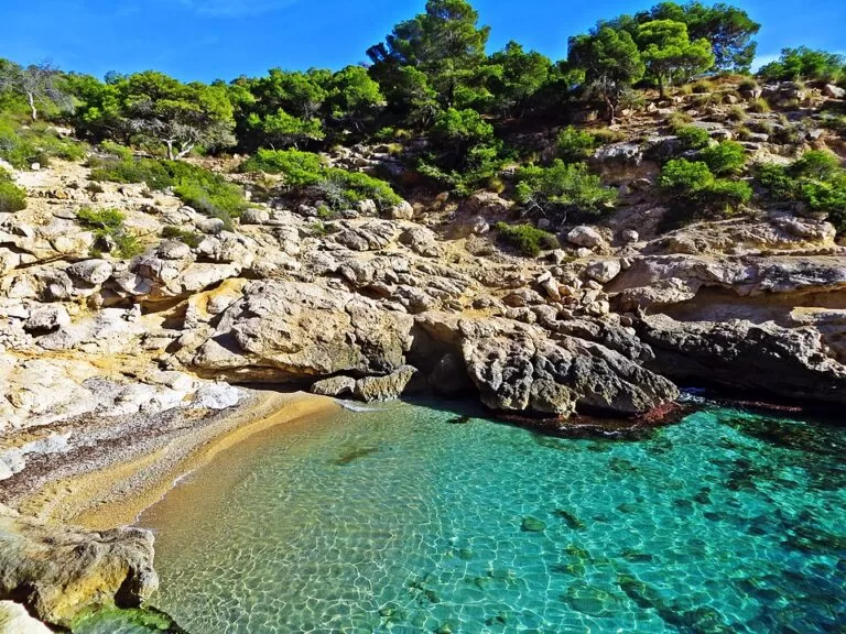
Racó del Conill to El Xarco
North of town are the naturist Racó del Conill coves and Bol Nou. Ciudad beach (over 1,300 m of sand) runs past the painted houses, with adapted bathing (Turisme Comunitat Valenciana). South are El Paraíso, El Torres (560 m) and El Xarco (580 m, dog area) (Turisme Comunitat Valenciana).
See the Racó del Conill guide →Things to do
Nature: cliffs, peaks and waterfalls
The Serra Gelada Natural Park covers 5,653.92 ha, most of it sea and islets, with cliffs over 300 m between Benidorm, L’Alfàs del Pi and Altea; a trail links Benidorm with L’Albir (Turisme Comunitat Valenciana). Inland, Puig Campana and Ponotx are a protected landscape since 2006, used for walking and climbing (Turisme Comunitat Valenciana). To the north, the Serra de Bèrnia reaches 1,129 m, with the rock tunnel of the Forat de Bèrnia (Turisme Comunitat Valenciana). For a swim in fresh water, go to the Algar falls.
History: Roman forts, castles and pirate towers
Start at the Tossal de la Cala in Benidorm, a Roman fort from the 2nd and 1st centuries BC, then Villajoyosa’s walled old town, its Roman funerary Torre de Sant Josep and Vilamuseu, founded by local people in 1975 (Turisme Comunitat Valenciana). The castles of Polop and Guadalest are a short drive inland. Along the coast, the 16th-century Torre Bombarda in L’Albir and Torre del Xarco in Villajoyosa were built to watch for corsair raids (Turisme Comunitat Valenciana).
Food, festivals and family days
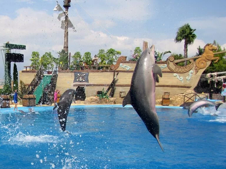
Benidorm has five parks with CostaMap guides: Terra Mítica, Aqualandia, Mundomar, Terra Natura and Aqua Natura. Expect rice and fish on the coast (Spain.info), pilotes de dacsa inland and chocolate in Villajoyosa. The big festival is Villajoyosa’s Moors and Christians, of International Tourist Interest, with a re-enacted landing on the beach (24–31 July in 2026) (Turisme Comunitat Valenciana); Altea has the Castell de l’Olla fireworks in August.
Where to stay by town
The towns we would base a trip in, north to south. We name no hotels; compare licensed accommodation on the regional tourist board’s search.
Altea
An old town on a hill, a seafront promenade with fish and rice restaurants, three marinas and pebble beaches. The TRAM to Benidorm and Dénia stops in town.
Couples, old-town evenings, boatingL’Albir
A smaller resort with a pebble beach, the Paseo de las Estrellas and the Serra Gelada on the doorstep; quieter than Benidorm, 6 km away.
Families, walkers, longer stays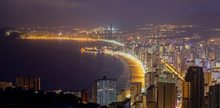
Benidorm
The widest choice: Levante for nightlife and the Rincón de Loix, the old town for character, Poniente for a calmer, more Spanish beach. Theme parks and city buses everywhere.
Beaches, nightlife, theme parksVillajoyosa
A working town with a sandy town beach, the painted houses, a chocolate museum and quiet coves north and south; on the TRAM line to Alicante.
Local life, food, a quieter baseGetting there and around
By air
Alicante-Elche airport is about 38 km from Villajoyosa, 48 km from Benidorm and 57 km from Altea in a straight line (OpenStreetMap). Benidorm’s tourism office lists hourly ALSA buses from 8:00 to midnight, about 45 minutes for 11–12 euros, and taxis or transfers of about 40–45 minutes (Benidorm tourism, checked November 2026).
By TRAM
The Alicante TRAM is a tram-train from Alicante to Benidorm (line 1, about 70 minutes) and a commuter railway from Benidorm along the coast to Altea, Calp and Dénia (line 9), run by FGV (Wikipedia). Benidorm’s station is on Avenida Beniardà (Benidorm tourism). Check FGV for current times and any engineering works.
By car and bus
The N-332 and the A-7/AP-7 run behind the coast (Turisme Comunitat Valenciana). Benidorm has a Low Emission Zone covering the old town and both promenades, with camera control (Benidorm tourism). Inside Benidorm, Llorente Bus runs 18 lines; for Guadalest, Polop or the Algar falls a car is easiest.
A two-day route
By car, based in Benidorm or L’Albir. Day 1 needs a car; day 2 can be done by TRAM and on foot.
Day 1
Polop, Guadalest and the Algar falls
Start at Polop and its 221-spout fountain, then drive up to Guadalest for the castle rock and a walk by the reservoir. After lunch, cross to Callosa d’en Sarrià and spend the afternoon on the 1.5 km path and pools of the Algar falls. Back on the coast, end with sunset from the Balcó del Mediterrani in Benidorm’s old town.
Day 2
Altea, the Albir lighthouse and Villajoyosa
Start with Altea’s old town while it is cool, from the Portal Vell up to the blue domes. Drop down to Albir Beach and walk the lighthouse trail through the Serra Gelada to the Albir lighthouse and back, then swim. In the late afternoon, head south to Villajoyosa for the painted houses, the chocolate museum and dinner on the seafront.
FAQ
Which is better to stay in, Benidorm or Altea?
Benidorm has sandy beaches, theme parks, nightlife and the most hotels; Altea is smaller and slower, with pebble beaches and a hilltop old town.
What is the difference between Levante and Poniente in Benidorm?
Levante, north-east of the old town, is just over 2 km of sand with the busiest promenade and nightlife. Poniente, south-west of the port, is 3.1 km long, wider and calmer, and the tourism office says it draws more Spanish visitors.
Can you get from Benidorm to Altea without a car?
Yes. The TRAM line 9 runs from Benidorm along the coast to Altea, Calp and Dénia; check FGV for current timetables.
Are the beaches in Altea sandy?
Mostly not. Altea’s beaches are pebble and gravel with patches of sand. For sand, go to Benidorm, La Cala de Finestrat or Ciudad beach in Villajoyosa.
How far is Guadalest from Benidorm?
About 16 km in a straight line, inland past Polop. The Algar falls are about 14 km from Benidorm.
Other areas of the Costa Blanca
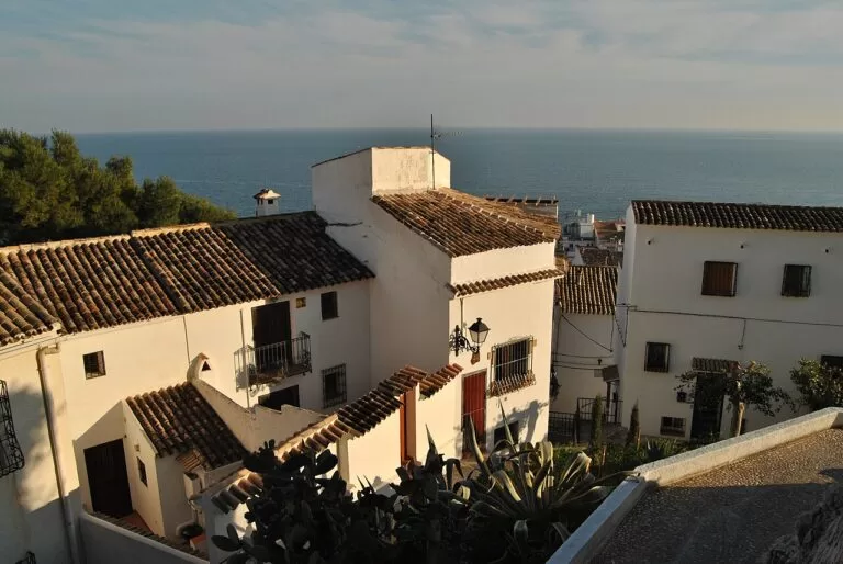
Costa Blanca
The whole Alicante coast from Dénia to Pilar de la Horadada, with the map, campsites, weather and itineraries.
Costa Blanca guide →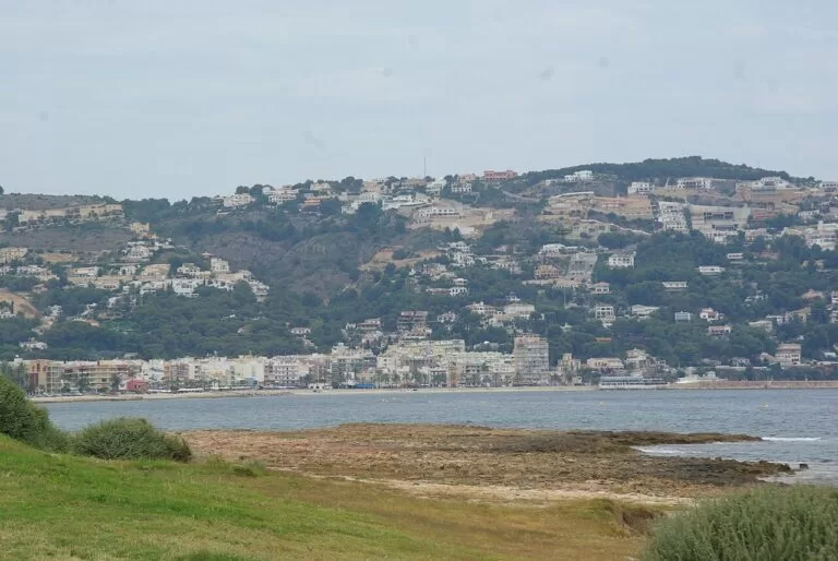
Marina Alta: Dénia to Calp
Cliffs and coves around the Montgó between Dénia and Xàbia, Moraira, Benissa and the Penyal d’Ifac at Calp.
Marina Alta guide →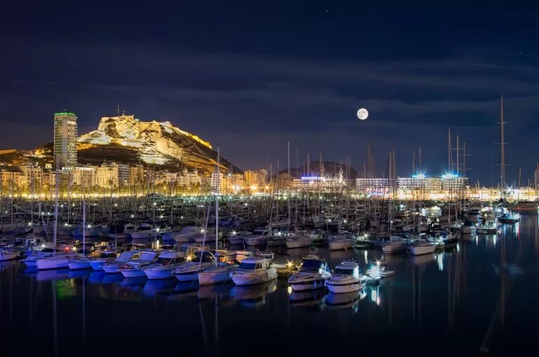
L’Alacantí: Alicante and Tabarca
Santa Bárbara Castle above the city beach, San Juan beach, El Campello and boats to Tabarca island.
Alicante and Tabarca guide →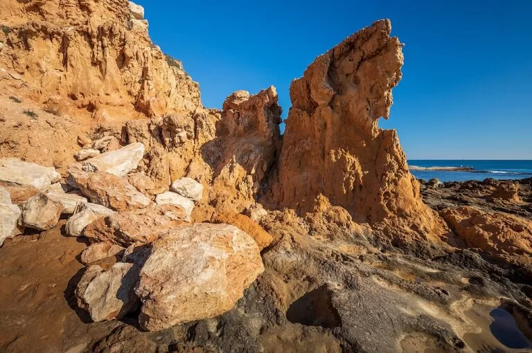
The south: Santa Pola to Pilar de la Horadada
Santa Pola, Guardamar’s dunes, Torrevieja’s salt lakes and the Orihuela Costa down to the Murcia border.
Santa Pola, Torrevieja and Orihuela Costa guide →Just north of Altea, the Mascarat cliffs mark the start of the Marina Alta and Calp; just south of Villajoyosa, El Campello begins L’Alacantí.
Sources and freshness
Checked 9 November 2026. Turisme Comunitat Valenciana pages for every town, beach, monument, museum and festival linked in the text above, starting from Altea, L’Alfàs del Pi, Benidorm, Finestrat, Villajoyosa, Polop, Callosa d’en Sarrià and El Castell de Guadalest, plus La Solsida, Bol Nou, El Paraíso and La Almadrava. Benidorm tourism (visitbenidorm.es) on beaches, Poniente, buses, airport transfers, getting around and the Low Emission Zone, as linked. Spain.info on Benidorm and Altea. Background: Wikipedia on the Alicante TRAM. Map data and distances: OpenStreetMap. Photos (Wikimedia Commons): hero Diego Delso, CC BY-SA 3.0; other photos as credited on the linked CostaMap pages; area cards as credited on the hub. Not confirmed: 2026 Blue Flags, TRAM timetables and line 9 works, festival dates after 2026, car park prices; costablanca.org could not be reached from here, and the town hall websites were not consulted. Corrected 9 November 2026: this note previously said the town hall websites could not be reached; they were not tried.
Every place we have mapped on the Marina Baixa
27 towns, beaches, coves and landmarks, kept up to date automatically.
- Albir Beach (L'Alfàs del Pi)
- Algar Waterfalls (Les Fonts de l'Algar)
- Altea
- Aqua Natura (Benidorm)
- Aqualandia (Benidorm)
- Balcó del Mediterrani (Benidorm Castle lookout)
- Benidorm
- Benidorm Island (Isla de Benidorm)
- Cala del Racó del Conill (Villajoyosa)
- Camping La Media Legua
- El Castell de Guadalest
- Faro del Albir (l'Albir Lighthouse)
- Illa de l'Olla (Altea)
- La Cala de Finestrat (beach next to Benidorm)
- Levante Beach (Benidorm)
- Marina Greenwich (Altea)
- Mundomar (Benidorm)
- Orange Grove Camper Park
- Polop de la Marina
- Poniente Beach (Benidorm)
- Puig Campana (Finestrat)
- Serra Gelada Natural Park (Benidorm, l'Albir)
- Sierra de Bernia (Altea)
- Terra Mítica (Benidorm)
- Terra Natura (Benidorm)
- Tossal de la Cala (Benidorm Roman fort)
- Villajoyosa (La Vila Joiosa)