
Costa Cálida · North
Mar Menor north travel guide: San Pedro del Pinatar, San Javier and Los Alcázares
The calm, shallow northern shore of the Mar Menor lagoon: the salt flats and mud baths of San Pedro del Pinatar, the palm-lined promenade of Santiago de la Ribera and the old bathing resort of Los Alcázares.
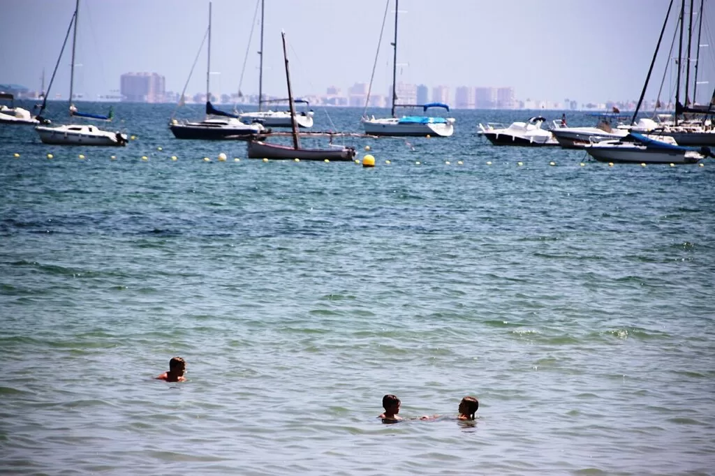
Boats and swimmers in the Mar Menor at Los Alcázares · Photo: Fanny S Forsdik, CC BY-SA 3.0
Part of the Costa Cálida guide · North: the Mar Menor lagoon shore
Mar Menor north is the top end of the Costa Cálida: the shore of the Mar Menor lagoon in the Region of Murcia from the salt flats of San Pedro del Pinatar, next to the border with Alicante province, south-west through San Javier and Santiago de la Ribera to Los Alcázares, about 12 km in a straight line. It is a coast of calm, warm and shallow lagoon beaches with long promenades, plus the wild Mediterranean beaches of the Salinas y Arenales regional park, and it is reached from the AP-7 motorway and Región de Murcia airport, about 26 km from San Javier (Región de Murcia tourism; OpenStreetMap).
At a glance
- Where the north and west shore of the Mar Menor, from El Mojón and the Salinas de San Pedro del Pinatar by the Alicante border to Los Narejos and Punta Brava at the southern edge of Los Alcázares.
- Towns San Pedro del Pinatar with Lo Pagán and El Mojón; San Javier with Santiago de la Ribera; Los Alcázares with Los Narejos and Punta Calera.
- Best for families with small children, calm-water swimming, sailing and windsurf lessons, flamingos and birdwatching, the Lo Pagán mud baths, and quiet winter stays.
- Getting there Región de Murcia airport (RMU) is about 26 km from San Javier and Alicante-Elche about 54 km from San Pedro, in a straight line (OpenStreetMap). The AP-7 and N-332 run just inland.
Map of Mar Menor north
The map shows the places on this stretch that have a CostaMap page. Tick a place type to filter, and click a marker to see the place in the panel.
Place type
Area · next level
 Area map
Mar Menor north
Click a marker to see the place here. From the salt flats of San Pedro del Pinatar along the lagoon shore to Santiago de la Ribera and Los Alcázares.
Towns and villagesTowns and villages
From north to south along the lagoon shore. Descriptions are from the Región de Murcia tourist board and spain.info; distances are in a straight line from OpenStreetMap.
San Pedro del Pinatar and El Mojón
San Pedro del Pinatar sits at the northern end of the Mar Menor, between the lagoon and the Mediterranean. The tourist board says its name comes from a fishermen’s chapel to Saint Peter in a pine wood. The town keeps a working fishing port with a fish market where the catch is auctioned when the boats come in, and two late-19th-century villas: the Palacio del Barón de Benifayó, with a neo-Moorish façade and the municipal museum, and the Casa del Reloj, where Emilio Castelar, president of the First Spanish Republic, died (Región de Murcia tourism). El Mojón, on the Mediterranean side, has a 465 m beach on the edge of the regional park (beach page). See our San Pedro del Pinatar town guide and the San Pedro del Pinatar place page.
Lo Pagán, the salt flats and the mud baths
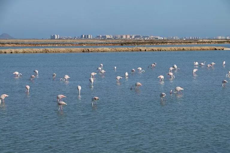
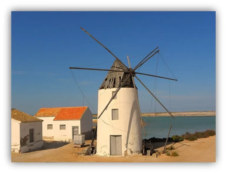
Lo Pagán is San Pedro’s resort district on the lagoon, which spain.info describes as a lively tourist centre with hotels, bars, restaurants and shops along a long promenade, beside the beaches of La Puntica and Villananitos (spain.info). Behind it lie the salt ponds of the Salinas y Arenales de San Pedro del Pinatar regional park, 856 hectares of salt flats, dunes and 6 km of Mediterranean beach, where flamingos can be seen all year (Región de Murcia tourism). On the La Mota walk between the Quintín and La Calcetera windmills are the open-air mud baths that the tourist board calls the largest outdoor mud-therapy site in Europe. See our new guides to the Salinas de San Pedro del Pinatar and the Lo Pagán mud baths.
Santiago de la Ribera
Santiago de la Ribera is the seaside district of San Javier, joined to Lo Pagán by the beach of La Puntica. The tourist board dates it to 1888, when a shrine to Saint James was built, and describes a modern-looking town that keeps its fishing-village feel (Región de Murcia tourism). Spain.info gives it 4 km of fine golden-sand beach with a palm-lined promenade along its whole length (spain.info). The General Air Academy is here, base of the Patrulla Águila aerobatic team that the tourist board says can appear over the Mar Menor at any moment. In summer the town holds the maritime procession of the Virgen del Carmen on 16 July. Offshore lies Isla Perdiguera, one of the islands of the lagoon.
San Javier
San Javier town lies about 2 km inland from Santiago de la Ribera. The tourist board says it grew around a shrine to Saint Francis Xavier built in the early 17th century; the parish church of San Francisco Javier has a religious art museum, and the Local History Museum, in a former Guardia Civil barracks, covers farming, fishing and aviation in the municipality, with free entry (checked November 2026, Región de Murcia tourism). The municipality also takes in most of La Manga, covered in our La Manga and Cabo de Palos guide. The International Jazz Festival fills July with concerts (Región de Murcia tourism). See our San Javier guide.
Los Alcázares
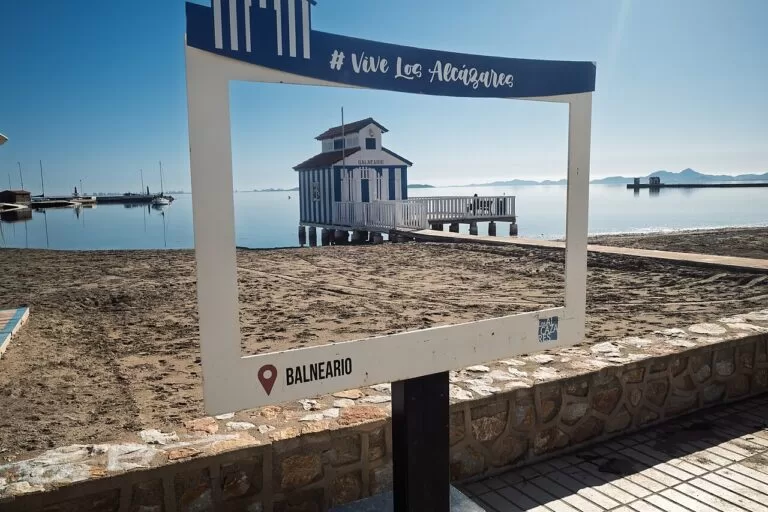
Los Alcázares has seven kilometres of lagoon shore from Los Narejos to Punta Brava. The tourist board traces its name to the Arabic for palace, after the houses the Moors built here for their holidays, and its growth to the early 20th century, when people from the Murcia huerta came in August for the novenarios, nine baths in the Mar Menor. The Hotel Balneario La Encarnación, a spa hotel from the start of the 20th century, still stands on the shore. The town was the first seaplane base in Spain, remembered in the Municipal Aeronautical Museum, and the medieval Torre del Rame stands among palms outside it (Región de Murcia tourism). Spain.info puts it 24 km from Cartagena (spain.info). See our Los Alcázares town guide and the Los Alcázares place page.
Los Narejos and Punta Calera
Los Narejos, at the northern end of Los Alcázares towards Santiago de la Ribera, has the town’s longest beach, 1,400 m of coarse sand with a promenade, terraces and beach bars, which the tourist board recommends for families and for sailing, paddle surfing, kayaking and windsurfing (Región de Murcia tourism). Among the modern buildings are the Balsas Romanas de Los Diegos, Roman pools found by chance whose original use is still unclear (Región de Murcia tourism). Inland, Torre-Pacheco is the nearest base away from the coast; see our Torre-Pacheco guide.
Beaches and coves
All the lagoon beaches have calm, shallow water; the open-sea beaches are inside the San Pedro regional park. Lengths are from the Región de Murcia tourist board’s beach pages.
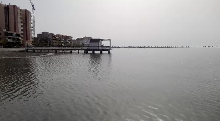
Villananitos and La Mota
Villananitos: 840 m of fine grey sand on the Lo Pagán promenade, next to the mud baths, with an adapted bathing area. La Mota: 2,700 m between the lagoon and the salt ponds (Región de Murcia tourism).
See the mud baths guide →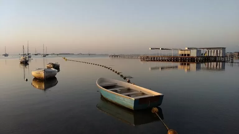
Colón, Barnuevo and El Castillico
Urban beaches of fine golden sand along the promenade: Colón 1,000 m with windsurf and sailing hire, Barnuevo 400 m in the centre, El Castillico 450 m (Región de Murcia tourism).
See the San Javier guide →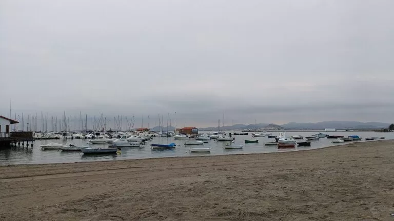
La Concha, Carrión and Las Palmeras
Town beaches by the marina and the yacht club: La Concha 207 m with an old bathing pavilion, Carrión 310 m with the statue of the actor José Sazatornil, Las Palmeras 650 m (Región de Murcia tourism).
See the Los Alcázares guide →- La Puntica – 520 m between Lo Pagán and Santiago de la Ribera, with a buoyed swimming area and sailing lessons (beach page).
- Las Salinas, Barraca Quemada and Punta de Algas – the La Llana beaches on the Mediterranean, 1,200 m, 700 m and 1,260 m of natural beach in the regional park (beach page).
- Torre Derribada – 2,210 m of Mediterranean beach on the north side of the park, with parking and a picnic area (beach page).
- Los Narejos – 1,400 m, the longest beach of Los Alcázares (beach page).
Things to do
Nature: salt flats, flamingos and islands
The Salinas de San Pedro del Pinatar are the oldest of Murcia’s regional parks. Flamingos, avocets and black-winged stilts are there all year; the SL-MU 9 Coterillo path, 3.8 km, passes bird hides on the way to Torre Derribada beach, and the Las Salinas visitor centre lends binoculars for free (Región de Murcia tourism). At Punta de Algas, fishermen still use the encañizadas, a maze of canes and nets of Arab origin. Out in the lagoon, Isla Perdiguera lies off this shore and Isla Grosa off La Manga.
History: spas, seaplanes and Roman pools
Los Alcázares has the Municipal Aeronautical Museum by the old aerodrome, on the first seaplane base in Spain, the Hotel Balneario La Encarnación, the medieval Torre del Rame and the Roman pools of Los Diegos (Región de Murcia tourism). In San Pedro, the Palacio del Barón de Benifayó holds the municipal museum, with fossils, archaeology and old toys (Región de Murcia tourism).
Food, water sports and festivals
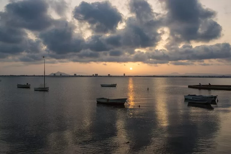
The dish of the Mar Menor is caldero, rice cooked in fish stock with ñora peppers; look also for Mar Menor langoustines, fish roe and dried tuna, and San Pedro’s fleur de sel (Región de Murcia tourism). The calm water suits beginners: the tourist board points to the Mar Menor Nautical Centre in San Pedro and the Mar Menor Marine Resort in San Javier for sailing, windsurfing, kayaking and diving. The calendar has the San Javier Jazz Festival in July, the Virgen del Carmen sea processions on 16 July, Los Alcázares’ International Week of the Huerta and the Sea in the second half of August, a pirate re-enactment at Easter, and a caldero cook-out on the beach on 12 October (Región de Murcia tourism).
Where to stay by town
North to south.
Lo Pagán (San Pedro del Pinatar)
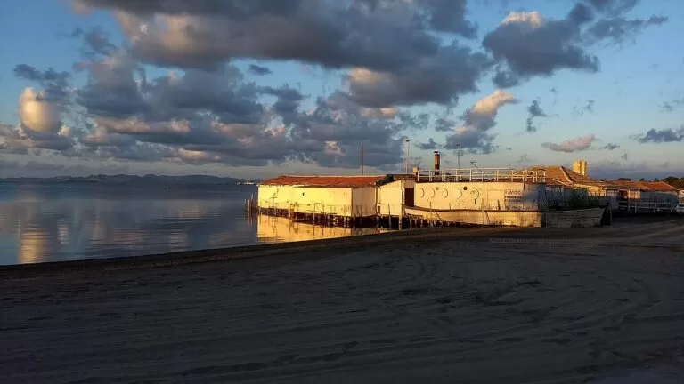
The promenade, the mud baths and the salt flats on foot, with both the lagoon and the Mediterranean beaches within reach. The liveliest of the three in summer.
Beach, mud baths and natureSantiago de la Ribera
A long palm-lined promenade and golden-sand town beaches, and sailing schools. Good for families and for the July jazz festival.
Families and sailingLos Alcázares
The old bathing resort, with a marina, town beaches and seven kilometres of promenade to Los Narejos. The closest of the three to Cartagena.
Calm water and historyGetting there and around
By air
Región de Murcia international airport (RMU), at Corvera, is about 26 km in a straight line from San Javier and Los Alcázares. Alicante-Elche (ALC) is about 54 km from San Pedro del Pinatar, with more flights (OpenStreetMap). We could not confirm airport bus timetables.
By car
The AP-7 motorway and the N-332 from Cartagena run just inland. For San Pedro and the salt flats, the tourist board gives AP-7 exit 774 and Avenida del Puerto; for La Puntica and Santiago de la Ribera, exit 777 (Región de Murcia tourism).
By train, bus and bike
There is no railway on the coast here: the nearest station on OpenStreetMap is Balsicas (Torre-Pacheco), about 12 km from Los Alcázares. Local buses stop along the beaches of Santiago de la Ribera, and a cycle lane runs along the San Javier beaches (Región de Murcia tourism). Check bus times locally before you travel.
A two-day route
By car or bike, north to south, with a night in Lo Pagán or Santiago de la Ribera.
Day 1
Salt flats, mud and the fish market
Start at dawn at the Salinas de San Pedro del Pinatar for the colours of the ponds and the flamingos, then the Las Salinas visitor centre and the Coterillo path to Torre Derribada beach. After lunch by the port, walk the La Mota path past the Quintín windmill to the Lo Pagán mud baths, and end on the Lo Pagán promenade at sunset.
Day 2
Santiago de la Ribera and Los Alcázares
Walk or cycle the promenade of Santiago de la Ribera and take a sailing or kayak lesson on the lagoon. In the afternoon drive to Los Alcázares for the Aeronautical Museum, a drink on the terrace of the old Balneario La Encarnación and a swim at La Concha, then caldero for dinner by the sea.
FAQ
Which is the best town on the Mar Menor for families?
All three towns have calm, shallow lagoon beaches with promenades and first-aid posts in summer. Santiago de la Ribera and Los Alcázares have the longest stretches of town beach; Lo Pagán adds the salt flats and the mud baths on foot.
Can you see flamingos in San Pedro del Pinatar?
Yes. The tourist board lists flamingos among the birds that can be seen all year in the Salinas y Arenales regional park, best from the hides on the Coterillo path and from the La Mota walk (Región de Murcia tourism).
Are the Lo Pagán mud baths free?
The tourist board lists no fee for bathing in the mud on the seafront at Lo Pagán; only treatments in spas and thalassotherapy centres are paid. See our Lo Pagán mud baths guide for how to use the mud.
What is the nearest airport to San Javier and Los Alcázares?
Región de Murcia international airport (RMU) at Corvera, about 26 km in a straight line. Alicante-Elche is about 54 km from San Pedro del Pinatar.
Is the Mar Menor warmer than the Mediterranean?
The tourist board describes the Mar Menor and the Mediterranean as two seas with different temperatures, saltiness and waves; the lagoon is shallow and calm. We could not find official water-temperature figures to compare.
How far is Cartagena from Los Alcázares?
About 24 km, according to spain.info (spain.info). See our Cartagena and La Unión coast guide.
Other areas of the Costa Cálida
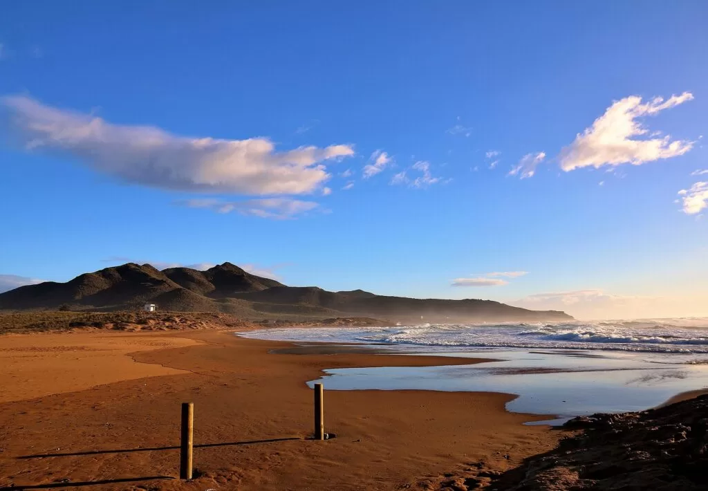
Costa Cálida
The whole coast of the Region of Murcia, with the map and the four areas.
Costa Cálida guide →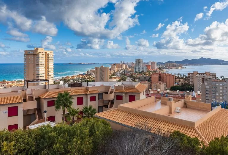
La Manga and Cabo de Palos
The sand bar between the lagoon and the open sea, the lighthouse and the Islas Hormigas marine reserve.
La Manga guide →
Cartagena and La Unión coast
Roman Cartagena, the mining hills of La Unión and the coves of Calblanque.
Cartagena coast guide →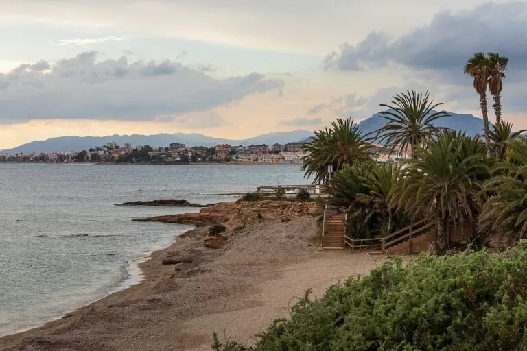
Mazarrón and Águilas
The open-sea coves and towns of the south, from Bolnuevo to the Cuatro Calas.
Mazarrón and Águilas guide →North of San Pedro del Pinatar the coast continues into Alicante province as the Costa Blanca: see our Pilar de la Horadada guide and the Costa Blanca guide.
Sources and freshness
Checked 6 November 2026. Región de Murcia tourism (Instituto de Turismo de la Región de Murcia) on San Pedro del Pinatar, San Javier, Los Alcázares, the Salinas y Arenales regional park, the Mar Menor muds, the San Javier museum and the Aeronautical Museum, and its beach pages for Villananitos, La Mota, La Puntica, Las Salinas, Barraca Quemada, Punta de Algas, Torre Derribada, El Mojón, Colón, Barnuevo, El Castillico, El Pescador, La Concha, Carrión, Las Palmeras and Los Narejos. Spain.info (Turespaña) on San Pedro del Pinatar, Santiago de la Ribera and Los Alcázares. Map data, the railway station and straight-line distances: OpenStreetMap contributors (ODbL). The regional environment site (murcianatural.carm.es) and the town hall sites could not be reached when we checked, so bus and boat timetables and prices are not given.
Photos from Wikimedia Commons: Los Alcázares bay by Fanny S Forsdik (CC BY-SA 3.0); Villananitos, Lo Pagán, by Anidae (CC BY-SA 4.0); the Floridablanca bathing pavilion, Lo Pagán, and the Paseo del Atalayón, Santiago de la Ribera, by Jmll (CC BY-SA 4.0); boats at Los Alcázares by Rhona 97 (CC BY-SA 4.0); Los Alcázares bathing pavilion by Esteban Palacios Blanco (CC BY 2.0); boats on the Mar Menor by Pedro J Pacheco (CC BY-SA 3.0 es); flamingos at the Salinas by Øyvind Holmstad (CC BY-SA 4.0); the Molino de Quintín by amaianos from Galicia (CC BY 2.0); La Manga, Cartagena and Playa de la Raja by Ximonic (Simo Räsänen) (CC BY-SA 4.0); Playa de Calblanque by José Miguel Grandal (CC BY-SA 4.0).