
Costa de la Luz · East
Tarifa and the Strait of Gibraltar travel guide: Bolonia to La Línea
The windy southern tip of mainland Europe: the beaches of Bolonia, Valdevaqueros and Los Lances, the old town and castle of Tarifa, Africa across the water, and the bay towns facing Gibraltar.
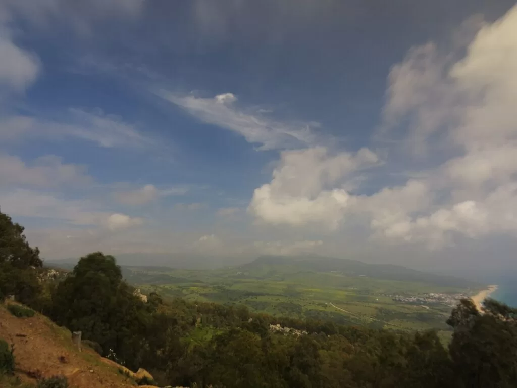
Bolonia bay from the Cerro del Moro, Tarifa · Photo: Juan Vladimir Paraschuk, CC BY-SA 4.0
Part of the Costa de la Luz guide · East: Tarifa and the Strait of Gibraltar
Tarifa and the Strait of Gibraltar is the eastern end of the Costa de la Luz: the coast of the Campo de Gibraltar in Cádiz province, from the Atlanterra beach next to Zahara de los Atunes round Punta de Tarifa and the Bay of Algeciras to La Línea and the San Roque coast at Torreguadiaro, about 54 km in a straight line. In the west it is open Atlantic beach and dune in the municipality of Tarifa, which has almost 38 km of beaches; in the east it is the port city of Algeciras, Los Barrios, San Roque and La Línea on the bay, with Gibraltar across it (Andalucía.org).
At a glance
- Where the Strait of Gibraltar coast of Cádiz province, from Atlanterra and Cabo de la Plata on the edge of Zahara de los Atunes to Punta de Tarifa, then along the Bay of Algeciras to the Gibraltar border at La Línea.
- Towns Tarifa with Bolonia, Valdevaqueros and Los Lances; Algeciras, Los Barrios with Palmones, San Roque with Sotogrande and Torreguadiaro, and La Línea de la Concepción.
- Best for kitesurfing and windsurfing, long wild beaches and dunes, Roman ruins, views of Morocco, and ferries to Tangier and Ceuta.
- Getting there Gibraltar airport is about 45 km from Tarifa by road, Jerez about 135 km and Málaga about 200 km (Andalucía.org). The N-340 runs along the Tarifa coast and the A-7 round the bay.
Map of Tarifa and the Strait of Gibraltar
The map shows the places on this stretch that have a CostaMap page. Tick a place type to filter, and click a marker to see the place in the panel.
Place type
Area · next level
 Area map
Tarifa and the Strait of Gibraltar
Click a marker to see the place here. From Bolonia, Valdevaqueros and Tarifa round the point to Algeciras, San Roque and La Línea.
Towns and villagesTowns and villages
From west to east, round the point of Tarifa and into the bay. Descriptions and history are from Andalucía.org, the Junta de Andalucía’s tourism site; beach lengths from spain.info, Spain’s official tourism site; distances are in a straight line from OpenStreetMap.
Atlanterra and Cabo de la Plata
The stretch begins where the beach of Zahara de los Atunes runs south into the municipality of Tarifa. Spain.info describes Atlanterra beach as the continuation of the Zahara beach, named after a development of detached houses on Cabo de la Plata: 2,900 m of golden sand, 60 m wide, busy in season (spain.info). Zahara itself belongs to Barbate and is covered in our La Janda guide; see also the Playa de Zahara de los Atunes guide.
Bolonia and Baelo Claudia
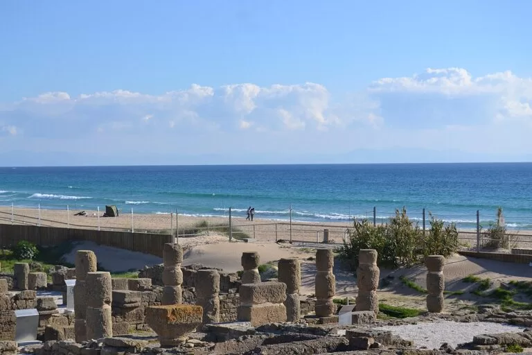
Bolonia is a small settlement in the bay of the same name, about 16 km north-west of Tarifa. Andalucía.org calls the Ensenada de Bolonia one of the most beautiful places in the municipality, and it holds the ruins of Baelo Claudia, a Roman town (Andalucía.org). Spain.info describes Bolonia beach as wild, with white sand, a big dune, pine woods and views of Africa (spain.info). The dune is protected as the Duna de Bolonia natural monument (spain.info). See our guides to Playa de Bolonia and Baelo Claudia.
Valdevaqueros and Punta Paloma
Valdevaqueros is the big bay about 10 km west of Tarifa, closed at its western end by Punta Paloma and a large dune. Spain.info calls the beach ideal for windsurfing (spain.info). Punta Paloma beach, next to the Valdevaqueros dune, lies inside the Strait (Estrecho) natural park, and spain.info counts it among the finest beaches of Tarifa (spain.info). See our Valdevaqueros guide.
Los Lances
Los Lances is the long beach that runs north-west from the edge of Tarifa town towards Valdevaqueros. Andalucía.org singles it out among Tarifa’s beaches, most of them of fine sand and shallow water: Los Lances is protected as a Paraje Natural and forms a complex of beach, dunes, pine woods and marsh (Andalucía.org). Spain.info recommends it for kitesurfing and windsurfing (spain.info). See our Los Lances guide.
Tarifa
Tarifa is the southernmost town of mainland Europe, open to the Atlantic and the Mediterranean. Andalucía.org dates its growth to the castle built in the 10th century under Abd al-Rahman III, and its narrow, winding streets to that period. It is named after Tarif ibn Malluk, a Berber leader who came with Tariq in 711; Sancho IV took it in 1292 (Andalucía.org). Spain.info adds the Gothic-Mudéjar chapel of Santiago, the convent of San Francisco and the churches of Santa María and San Mateo (spain.info). The small port has a passenger terminal with ferries to Tangier (Andalucía.org). See our Tarifa guide, the Tarifa town page and the new Castle of Guzmán el Bueno guide.
Algeciras
Algeciras sits on the western side of the bay that carries its name, facing Gibraltar, about 19 km north-east of Tarifa. Andalucía.org calls its port one of the most important in Spain and the city’s economic centre; industry takes much of its 23 km of shore, but El Rinconcillo, San García and Getares are good beaches. Alfonso XI took the town in 1344, and in 1906 it hosted the Algeciras Conference on Morocco (Andalucía.org). Spain.info points to the old San Isidro quarter and the church of Nuestra Señora de la Palma (spain.info). See our Algeciras guide.
Los Barrios and Palmones
Los Barrios lies inland at the head of the bay, about 7 km north of Algeciras, and much of its land is inside Los Alcornocales natural park. Andalucía.org traces the town to the farmhouses where people from Gibraltar took refuge after 1704, on the left bank of the Palmones river, and recommends the Bacinetes caves (Andalucía.org). Its coast is Palmones, a village at the mouth of the river: spain.info gives its beach 750 m of golden sand with calm water, often windy (spain.info). See our Los Barrios guide.
San Roque, Carteia and Sotogrande
San Roque was founded by the Spanish people of Gibraltar who left the Rock in 1704 and settled on the hill with the chapel of San Roque, and it keeps Gibraltar’s old municipal archive. Its protected old town has the church of Santa María la Coronada and a viewpoint over the bay, Gibraltar and North Africa. On its shore at Guadarranque lies Carteia, the first Latin colony outside Italy, from 171 BC (Andalucía.org). The municipality runs north-east to Sotogrande, a marina and sports estate known for summer polo, and Torreguadiaro, a fishing village with a 1,300 m beach (spain.info). See our San Roque guide, the new Carteia guide and the Marina de Sotogrande guide.
La Línea de la Concepción
La Línea stands on the isthmus that joins the Rock of Gibraltar to the mainland, with the bay on one side and the Levante beaches on the other; it is the only crossing between the two. Andalucía.org traces it to the siege line built between the forts of Santa Bárbara and San Felipe to retake Gibraltar. It belonged to San Roque until 1870 and became a separate municipality, with its present name, on the feast of the Immaculate Conception in 1873 (Andalucía.org). See our La Línea guide.
Beaches and coves
Windy Atlantic beaches west of Tarifa, calmer bay beaches east of it (lengths from spain.info).
Bolonia
3,800 m of white sand with a big protected dune, pine woods and a nudist area; windy and isolated, with Baelo Claudia almost on the beach (spain.info).
See the Bolonia guide →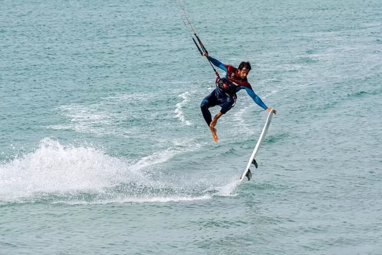
Valdevaqueros
4,050 m of golden sand, 120 m wide, below the Punta Paloma dune; moderate waves, often windy, with water-sports hire and showers (spain.info).
See the Valdevaqueros guide →Los Lances
The protected beach, dune and marsh system at the edge of town, Tarifa’s main kitesurf and windsurf beach (Andalucía.org).
See the Los Lances guide →- Atlanterra – 2,900 m by 60 m of golden sand south of Zahara, with all services (spain.info).
- Getares – 1,500 m of calm water south of Algeciras with ramps for wheelchair users (spain.info).
- El Rinconcillo – Algeciras’s largest beach, 2,550 m, open to the bay, with parking (spain.info).
- Guadarranque – 600 m below the Carteia site in San Roque; spain.info calls its surroundings industrial and rather neglected (spain.info).
- La Alcaidesa, Torreguadiaro, Sotogrande and Cala Sardina – dark-sand beaches of San Roque on the Mediterranean side: 1,400 m, 1,300 m, 2,250 m and 900 m; Cala Sardina is the quietest (spain.info).
Things to do
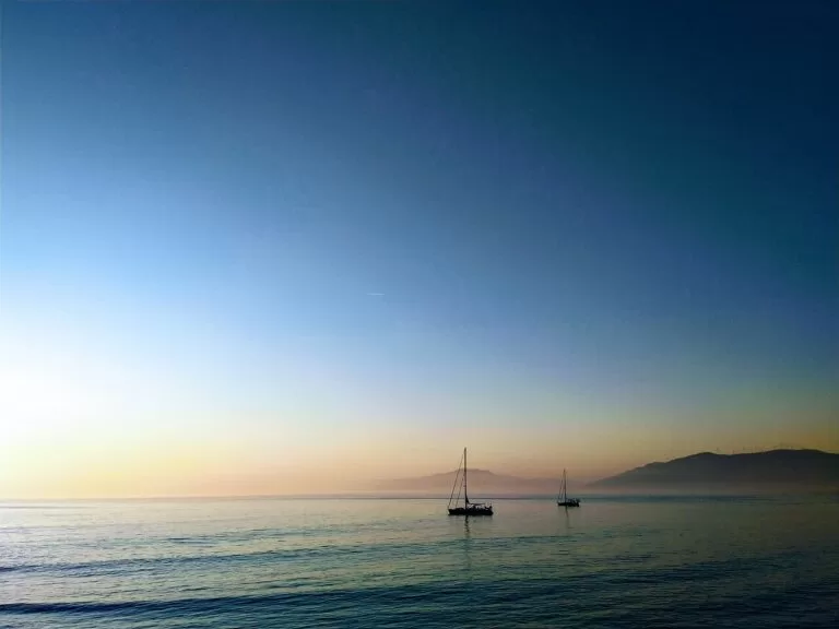
Nature: the Strait, dunes and cork forest
The coast from Bolonia to the bay is inside the Estrecho natural park, part of the Intercontinental Biosphere Reserve of the Mediterranean that UNESCO declared in 2006 with Morocco, the first with sea inside it; the reserve also takes in the Los Lances Paraje Natural and the Duna de Bolonia natural monument, and the Strait is a migration route for birds between Europe and Africa (spain.info). The park’s information point, with a small exhibition, is about 3 km from Tarifa (Andalucía.org). For the view of Africa, about 15 km away, stop at the Mirador del Estrecho, 7 km from Tarifa on the road to Algeciras (spain.info). Inland lies Los Alcornocales natural park, 173,619 ha of cork oak forest (spain.info).
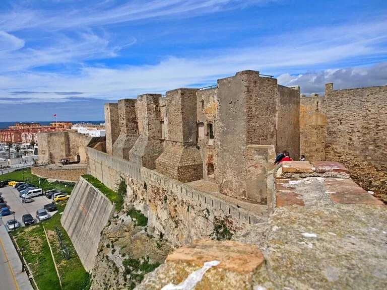
History: Romans, Guzmán and Gibraltar
Two Roman towns frame the stretch: Baelo Claudia on the beach at Bolonia, and Carteia on the bay at San Roque, with a Punic wall, a Republican temple, baths and a theatre, open only on guided visits booked by email (Andalucía.org). In Tarifa, the Castle of Guzmán el Bueno recalls the siege of 1294, when Guzmán threw down his own knife rather than surrender the town for his son’s life (Andalucía.org). The bay towns of San Roque, Los Barrios and La Línea grew out of the loss of Gibraltar in 1704.
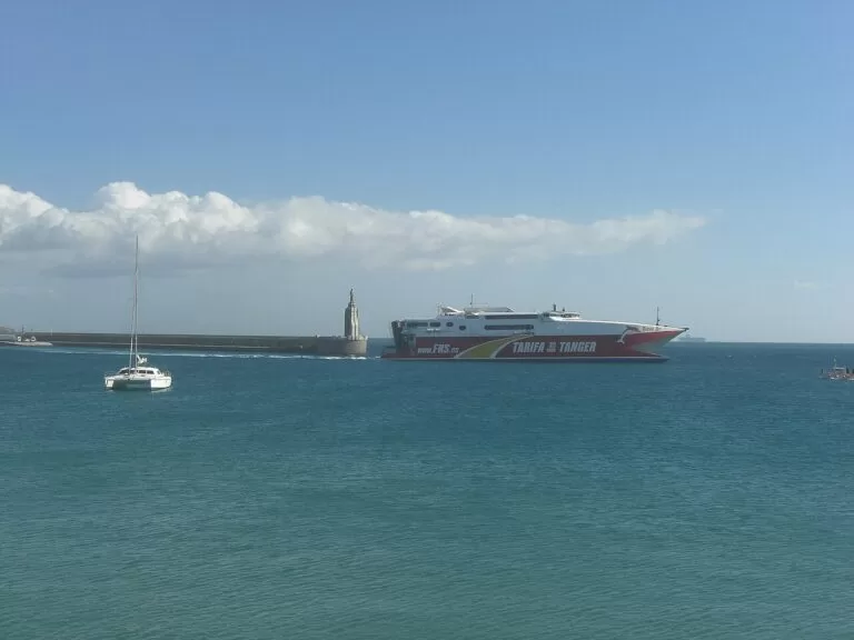
Wind, water and music
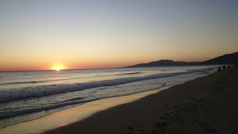
Andalucía.org calls Tarifa the capital of the wind (Andalucía.org); the beaches from Los Lances to Bolonia are spain.info’s picks for windsurfing and kitesurfing. For flamenco, Tarifa has its own fandango, the chacarrá, and a national folk music festival (Andalucía.org), and Algeciras its Fandango de Algeciras (Andalucía.org). For whale and dolphin trips, see our Costa de la Luz guide.
Where to stay by town
The bases we would choose, west to east.
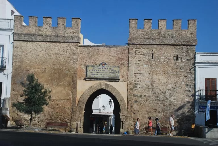
Tarifa
The old town, the castle, the port for Tangier and Los Lances on the doorstep. Best for kitesurfers, couples and anyone without a car. Expect strong wind on many days.
Town, wind and beach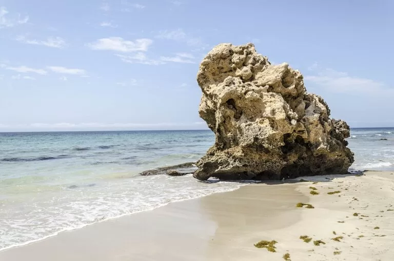
Bolonia, Valdevaqueros and Atlanterra
Small, scattered places near the wildest beaches, from Zahara’s edge to Punta Paloma. Quiet out of season; you need a car for shops and restaurants.
Beaches and dunesAlgeciras
A working port city with the railway station and the ferries to Ceuta and Tanger Med. Practical for a night before or after a crossing, less so for a beach holiday.
Ferries and trains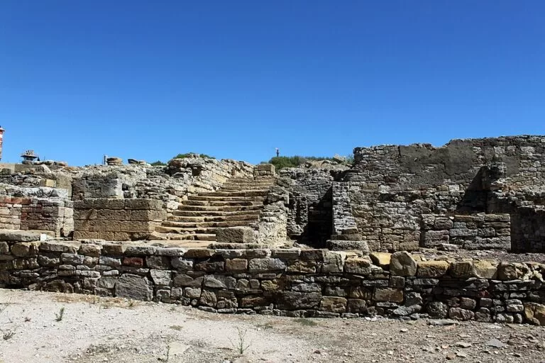
San Roque and Sotogrande
The hill town for Carteia and views of Gibraltar; Sotogrande and Torreguadiaro on the coast for a marina, golf and calm, dark-sand beaches.
History, golf and marinaGetting there and around
By air
Andalucía.org gives these road distances from Tarifa: Gibraltar airport 45 km, about 30 minutes on the N-340; Jerez 135 km, about an hour; Málaga 200 km, about 1 hour 40 minutes; Seville 220 km, about two hours.
By car
The N-340 is the coast road of Tarifa, past Atlanterra, Bolonia and Valdevaqueros (spain.info). Round the bay, the A-7 serves Algeciras, Los Barrios, San Roque and Sotogrande. Bolonia is reached on a local road off the N-340.
By train, bus and ferry
Algeciras has the only railway station on this stretch, and a bus station in Calle San Bernardo, both near the port (OpenStreetMap). Ferries sail from Tarifa to Tangier (Andalucía.org) and from Algeciras to Ceuta and Tanger Med (see our Algeciras guide). We could not confirm bus timetables; check them before you travel.
A two-day route
By car, west to east, with a night in Tarifa.
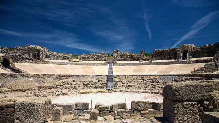
Day 1
Bolonia, Baelo Claudia and Valdevaqueros
Start early at Baelo Claudia, then climb the Bolonia dune. In the afternoon stop at Punta Paloma and Valdevaqueros to watch the kites, and end on Los Lances at sunset before dinner in Tarifa’s old town.
Day 2
Tarifa castle, the Mirador del Estrecho and the bay
Visit the Castle of Guzmán el Bueno and walk to the Isla de las Palomas causeway. Drive east to the Mirador del Estrecho for the view of Morocco, then round the bay to Carteia, if you have booked a guided visit, and San Roque’s old town.
FAQ
Is Tarifa on the Costa de la Luz or the Costa del Sol?
Tarifa is the last town of the Costa de la Luz, Spain’s Atlantic coast. The bay towns of Algeciras, San Roque and La Línea are on the Strait; east of Sotogrande, in Málaga province, the coast becomes the Costa del Sol.
How far is Africa from Tarifa?
The coast of Morocco is only about 15 km away, according to spain.info, and on a clear day you can see it from the town and from the Mirador del Estrecho.
Can you take a ferry from Tarifa to Morocco?
Yes. The port of Tarifa has a passenger terminal with ferries to Tangier, and it is a Schengen border point (Andalucía.org). Algeciras has ferries to Ceuta and Tanger Med.
What is the nearest airport to Tarifa?
Gibraltar, about 45 km by road. Jerez is about 135 km and Málaga about 200 km, both with more flights (Andalucía.org).
What is the best beach near Tarifa?
Bolonia for its dune, its Roman ruins and white sand; Valdevaqueros and Los Lances for kitesurfing and windsurfing; Getares in Algeciras for calm water when the wind blows.
Other areas of the Costa de la Luz
Costa de la Luz
The whole Atlantic coast of Huelva and Cádiz, with the map and the four areas.
Costa de la Luz guide →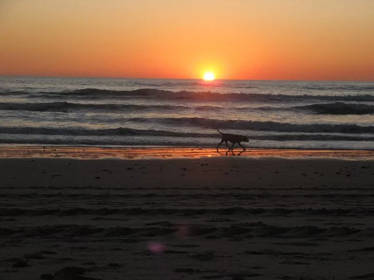
La Janda: Chiclana, Conil, Vejer and Barbate
Wide Atlantic beaches, the hill town of Vejer, La Breña and the tuna port of Barbate, next door to the west.
La Janda guide →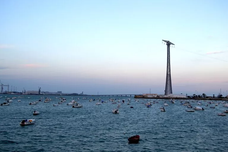
Sherry coast and the Bay of Cádiz
Sanlúcar’s manzanilla bodegas, El Puerto, Rota and the city of Cádiz on its peninsula.
Sherry coast guide →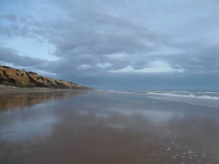
Huelva coast: Ayamonte to Moguer
Long, low beaches from the Portuguese border to the Huelva estuary.
Huelva coast guide →East of Sotogrande, the coast continues into Málaga province as the Costa del Sol: see our Estepona, Manilva and Casares guide and the Costa del Sol guide.
Sources and freshness
Checked 7 November 2026. Andalucía.org (Junta de Andalucía tourism) on Tarifa, the Castle of Guzmán el Bueno, the port of Tarifa (ferries, airport distances), the Estrecho information point, Algeciras, Los Barrios, San Roque, Carteia and La Línea de la Concepción. Spain.info (Turespaña) on Tarifa, Algeciras, the Intercontinental Biosphere Reserve, Los Alcornocales, the Mirador del Estrecho, Punta Paloma and Los Lances, and its beach sheets for Atlanterra, Bolonia, Valdevaqueros, Getares, El Rinconcillo, Palmones, Guadarranque, La Alcaidesa, Torreguadiaro, Sotogrande and Cala Sardina. Map data, stations and straight-line distances: OpenStreetMap (ODbL). The town hall sites of Tarifa, Algeciras, San Roque, Los Barrios and La Línea, Tarifa’s tourism site and the Junta de Andalucía’s environment pages could not be reached when we checked, so park areas and bus and ferry timetables are not given. Photos from Wikimedia Commons: Bolonia bay from the Cerro del Moro and Los Lances at sunset by Juan Vladimir Paraschuk (CC BY-SA 4.0); Bolonia and Baelo Claudia by Emilio J. Rodríguez Posada (CC BY-SA 2.0); Bolonia beach by Gerardo Almeida (CC BY-SA 3.0); kitesurfer at Los Lances by Isiwal (CC BY-SA 4.0); Isla de las Palomas by Jelger Groeneveld (CC BY 2.0); Tarifa castle by José Rodríguez Cordón (CC BY-SA 4.0); Carteia by Falconaumanni (CC BY-SA 3.0); Tarifa ferry by Olivier Bruchez (CC BY-SA 2.0); Puerta de Jerez, Tarifa, by Lamberto Zannotti (CC BY-SA 3.0); Baelo Claudia theatre by Jan Hazevoet (CC BY 3.0); Conil by Jon Agüera (CC BY-SA 3.0); Bay of Cádiz by Josan Gómez (CC BY-SA 3.0); Mazagón by isol (CC BY-SA 3.0).