
Expect a small Catalan municipality whose main quirks are historical and environmental rather than flashy tourism. This is a place where the story of a vanished lake frames much of what to see and do: low-key nature patches, a village centre with municipal life, and straightforward road and rail links that make it an easy detour between Girona and Barcelona. If you want beaches, big museums or nightlife, this isn’t the stop for that — but if you like quiet walks, local-scale history and watching ecosystem restoration unfold, plan some time here.
Sils at a glance
- Comarca: Selva, in the Province of Girona (Catalonia).
- Coordinates: 41°48′N 2°45′E; elevation about 76 m above sea level.
- Transport: on the Renfe line between Barcelona and Girona; served by the AP-7 motorway and the N‑II road.
- Population: 6,920 (2025); demonyms: Silenc (male), silenca (female).
- Historic landscape: next to the former Llac de Sils (Estany de Sils), desiccated in the 19th century; original lake once ≈7 km².
- Local government: mayor (as of 2019) Eduard Colomé Ribas; official website at www.sils.cat.
Things to do in the town
Activities here lean on the setting: short nature trails, interpretation of a drained lake landscape, and simple village wanderings. There are no large-scale attractions; most visits combine a few outdoor stops with a café or two in the centre and possibly a short rail hop to larger nearby towns.
| Attraction | What it is | Price/entry | Best for |
|---|---|---|---|
| Site of the former Llac de Sils (Estany de Sils) | Reclaimed marsh and restoration plots commemorating a 19th-century drained lake | — | Nature walkers, birders, people interested in landscape history |
| Town centre and municipal buildings | Compact village streets, town hall, local shops and cafés | — | Short strolls, everyday Catalan life |
| Railway station (line between Barcelona and Girona) | Practical rail link rather than an attraction | — | Travel logistics and daytrip base |
The former lake and restoration area
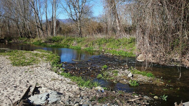
The defining landscape feature is the footprint of the Llac de Sils (Estany de Sils), a lake that was about 7 km² before it was desiccated in the nineteenth century. Today you won’t find an expansive body of water; instead, look for wetland remnants and planned restoration plots where local authorities and conservation groups have been working to reintroduce elements of the original vegetation. This is a low-key, process-oriented destination — the appeal is in observing the ecology and imagining the former wetland rather than in scenic panoramas.
Village life and short walks
The built-up centre is compact. Short walks around the streets yield a practical local experience: municipal buildings, small shops and cafés where locals run errands, and typical Catalan village rhythms. There are no claims of a major historic quarter or grand monuments in the records we use, so treat the centre as a place for a relaxed hour or two rather than a major excursion.
Using the station as a base
The local Renfe stop sits on the line linking two regional hubs. While the station itself is utilitarian, it makes the town viable as a quiet base for travellers who prefer to move by train. If you plan day trips, the rail link is the primary public-transport asset here.
Best beaches in the area
This municipality is inland and does not offer bathing beaches. If coastal swimming is a priority, you’ll need to travel out to the Costa Brava towns nearby.
Sils with kids
Families who bring children should plan for outdoor, low-intensity activities: short nature walks around the drained-lake area, simple picnics and easy village strolls. There are no large playground complexes or theme attractions recorded for the municipality, so the place works best for kids who enjoy exploring woodlands, observing wildlife and collecting natural curiosities under supervision.
How to get to Sils and get around
Getting here is straightforward by both road and rail; once in the municipality, walking is the main way to experience the centre and the nearby restoration plots.
| From | By | Approx time |
|---|---|---|
| Regional hubs (Barcelona / Girona) | Renfe railway (line between Barcelona and Girona) | — |
| Along the Mediterranean corridor | Autopista AP-7 or road N‑II | — |
Within the municipality, most points of interest are walkable from the town centre. If you plan to visit wider Selva or the Costa Brava coast, a car is convenient because it saves transfers and schedule constraints; otherwise the train provides a practical public-transport alternative for regional hops.
Where to stay in the area
Accommodation options inside the municipality are modest and oriented toward local stays rather than resort hotels. Consider these general neighbourhood choices:
- Town centre — best for walking access to shops, cafés and municipal services; suits short stays and arrivals by train.
- Perimeter near the former lake footprint — suits visitors prioritising nature and the restoration areas; expect quieter surroundings.
- Nearby towns in Selva — choose a nearby larger town if you want more hotel choices or easier access to coastal resorts; the municipality functions well as a quiet alternative.
Best time to visit Sils
Timing depends on your tolerance for seasonal weather and how you prefer to experience the outdoors. Restoration areas and nature walks are accessible for much of the year; avoid planning during extreme heat if you prefer cooler walking conditions.
| Season | Months | What to expect |
|---|---|---|
| Spring | March–May | Good time for vegetation growth and bird activity around the restored wetlands. |
| Summer | June–August | Warmer conditions; suitable for walks early or late in the day; coastal day trips possible. |
| Autumn | September–November | Often pleasant weather for outdoor visits and quieter than high-season coastlines. |
| Winter | December–February | Cooler, quieter village life; outdoor activities are still possible if prepared for lower temperatures. |
History of the place
The municipality’s identity is inseparable from the history of the Llac de Sils (Estany de Sils). In the nineteenth century the lake — originally about 7 km² — was drained, changing local land use and ecology. That transformation freed up land for agriculture and other uses but also erased a significant wetland ecosystem. The modern municipality now includes efforts to restore part of the original vegetation near the former lake area, reflecting an interest in reconnecting with the landscape that defined the site for centuries.
Practical info
- Official website: the municipal website is www.sils.cat — consult it for local notices and administrative information.
- Coordinates and elevation: 41°48′N 2°45′E; the town sits at roughly 76 m above sea level.
- Area and population: total area recorded as 29.9 km²; population listed as 6,920 (2025) with a density of 231/km².
- Demonyms: male residents are documented as Silenc, female residents as silenca.
- Local governance: the mayor recorded as of 2019 is Eduard Colomé Ribas.
- Transport arteries: the motorway AP‑7 and road N‑II pass through the municipality, and there is a Renfe railway station on the Barcelona–Girona line — useful for planning road or rail access.
- Parking and accessibility: specific parking facilities and accessibility features are not enumerated in the sourced records; expect village-centre roadside parking and pedestrianised short routes.
Worth it for: travellers interested in landscape history, low-key nature and watching ecological restoration; people who want a quiet base with good rail/road links to Girona and Barcelona. Less so if: you expect beaches, nightlife or major tourist attractions — those require a coastal stop elsewhere.
How we assess this guide
This guide compiles verified municipal and geographic records and cross-checks transport and demographic claims against official sources. We flag where the landscape has changed historically (the drained Llac de Sils) and note ongoing restoration efforts. This is not a field report; we rely on public records and documented data, and we avoid presenting unverified services, prices or opening hours.
Frequently asked questions
How do I get to Sils from Barcelona or Girona?
There is a Renfe railway station on the line between Barcelona and Girona that serves the municipality; alternatively, the town is accessible by road using the AP‑7 motorway or the N‑II.
Is the former Llac de Sils still a lake?
No — the lake was desiccated in the nineteenth century. You will find wetland remnants and areas where restoration of original vegetation is underway rather than an intact lake.
Is Sils expensive to visit?
There are no comprehensive cost indices in the sourced records. The municipality is a small inland town: expect local-scale prices typical of Catalan villages rather than premium resort pricing, but check current listings for accommodation and dining.
Which nearby beach is best for a day trip?
The municipality is inland and does not have beaches; for coastal swimming you need to travel to Costa Brava towns on the coast. Use regional maps and transport options from the AP‑7 or the regional rail network to plan a day trip to nearby coastal resorts.
How many days should I spend here?
One full day or an overnight stay is enough for the core experience: walks by the former lake area, a relaxed village visit and possibly a short regional rail or road excursion. Extend your stay if you plan excursions into the wider Selva comarca or the Costa Brava.
Is the town good for families with children?
Yes for families who enjoy outdoor exploration and calm village life; there are no major family attractions recorded, so plan low-key nature activities and short walks suited to children.
Can I get around without a car?
Yes — the Renfe railway link makes travel by public transport feasible for reaching the town and for some day trips. Within the municipality, walking covers most points of interest.
Where can I park if I drive?
Specific parking locations are not detailed in the records consulted. The municipality lies along the AP‑7 and N‑II corridors and village centres typically offer roadside and municipal parking; prepare for limited central parking on busy days.
What is the best time of year to visit for outdoor walks?
Spring and autumn are generally favourable for vegetation and comfortable temperatures for walking; summer offers warmer weather but plan walks for cooler parts of the day.
Are there guided tours of the restoration area?
There are documented efforts to restore original vegetation near the former lake, but no specific guided-tour services are listed in the sourced material. Check the municipal website (www.sils.cat) or local visitor resources for any organised activities or interpretive events.
Who is the local mayor?
The mayor recorded as of 2019 is Eduard Colomé Ribas.
Where can I find official information and local notices?
The municipality’s official website is www.sils.cat; consult it for administrative notices, local initiatives and contact details for municipal services.
Are there nature/wildlife observation opportunities?
Yes — the former lake footprint and restoration plots are the primary spots for observing wetland-adapted vegetation and associated wildlife; expect a process-oriented, rather than fully re-established, habitat.
Is the town in Girona province?
Yes, it lies within the Province of Girona in the comarca of Selva, Catalonia.
Plan the wider trip
Nearby on the Costa Brava
Sils on the map
Places worth knowing near Sils
This place is part of our Costa Brava Guide: Coves, Cadaqués, Girona and the Wild Coast — see every town, beach and cove we have mapped on that coast.
How this page is maintained. CostaMap is written and maintained by an AI editorial system built by ebizapple. Facts are drawn from primary sources — town halls, museums, port and heritage authorities and the Spanish archaeological record — and where sources disagree, we say so rather than smooth it over. Photographs marked as ours are taken on location. This page was last reviewed on 14 August 2026. Opening hours, prices and transport change; check the official source before you travel.