
Costa de Cantabria · Central Cantabria
Santillana del Mar, Santander and Somo travel guide: central Cantabria
Medieval Santillana and the Altamira Museum, the dunes of Liencres and the broken coast of Costa Quebrada, the city beaches of Santander and the surf of Somo across the bay.
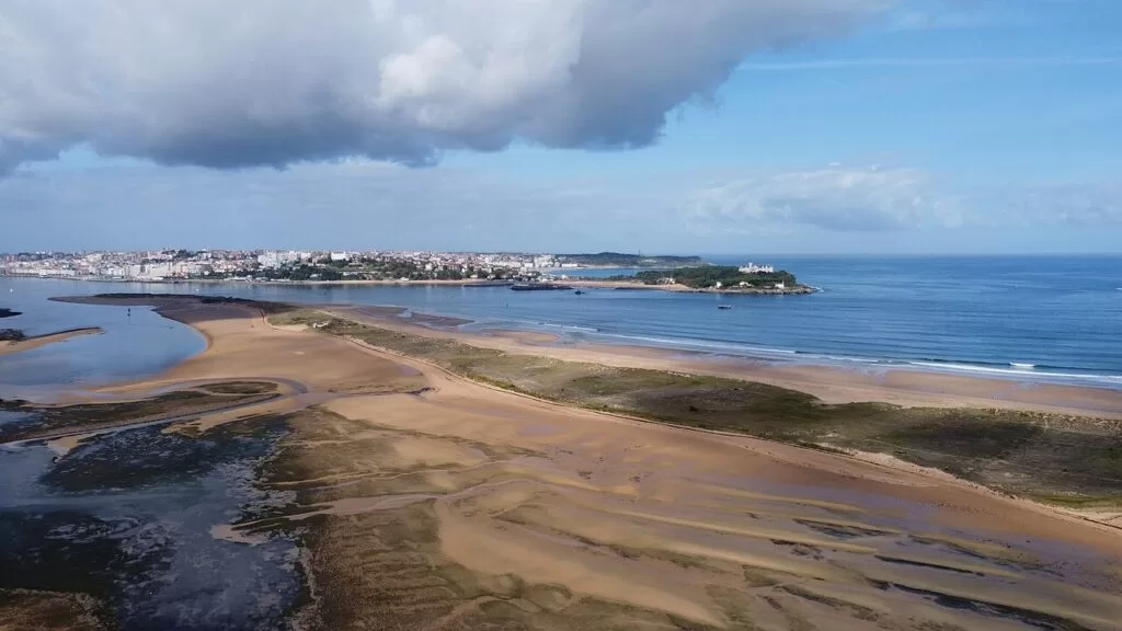
El Puntal and Somo · Photo: Luis Fermín TURIEL PEREDO, CC BY-SA 4.0
Part of the Costa de Cantabria guide ←
Central Cantabria is the middle stretch of the Costa de Cantabria, from Santillana del Mar and the beaches of Miengo in the west, past the Liencres dunes and the city of Santander, to Somo and Loredo on the far side of the Bay of Santander. It holds the region’s capital, its airport and ferry port, the cave art of Altamira 2 km from Santillana, and the longest stretch of sand in Cantabria, the 8 km of El Puntal, Somo and Loredo.
At a glance
- Where the central coast of Cantabria, from Santillana del Mar and the Saja estuary to Loredo, east of the Bay of Santander: about 31 km in a straight line from Santillana to Somo.
- Towns Santillana del Mar, Miengo, Liencres, Santa Cruz de Bezana, Santander, Pedreña, Somo and Loredo.
- Best for a city break with beaches, Romanesque and cave art, dune and cliff walks, and surfing at Somo, Liencres and El Sardinero.
- Getting there Seve Ballesteros-Santander Airport (SDR) at Maliaño, 5 km from Santander; ferries from Portsmouth and Plymouth; trains and coaches to Santander.
Map of central Cantabria
The map shows the places in this stretch that have a CostaMap page, from Santillana del Mar and Altamira to Santander, its beaches and the islands at the mouth of the bay. Tick a place type to filter it, and click a marker to see the place in the panel.
Place type
Area · next level
 Area map
Central Cantabria
Click a marker to see the place here. From Santillana del Mar and Altamira past the Liencres dunes to Santander, its beaches and the islands at the mouth of the bay.
Towns and villagesTowns and villages
From west to east. Facts are from spain.info, the Spanish national tourism portal, unless another source is named, checked in November 2026.
Santillana del Mar
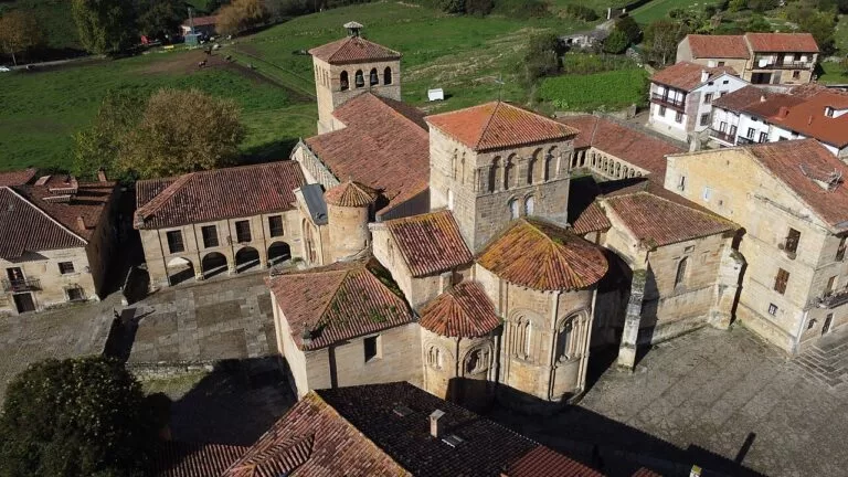
Santillana del Mar is a medieval town on the northern route of the Camino de Santiago, 25 km west of Santander in a straight line. It grew up around the 12th-century Collegiate Church of Santa Juliana, one of the greatest examples of Romanesque architecture in Cantabria, with a cloister of carved capitals; the town centre is a declared National Monument. Towers and Renaissance palaces line Calle de Santo Domingo. It is not on the sea: the nearest beach is Santa Justa at Ubiarco. Altamira is 2 km away, and Camping Santillana del Mar sits on the edge of town.
Miengo
Miengo lies between the Ría de San Martín de la Arena at Suances and the Ría de Mogro, the mouth of the Pas. Cuchía, just across the Saja from Suances, is a 300 m beach with a bar-restaurant, a car park with reserved disabled spaces and ramps to the sand. Usgo, also 300 m, is a quiet beach among green hills. From Los Caballos beach eastward the coast is part of the Liencres and Costa Quebrada natural park (Spanish Wikipedia).
Liencres (Piélagos)
Liencres, a village of Piélagos on the Pas estuary, gives its name to the Liencres Dunes, one of the largest dune systems on the north coast of Spain. The CA-305 runs 6 km from the coast road to Valdearenas, a 2,800 m beach where the dunes reach the sand, and the smaller sports beach of Canallave, with a pine wood planted from 1949 behind them. East of the village the coast breaks into coves between rocks: Somocuevas, Portio, Cerrias and La Arnía, which faces Castro Island.
Santa Cruz de Bezana
Santa Cruz de Bezana lies between Liencres and Santander, where the natural park ends at the Canal de Hoz (Spanish Wikipedia). Its best-known beach, Covachos, is split in two by a small rocky cliff, and at low tide a bar of sand joins it to Castro Island, which you can then reach on foot; the path down is difficult. San Juan de la Canal sits on its own small inlet. The Costa Quebrada Geopark has its central office in Soto de la Marina.
Santander
Santander, the capital of Cantabria, has about 172,000 people (Wikipedia, 2017) and lies on the north side of the Bay of Santander, the largest estuary on the north coast of Spain. spain.info calls it a city of monarchs and fishermen: a royal summer resort from the end of the 19th century, with a fishing quarter and avant-garde buildings on a bay recognised as one of the prettiest in the world. A fire in 1941 destroyed most of the medieval centre (Wikipedia). It is best taken district by district.
Santander: the centre and Puertochico
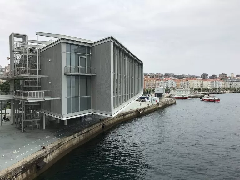
The centre runs along the bay from the ferry port to the marina basin of Puertochico. Here are the cathedral, whose lower church was built around 1200 (Wikipedia), and the Centro Botín, opened in 2017 in the Pereda Gardens: Renzo Piano’s arts centre stands on slender columns partly over the sea, with a public roof terrace. Puertochico was the old seafaring quarter until the fishermen moved to the Barrio Pesquero in 1946 (Spanish Wikipedia). Boats round the bay and to Pedreña and Somo leave from the waterfront.
Santander: the Magdalena peninsula
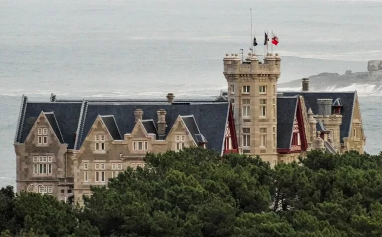
The Magdalena Palace, begun in 1908 on top of the peninsula, was the summer residence of King Alfonso XIII and Queen Victoria Eugenia; since 1933 it has been the seat of the Menéndez Pelayo International University. Guided tours are by appointment through the palace website. Around it are gardens, the La Magdalena Marine Park and the El Magdaleno tourist train. On the bay side, La Magdalena beach (900 m) and Los Peligros (200 m) have calm water.
Santander: El Sardinero
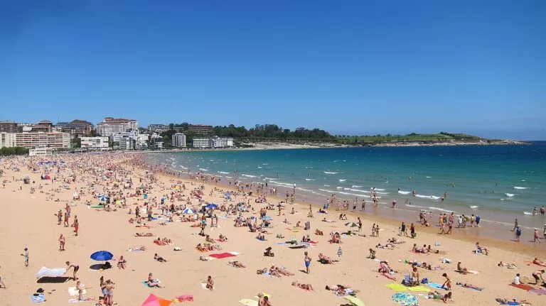
El Sardinero is the district and the beaches on the open sea, about 2.3 km from the centre. The First beach (350 m) and the Second (1,000 m) are separated by the Piquío gardens and join at low tide. The resort grew in the 19th century, and the Gran Casino and the Hotel Real followed the royal family after 1912 (Spanish Wikipedia). The Racing de Santander stadium stands behind the beach, and the lighthouse on Isla de Mouro is in view offshore.
Santander: Cabo Mayor and Mataleñas
North of El Sardinero the city ends in green headlands. Mataleñas has a 125 m beach reached only on foot. Beyond it is the lighthouse of Cabo Mayor, which Wikipedia says presides over the entrance to the bay. The walk from the Sardinero beaches past Mataleñas to the cape gives open sea views away from the traffic.
Santander: the Barrio Pesquero
The fishing quarter, south-west of the centre, was built in the 1940s for the fishing families of Puertochico and opened in 1946, with the fish market across the dock (Spanish Wikipedia). spain.info sends visitors here for rabas (fried squid), maganos (squid with onions) and clams in marinara sauce.
Pedreña (Marina de Cudeyo)
Pedreña sits on a peninsula about 2 km across the bay from Santander, though 18 km away by road, and the boats from Santander stop here on the way to Somo (Wikipedia). It is the home village of the golfer Seve Ballesteros (1957–2011) and of the Real Golf de Pedreña, opened in 1928 with views over the bay.
Somo and El Puntal (Ribamontán al Mar)
Somo faces Santander from the east side of the bay. Somo beach is 2,000 m by 80 m, with strong waves loved by surfers, a surf school, a lifeguard and a car park; the village also has ceramics workshops. West of it, El Puntal is a 4,500 m spit of sand and dunes at the mouth of the bay, the most unspoilt of the three beaches, reached on foot or by boat. In 2012 Ribamontán al Mar was declared Spain’s first surf reserve (Spanish Wikipedia).
Loredo and Langre (Ribamontán al Mar)
Loredo, east of Somo, is the third of the three beaches, 1,400 m with showers, a car park and a campsite at its right-hand end. Offshore lies the Isla de Santa Marina, the largest island in the Cantabrian Sea, private and seen from the clifftops above Loredo. Further east are the long beach of Langre (Spanish Wikipedia) and the 150 m cove of Galizano, before the coast runs on towards Noja.
Beaches and coves
Our pick from west to east. Lengths, waves and services are from spain.info’s beach sheets, checked November 2026. Most of these beaches face the open Cantabrian Sea, so swim where there is a lifeguard and check the flags.
Valdearenas
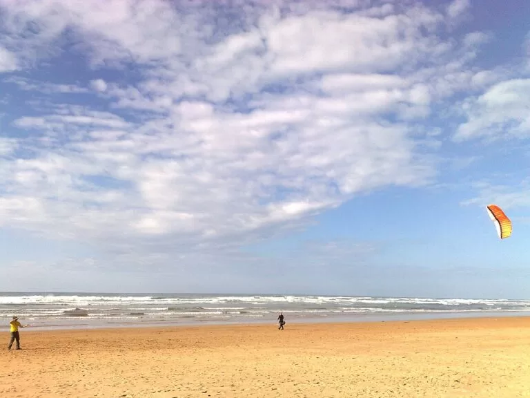
2,800 m by 50 m of golden sand inside the Liencres natural park, with dunes reaching the beach; strong, windy waves and a surf area. Liencres Dunes guide.
El Sardinero
The city’s two main beaches, 350 m and 1,000 m, with moderate waves, a promenade and full services, easy to reach even with limited mobility. El Sardinero guide.
Somo
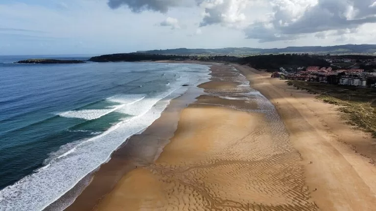
2,000 m by 80 m, part of more than 8 km of sand with El Puntal and Loredo; strong waves, a surf school and a lifeguard. Somo beach guide.
- Cuchía (Miengo) – 300 m with moderate waves, a car park with reserved disabled spaces and ramps to the sand.
- Canallave (Piélagos) – 220 m at the western end of the dunes, sheltered by rocks; surfing, beach volleyball and paragliding.
- Somocuevas (Piélagos) – a 100 m cove reached by a path from a clifftop car park, sheltered by Somocueva Point. spain.info lists it as a nudist beach.
- La Arnía (Piélagos) – 150 m below a large smooth rock that shelters it, facing Castro Island; a scuba diving area.
- Covachos (Santa Cruz de Bezana) – split by a rocky cliff, with a sand bar to Castro Island at low tide; difficult path down.
- La Magdalena and Los Peligros (Santander) – calm bay beaches of 900 m and 200 m.
- El Puntal (Ribamontán al Mar) – 4,500 m of sand and dunes at the mouth of the bay, no services; walk from Somo or take a boat.
- Loredo (Ribamontán al Mar) – 1,400 m, strong waves, showers and a car park, facing Isla de Santa Marina.
Things to do
Nature
Walk the Liencres Dunes and their pine wood, then follow Costa Quebrada east: cliffs, rock platforms and islets that UNESCO certified as a Global Geopark in 2025, which spain.info calls an open-air laboratory of geology. Spanish Wikipedia describes a coastal walk from Somocuevas to the Mogro estuary and up La Picota (239 m). Near Santander, walk round the Magdalena peninsula to Cabo Mayor, facing Isla de Mouro, or the 8 km of sand from El Puntal to Loredo, facing Isla de Santa Marina.
History and art
At Altamira, a World Heritage Site since 1985, the museum’s Neocave reproduces the painted cave; the real cave is closed to normal visits. Then spend an hour in Santillana del Mar for the collegiate church and its cloister. In Santander, add the Magdalena Palace on a booked tour, the Centro Botín, the cathedral crypt, the Maritime Museum and the Museum of Prehistory and Archaeology of Cantabria.
Food and drink
Eat fish in Santander’s Barrio Pesquero, where spain.info recommends rabas, maganos and clams in marinara sauce. In Santillana, the local specialities include cocido montañés, a stew of beans, meat and cabbage, Cantabrian cheeses and sobaos pasiegos, a buttery sponge cake.
Surfing
Somo has a surf school on the beach, and Valdearenas and Canallave at Liencres have surf practice areas. The waves are strong at all three, so beginners should take a lesson.
Where to stay by town
We do not list hotels. These are the bases we would choose, with what each suits.
Santander centre
The widest choice of hotels and restaurants, the train and bus stations and the ferry port, and boats across the bay. Good without a car.
City break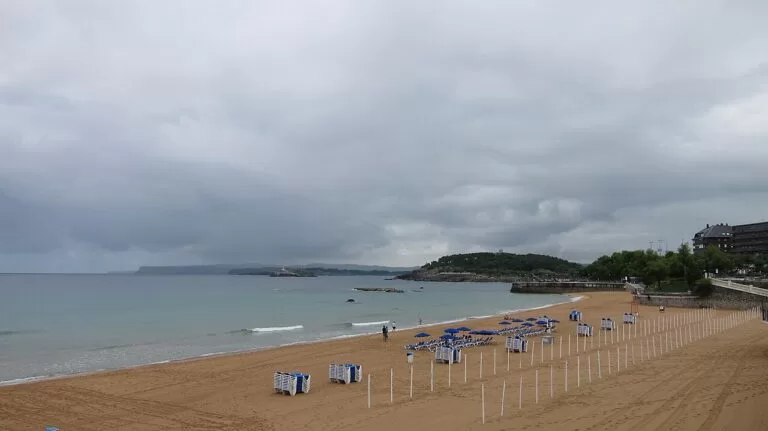
El Sardinero
Hotels and flats by the beach, linked to the centre by city buses; the Magdalena peninsula and Mataleñas are on foot.
City beach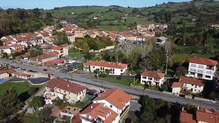
Santillana del Mar
A medieval town with a Parador and a campsite, 2 km from Altamira. Quiet in the evening once the day visitors leave; a car helps.
History and caves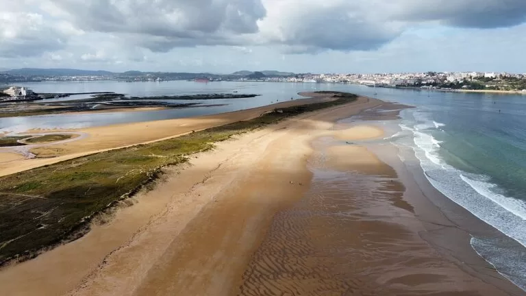
Somo and Loredo
Beach villages with a surf school on Somo beach and a campsite at Loredo, a boat ride from Santander.
Beach and surfGetting there and around
By air: Seve Ballesteros-Santander Airport (SDR) is at Maliaño, 5 km from Santander. spain.info says a bus runs to the city every 40 minutes between 07:00 and 23:00, and there are taxis.
By sea: the ferry port is in the city centre, so foot passengers can walk into town. Brittany Ferries sails from Portsmouth and Plymouth, and Wikipedia also lists Cork in Ireland.
By train, bus and car: Santander’s railway and bus stations face each other in the centre. The A-67 links the city with the A-1, and the A-8 runs along the coast. For Liencres, take the CA-231 and then the CA-305 to the sea; for Somo by road, the CA-141 round the bay.
Across the bay: passenger boats run from the Santander waterfront to Pedreña and Somo; OpenStreetMap shows both Los Reginas and Alsa on the route, so check the current operator and timetable at the quay.
Getting around: Santander has city buses and the TUeBICI bike-share; Santillana, Altamira and the Liencres dunes are easier by car.
A two-day route
Two days
Day 1
Altamira, Santillana del Mar and the Liencres dunes
Book the Altamira Museum ahead and start there with the Neocave, then drive 2 km to Santillana del Mar for the collegiate church, Calle de Santo Domingo and lunch. In the afternoon, take the CA-231 and the CA-305 to Valdearenas and walk through the dunes and the pine wood to Canallave.
Day 2
Santander and the boat to Somo
Begin at the Centro Botín and its roof terrace, walk past Puertochico to the Magdalena peninsula, and take the palace tour if you have booked it. Continue to El Sardinero and the Piquío gardens for a swim or lunch. In the afternoon, take the boat from the waterfront across the bay to Somo, walk west along El Puntal or watch the surfers, and come back on an evening boat for dinner in the Barrio Pesquero.
FAQ
What is the best beach near Santander?
In the city, El Sardinero, with two beaches of 350 m and 1,000 m and full services. For a wilder beach, Somo is a short boat ride across the bay, and Valdearenas at Liencres is about 13 km west.
How do I get from Santander to Somo?
By passenger boat from the Santander waterfront, which also calls at Pedreña, or by road on the CA-141 round the bay.
How far is Santillana del Mar from Santander?
About 25 km in a straight line west of the city. The Altamira Museum is 2 km from Santillana.
Can you visit the Altamira cave?
The original cave is closed to normal visits. The Altamira Museum near Santillana has the Neocave, a replica of the painted cave.
Where can you surf near Santander?
Somo, with a surf school on the beach; Valdearenas and Canallave at Liencres; and El Sardinero in the city. Somo and Liencres have strong waves.
Other areas of the Costa de Cantabria
Western Cantabria
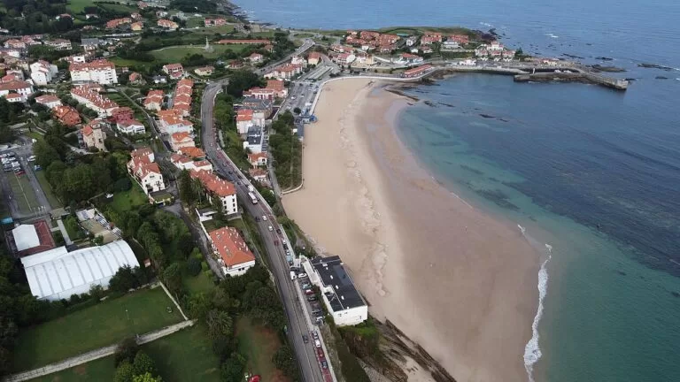
The estuary town of San Vicente de la Barquera, the dunes of Oyambre, Gaudí’s Comillas and the surf at Suances.
Western Cantabria guide →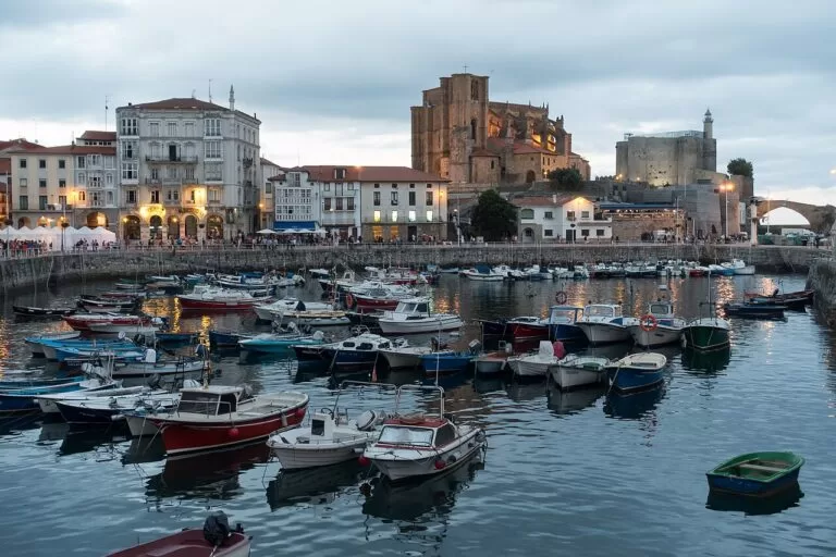
Eastern Cantabria
The long beaches of Noja and Laredo, the anchovy port of Santoña and the Gothic harbour of Castro Urdiales.
Eastern Cantabria guide →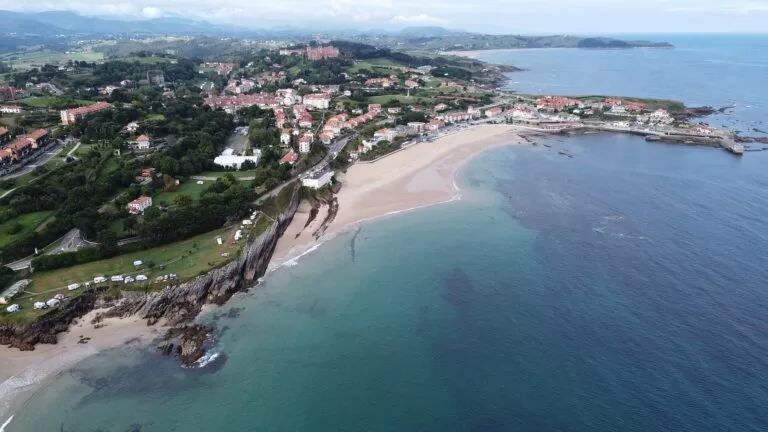
Costa de Cantabria
The full guide to the coast of Cantabria: all three areas, the caves you can visit, campsites, weather and routes.
Costa de Cantabria guide →Sources and freshness
Checked 9 November 2026. spain.info (Turespaña) on Santander, the Magdalena Palace, the Centro Botín, Santillana del Mar and the Liencres and Costa Quebrada Natural Park; and its beach sheets for Cuchía, Usgo, Valdearenas, Canallave, Somocuevas, Portio, Cerrias, La Arnía, Covachos, La Magdalena, Los Peligros, La Concha, Sardinero I, Sardinero II, Mataleñas, El Puntal, Somo, Loredo and Galizano. The Cantabria tourist board (turismodecantabria.com) blocked our requests. Background: Wikipedia on Santander, the Bay of Santander and Pedreña, and Spanish Wikipedia on the Liencres natural park, El Sardinero, Puertochico, the Barrio Pesquero, Somo beach and Ribamontán al Mar. Altamira’s World Heritage date: UNESCO. Roads, the bay ferry route, car parks and straight-line distances: OpenStreetMap contributors (ODbL).
Photo credits · 13 photos from Wikimedia Commons Show
Photos from Wikimedia Commons, not altered except for cropping: El Puntal and Somo by Luis Fermín TURIEL PEREDO (CC BY-SA 4.0); Valdearenas, Liencres by www.webcamsantander.… (CC BY 3.0); El Sardinero by Carlos Cunha (CC BY-SA 3.0); Somo by Luis Fermín TURIEL PEREDO (CC BY-SA 4.0); Centro Botín by Zandcee (CC BY-SA 4.0); El Sardinero by Carlos Cunha (CC BY-SA 3.0); Santillana del Mar by Luis Fermín TURIEL PEREDO (CC BY-SA 4.0); El Puntal by Luis Fermín TURIEL PEREDO (CC BY-SA 4.0); Santillana del Mar by Luis Fermín TURIEL PEREDO (CC BY-SA 4.0); Magdalena Palace by Carlos Ramón Bonilla… (CC BY-SA 3.0); Comillas by Luis Fermín TURIEL PEREDO (CC BY-SA 4.0); Castro Urdiales by Edmundo Sáez (CC BY-SA 4.0); Comillas by Luis Fermín TURIEL PEREDO (CC BY-SA 4.0).