
Níjar is a large municipality in Almería province, and for most visitors it means the Cabo de Gata-Níjar natural park: the fishing village of San José, the old mining village of Rodalquilar and dozens of coves along about 50 km of coast. It suits walkers, beach people and anyone who wants small white villages instead of a resort strip, and it works best with a car. It is part of our Costa de Almería guide.
Quick facts
- Where: the municipality of Níjar, in the province of Almería, Andalusia. The Níjar tourist office counts 25 settlements and describes it as the largest municipality by area in the province.
- Residents: 33,319 in the municipality on 1 January 2025 (INE, municipal population figures).
- Beach: yes. The tourist office lists 37 beaches and coves and gives the coast as about 50 km long.
- Nearest city: Almería. San José is 56 km from Almería, according to the Níjar tourist office.
- Nearest airport: Almería Airport, 9 km east of Almería city (Aena). There is no airport in the municipality.
- Park size: the natural park covers 37,497 ha of land and 12,120 ha of sea, a strip one nautical mile wide (Níjar tourist office).
- Language: Spanish.
- Known for: volcanic beaches and coves, the gold-mining village of Rodalquilar and the rag rugs of Níjar village.
Where to base yourself
The municipality is spread out, so the choice of base decides how much driving you do. Four areas cover most trips.
San José
San José is the main visitor base. The tourist office calls it a fishing village surrounded by the Sierra de Gata, with white houses stepping up the hills around the bay, and its tourist office directory is the longest of any village, with hotels, hostels, a campsite at Cala Higuera and dive centres. It is also the starting point for the beaches to the west, including Genoveses and Mónsul. It suits families and first-time visitors who want shops, restaurants and a beach within walking distance. The trade-off is that it is the busiest place in the park in peak season.
Rodalquilar and Los Escullos
Rodalquilar is a former gold-mining settlement, and the tourist office says it became a ghost town when the mines closed in the 1960s. Today it has the park’s administrative centre, a botanical garden and a geology museum. Los Escullos, on the coast, is described by the tourist office as a tiny white village with a 17th-century castle and a fossil dune at its foot. Both suit people who want quiet, walking and a small number of places to eat. You will need a car or a plan for the bus.
Las Negras and Agua Amarga
Las Negras sits at the foot of Cerro Negro and keeps the look of a Mediterranean fishing village, with few cars in the streets. Agua Amarga, further south, is a small fishing village with fewer than 300 residents, according to the tourist office. Choose these for coves reached on foot and for evenings with very little going on. Skip them if you want nightlife or a large choice of restaurants.
Níjar village
Níjar village is inland, on the slopes of the Sierra Alhamilla between the Tabernas Desert and the coast. It is not a beach base. Stay here only if you want a craft village as your main focus, and treat the coast as a day trip by car.
Things to do
Níjar village and its crafts
The tourist office says the best-known product of Níjar is its jarapas, woven rugs, along with pottery and esparto-grass work. The parish church of Nuestra Señora de la Asunción is a Mudéjar church in the village since the 16th century, with a Mudéjar timber ceiling. The quarters of La Atalaya and El Portillo are where the Arab origins of the village are easiest to see. Walk the old streets and look at the rugs and pottery.
Rodalquilar and the Casa de los Volcanes
The Junta de Andalucía describes the Casa de los Volcanes as an ecomuseum in the former Casa PAF, a gold-ore processing building. It offers a guided geological walk through the landscapes of the Cabo de Gata Geopark, and one room covers the district’s mining history, from alum in the 16th century to the modern gold plant. The Junta says gold working ended in 1966. Above the beach of El Playazo stands the Castillo de San Ramón, built for coastal defence.
The lighthouse at the south-eastern tip
The Cabo de Gata lighthouse marks what the tourist office calls the south-easternmost point of the Iberian Peninsula. Below it lies the Arrecife de las Sirenas, a reef said to be named by sailors who mistook monk seals for sirens. The tourist office also notes a fortress here dating from 850 and the later Castillo de San Francisco de Paula, built in 1600.
Beaches and places nearby
The beaches are the main reason to come. They fall into three types: village beaches, beaches on the dirt track west of San José, and coves that need a walk.
West of San José
Los Genoveses is the largest beach in its bay. The tourist office gives it as 1,180 m long and 80 m wide, calls it a virgin beach with many dunes and says private car access is restricted to a limited number of vehicles. Mónsul is smaller, 300 m long and 45 m wide, with a large living dune. The tourist office lists Raiders of the Lost Ark, The Adventures of Baron Munchausen and Lawrence of Arabia among the films shot there. Both sit in an area without paved roads. Cabo de Gata transport information says that in peak season you reach this stretch on foot or on a special bus line, so check the current arrangement with the tourist office before you plan the day.
Rodalquilar, Los Escullos and Las Negras
The tourist office describes El Playazo near Rodalquilar as golden and clear, set in white, steep surroundings. At Los Escullos it names the beaches of El Arco and El Esparto. Las Negras has a village beach that the tourist office says is mostly filled with parked boats. From Las Negras, Cala de San Pedro can be reached only by boat or on foot, a walk of about two hours according to the tourist office; there is a freshwater spring on the beach and a ruined castle-battery above it. Take water and sun protection.
Agua Amarga and south
Cala de Enmedio near Agua Amarga can be reached only on foot. Playa de los Muertos, which the tourist office calls the last beach of the natural park, lies past the Mesa Roldán tower toward Carboneras. Our Carboneras guide covers the next town along the coast.
For a bigger city with a fortress and city beaches, see our Almería guide.
Other town guides nearby: Mojácar (about 37 km in a straight line).
Food and drink
Food here is fishermen’s and farmers’ cooking. The Guía del Parque, an information site for the natural park, lists traditional dishes of the park area, and several of them are easy to find in the villages:
- Gurullos con jibia: a stew of handmade wheat pasta, chickpeas and cuttlefish.
- Arroz caldúo: a soupy rice cooked with fish in a clay pot, to be eaten at once.
- Cuajadera de pescado: whole fish baked on sliced onion and potato, with tomato, pepper, garlic and lemon.
- Salmonetes con ajoblanco: fried red mullet with a sauce of garlic, almonds, bread and olive oil.
- Migas: in Almería made with flour rather than bread.
Where to stay
The tourist office directory lists the accommodation by village, and the range is wide: small hostels and family-run hotels in San José, rural cortijos and hotels around Los Escullos and Rodalquilar, and campsites such as the one at Cala Higuera. Prices follow the season, so compare dates and check current rates with each property. San José has the most entries in the directory, while the smaller villages have only a handful of places each, so book those first if you have a particular village in mind.
Getting there and around
Flying in
The nearest airport is Almería Airport, 9 km east of Almería city, according to Aena. From there you can take city bus line 30 into Almería, where the long-distance and regional coaches start, or collect a hire car. San José is 56 km from Almería (Níjar tourist office).
By bus
Buses from Almería’s intermodal station serve the park, but they are infrequent, so check the current timetable before you plan a day around them. Autocares Bernardo runs a service to San José and Isleta del Moro. According to the Cabo de Gata transport page, Bernardo also serves Los Escullos, Los Albaricoques and Pozo de los Frailes, Alsa runs a line to Rodalquilar through Níjar, Fernán Pérez, Las Hortichuelas and Las Negras, and Frahermar serves Carboneras and Agua Amarga. The Níjar town council also runs a line linking San José, Los Escullos, La Isleta, Rodalquilar, Las Negras and Fernán Pérez on Wednesdays and Thursdays only. Buses do not link all the villages directly, so moving between them can mean going back to Almería.
By car
A car gives the most freedom, especially for the coves and the track west of San José. Distances between villages are short on the map but roads are winding. Be ready for the access rules at the beaches west of San José in peak season, described above.
Best time to visit
The AEMET climate normals used here are for Almería Airport, on the coast of the neighbouring municipality, for 1981 to 2010. They give a mean temperature of 12.6 °C in January, 26.1 °C in July and 26.7 °C in August, with 200 mm of rain a year and 2,994 hours of sunshine. July has 1 mm of rain on average. These are long-term averages from one station, not a forecast, and the park’s villages can differ from them.
The practical reading: summer is hot and the beaches are busiest, with the vehicle rules in force on the western beaches. The January mean of 12.6 °C shows how mild winters are, and the long hot summer is why the coves on foot are best tackled early. Check local sources for festival dates.
FAQ
Is Níjar a beach destination?
Mostly yes, if you mean the coast: the tourist office lists 37 beaches and coves along about 50 km of shore. Níjar village itself is inland, so choose your base by whether you want the coast or the craft village.
Do you need a car in Níjar?
For the best coves, yes. Buses link Almería with San José, Rodalquilar, Las Negras and Agua Amarga, but they do not connect every village, and the beaches west of San José are reached on foot or by a special bus in peak season.
How far is San José from Almería?
56 km, according to the Níjar tourist office. Almería Airport is 9 km east of Almería city (Aena).
Which is the best base: San José or Rodalquilar?
San José has more places to stay and eat and is the starting point for the western beaches. Rodalquilar is quieter and suits geology, mining history and walking.
How long is Los Genoveses beach?
1,180 m long and 80 m wide, according to the Níjar tourist office.
Sources and freshness
Last checked: October 2026. Bus services, beach access rules and opening hours change, so confirm them with the operator or the tourist office before you travel.
- INE, official population figures (table 2857, municipality of Níjar, 1 January 2025)
- Níjar tourist office, villages of the municipality
- Níjar tourist office, San José
- Níjar tourist office, Níjar village
- Níjar tourist office, Rodalquilar
- Níjar tourist office, Las Negras
- Níjar tourist office, Los Escullos
- Níjar tourist office, Agua Amarga
- Níjar tourist office, Cabo de Gata lighthouse
- Níjar tourist office, the natural park
- Níjar tourist office, list of beaches
- Níjar tourist office, Los Genoveses beach
- Níjar tourist office, Mónsul beach
- Junta de Andalucía, Cabo de Gata-Níjar natural park
- Junta de Andalucía, Casa de los Volcanes
- Aena, Almería Airport bus
- Autocares Bernardo, Almería to San José
- Cabo de Gata Almería, public transport in the park
- Guía del Parque, traditional cooking of Cabo de Gata-Níjar
- AEMET, climate normals, Almería Airport
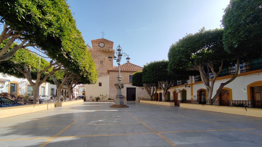
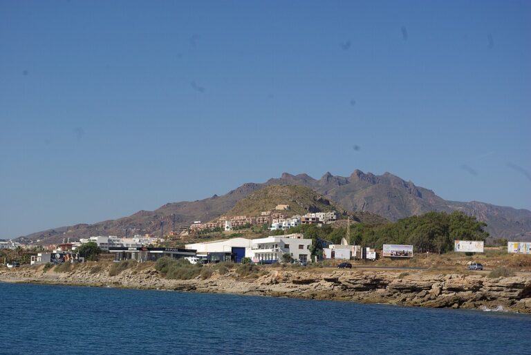
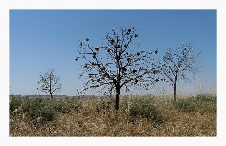
Main photo: MdeVicente, CC0, via Wikimedia Commons.
Nearby on the Costa de Almería
Níjar on the map
Places worth knowing near Níjar
How this page is maintained. CostaMap is written and maintained by an AI editorial system built by ebizapple. Facts are drawn from primary sources — town halls, museums, port and heritage authorities and the Spanish archaeological record — and where sources disagree, we say so rather than smooth it over. Photographs marked as ours are taken on location. This page was last reviewed on 29 October 2026. Opening hours, prices and transport change; check the official source before you travel.