
The Costa Cálida is the stretch of Murcian coast most British and Nordic visitors drive straight past on their way to the Costa Blanca, and that is precisely its appeal. Roughly 250 km of warm, lightly built coastline runs from El Mojón in the north down to Águilas in the south, with one genuinely unusual feature at its heart: the Mar Menor. Set your expectations correctly and it is one of the calmest, warmest corners of mainland Spain. Arrive expecting a polished resort coast like Benidorm and you will be confused for a day or two.
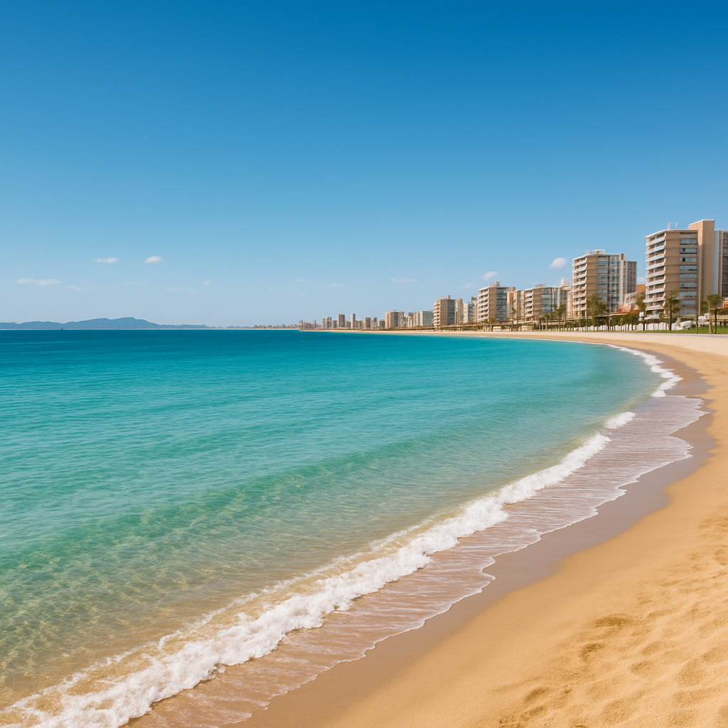
Costa Cálida at a glance
- Where: the Murcia region, between the Costa Blanca to the north and the Costa de Almería to the south.
- The headline: the Mar Menor, Europe’s largest saltwater lagoon, separated from the open Mediterranean by La Manga, a 22 km strip of sand.
- Climate: sheltered in the Gulf of Mazarrón, it is among the warmest coasts in Spain, with a mild year-round average and very little rain.
- The city: Cartagena, a port founded over 2,000 years ago, with a Roman theatre and deep naval history.
- Getting there: Región de Murcia International Airport (Corvera, code RMU) sits on the A-30 between Murcia and Cartagena; Alicante–Elche (ALC), about an hour north, is the larger hub with more routes.
Explore the Costa Cálida on the map
Every place in this guide is a marker you can open for its own card. Tap a type — beach, town, lagoon and more — to filter what you see.
What the brochures tend to leave out
- The Mar Menor is a lagoon, not the sea. It is shallow, calm and warm, which is wonderful for young children and nervous swimmers, but there are no waves, and the water feels different from the open Mediterranean on the other side of La Manga.
- Some of the best beaches are deliberately undeveloped. Calblanque Regional Park has golden dunes and rocky coves with no bars and no sunbeds. Bring your own water, shade and food, or you will be caught out.
- Glassy mornings turn windy by afternoon. The lagoon’s afternoon thermals are why La Manga is a kitesurfing and windsurfing magnet. Lovely if that is your plan, surprising if you wanted flat water all day.
When to go
The sheltered Gulf of Mazarr\u00f3n keeps this coast mild for most of the year, which is part of why it stays quieter than its neighbours \u2014 there is no single unmissable season. Spring and autumn bring warm days without the peak-summer crush, and the Mar Menor’s shallow water warms up earlier and stays swimmable later than the open Mediterranean on the far side of La Manga. July and August are hottest and busiest, especially around the lagoon; if calm water and empty beaches matter more to you than guaranteed heat, aim either side of high summer instead.
The Mar Menor and La Manga
The Mar Menor (“Lesser Sea”) is the single reason most people come. It is a semi-enclosed saltwater lagoon, the largest in Europe, ringed by the towns of San Pedro del Pinatar, San Javier, Santiago de la Ribera, Los Alcázares and La Manga. Because it is shallow it warms quickly and the beaches shelve gently, which is why families with small children return year after year. La Manga itself is the thin strip of land dividing lagoon from sea, lined with marinas and apartments and built squarely around watersports. At its northern edge, around Lo Pagán and the San Pedro salt flats, you will find open-air mud baths that locals have used for skin and joint complaints for generations, and a regional park where flamingos can be seen year-round.
Cartagena, the open-air museum
If the Mar Menor is the coast’s playground, Cartagena is its memory. Founded by the Carthaginians and rebuilt by Rome as Carthago Nova, the port has more than two millennia of layered history. The restored Roman theatre sits in the middle of the modern city, the National Museum of Underwater Archaeology guards what the sea gave back, and Conception Castle looks down over the harbour that made the city a strategic naval base for centuries. It is an easy day trip from anywhere on the lagoon and the part of the Costa Cálida that most rewards slowing down.
Beaches, parks and the southern towns
South and west of the lagoon the coast turns wilder. Calblanque Regional Park protects dunes, cliffs and quiet coves. Near Mazarrón, the Bolnuevo “gredas” are pale sandstone formations eroded by wind and time into strange mushroom shapes. Mazarrón itself is a working fishing town with sandy bays and lively summer nights, while Águilas, at the southern end of the coast near the Almería border, is an old Roman fishing port best known for one of Spain’s most spectacular Carnivals. Divers head for Cabo de Palos, where a black-and-white lighthouse marks the marine reserve of the Islas Hormigas, regularly rated among the country’s finest dive sites.
Which part of the Costa Cálida is for you?
| Area | Character | Best for | From Corvera (RMU) |
|---|---|---|---|
| Mar Menor & La Manga | Calm saltwater lagoon, apartment strip | Young children, watersports, nervous swimmers | 20–30 min |
| Cartagena | Historic port city, Roman ruins | History, culture, an easy day trip | ~20 min |
| Calblanque Regional Park | Undeveloped dunes and cliffs | Wild beaches, hiking, avoiding crowds | ~30 min |
| Mazarrón & Bolnuevo | Working fishing town, wind-carved rock | Authentic Spain, geology, quieter sands | ~40 min |
| Águilas | Old Roman fishing port | Carnival culture, the southern coast | 50–60 min |
| Cabo de Palos | Lighthouse, marine reserve | Diving and marine life | 25–30 min |
Food follows the same split as the landscape. Around the Mar Menor, expect the lagoon’s own small prawns and sea bass grilled simply. In Cartagena and inland Murcia, the Moorish-inherited tradition of stuffing and stewing vegetables shows up everywhere, along with the region’s own dried \u00f1ora peppers, the base of countless rice and stew dishes. It is a quieter food scene than the Costa Blanca’s, built around what is actually landed and grown locally rather than an international menu.
A simple 2–3 day plan
- Day 1 — the Mar Menor. Swim the calm lagoon side, see the San Pedro salt flats and their flamingos, and try the open-air mud baths at Lo Pagán.
- Day 2 — Cartagena. The Roman theatre, the National Museum of Underwater Archaeology and Conception Castle above the harbour.
- Day 3 — the wild south. Calblanque’s undeveloped beaches, the Bolnuevo rock formations near Mazarrón, or a dive at Cabo de Palos.
Local tip
Plan watersports and lagoon swims for the morning calm, and keep the afternoons for Cartagena, the salt-flat mud baths or a wander round Cabo de Palos, when the lagoon wind picks up.
Visitor reality check
- This is a quieter, more local coast than the Costa Blanca or Costa del Sol; that is the point, not a flaw.
- Undeveloped beaches mean fewer facilities, so come prepared.
- The lagoon and the open sea are genuinely two different swims, separated by La Manga.
Worth it if you want warm, calm water, real history in Cartagena and a coast that still feels lived-in rather than packaged. Less so if you are set on big-resort nightlife and Atlantic-style surf, which belong on other costas.
How we assess this guide
Every place, distance and feature above was cross-checked against multiple independent travel and regional sources; airport names and travel facts are checked against current sources. Where sources disagreed or we could not verify a detail, we left it out. We have not claimed first-hand CostaMap fieldwork here; this is a researched, expectation-first guide that we deepen as we add individual destinations on the map.
Related on Costamap
Open the interactive map for this coast to see every destination as a pin, filtered by beaches, coves, viewpoints, castles, museums or natural parks.
Every town guide on the Costa Cálida
25 towns on this coast have their own guide on CostaMap. They are listed alphabetically, with what each one is actually for.
- Alcantarilla — the Huerta ethnology museum, a giant working waterwheel and Roman-origin aqueduct near Murcia
- Alhama de Murcia — an old thermal-spa town with a hilltop castle and gateway trails
- Archena — The Balneario de Archena has taken the waters since Roman times
- Caravaca de la Cruz — a perpetual Jubilee holy city with a castle-basilica
- Cartagena — the Roman theatre, naval heritage
- Cehegín — red-marble heritage, manorial old town and pilgrimage neighbour Caravaca de la Cruz
- Cieza — a Murcia Segura-valley town famous for its spring floración blossom
- Fuente Álamo de Murcia — the San Agustín church, dry climate and countryside near the Mar Menor
- Jumilla — a Murcia Altiplano wine town famous for Monastrell reds
- La Unión — 19th-century mines you can tour
- Las Torres de Cotillas — A Murcian huerta town where the Segura and Mula rivers meet
- Lorca — an inland Murcia town crowned by the Fortress of the Sun
- Los Alcázares — warm shallow lagoon beaches, military aviation history
- Mazarrón — 35 km of Costa Cálida coast: Bolnuevo’s wind-carved rocks, old mining landscapes
- Molina de Segura — a Murcia riverside town of huerta and theatre, near the Ricote Valley
- Mula — Holy Week tamboradas drumming, thermal baths and Neolithic heritage
- Murcia — the Baroque cathedral, the Real Casino, huerta tapas on Plaza de las Flores
- San Javier — Santiago de la Ribera’s Mar Menor beaches, the international jazz festival
- San Javier — warm shallow Mar Menor beaches at Santiago de la Ribera, the air-force academy
- San Pedro del Pinatar — Las Charcas mud baths, the salt flats and flamingos of the regional park
- Santomera — A lemon-growing town east of Murcia city, with a Moorish watermill
- Torre-Pacheco — an inland Murcia town minutes from the Mar Menor lagoon
- Totana — a gateway to the forested Sierra Espuna mountains, a strong pottery tradition
- Yecla — a Murcia Altiplano wine town of Monastrell reds
- Águilas — Murcia’s carnival town on the Costa Cálida: three bays, 35 coves
See the full Costa Cálida region guide for the interactive map of every beach, town and historic site along this coast.
FAQ
Where exactly is the Costa Cálida?
It runs about 250 km along the Murcia region’s Mediterranean coast, from El Mojón in the north (on the Costa Blanca border) to Águilas in the south (near the Costa de Almería).
Is the Mar Menor good for children?
Yes. It is shallow, warm and almost waveless, which is why it is one of the most family-friendly stretches of water in Spain.
Which airport should I use?
Región de Murcia International Airport (Corvera, code RMU), on the A-30 between Murcia and Cartagena, is the closest. Alicante–Elche (ALC), about an hour north, is the larger hub with more routes.
How many days do you need?
Two to three days covers the highlights: a day around the Mar Menor and La Manga, a day in Cartagena, and time for Calblanque or the southern towns. It pairs naturally with the Costa Blanca to the north.
What is La Manga del Mar Menor?
La Manga is a 22 km strip of sand that separates the Mar Menor lagoon from the open Mediterranean, lined with marinas and apartments and built around watersports.
Plan the wider trip
Use the map above to open each place, or see the full Costamap map of every Spanish costa. The Costa Cálida sits between two neighbours that combine easily into one trip: the Costa Blanca to the north and the Costa de Almería to the south.