
Expect a small inland Murcian town where agriculture and local rhythms shape daily life more than tourism. This guide gives a plain-speaking, practical look at what to expect: an historic settlement with Roman roots, lively local festivals, a working agricultural landscape dominated by peaches and lemons, basic health and school infrastructure, and a handful of sights that reward a curious day visitor. If you arrive expecting beaches or heavy tourist infrastructure you’ll be disappointed; if you want authentic local festivals, quiet streets and short day trips across Murcia, this place delivers.
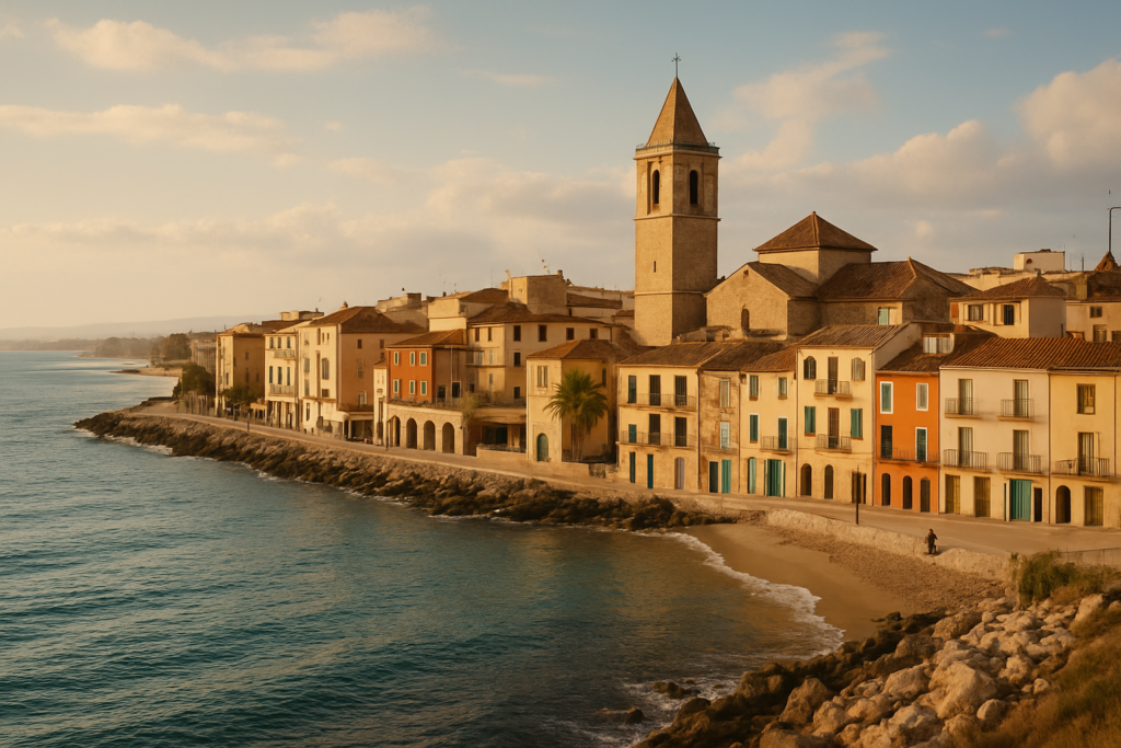
Las Torres de Cotillas at a glance
- Population: the main locality is inhabited by about 16,645 people.
- Founded in 1318; archaeological evidence indicates a Roman villa here in the 2nd century BC.
- Agricultural: roughly 25.7% of municipal territory is used for crops — mainly peaches and lemons.
- Health services: a centro de salud in the main town plus a consultorio in Los Pulpites; the area belongs to Health Area VI (Vega Media del Segura).
- Education: six early childhood and primary centres and two secondary centres serve the municipality.
- Geography: the Segura River crosses the western third of the municipality.
- Noticeable landmark: a 186-metre guyed radio mast stands to the west at 38°01’35″N 1°15’15″W.
Before you plan
This guide reflects stable, non-seasonal local facts: public health and education locations, land use figures, heritage origins and festival timing. It does not include daily service timetables or private-business opening hours; check local sources for event dates and schedules before you travel.
Things to do in Las Torres de Cotillas
There aren’t long museum queues or theme-park days here. Instead, the best visits are short, local and tangible: wander streets shaped by centuries, note Roman-era remains, walk along the Segura where the town meets the river plain, and plan a visit around one of the local festivals if your travel dates line up. Below is a quick comparison of the main points of interest grounded in municipal facts.
| Attraction | What it is | Price/entry | Best for |
|---|---|---|---|
| Roman villa remains | Archaeological evidence of a 2nd century BC villa | — | history-minded visitors |
| Segura River banks | Riverside area traversing the western third of the municipality | free | walks, birdwatching, short nature strolls |
| Town festivals | Carnival, Holy Week and patron saint festivities in early October | — | culture and events |
| Radio mast landmark | 186-metre mediumwave broadcasting mast west of town (38°01’35″N 1°15’15″W) | — | industrial/landmark photography |
Roman-era archaeology
Archaeological records show a Roman villa in the area going back to the 2nd century BC. There is no claim here of a large, on-display archaeological park, so treat the villa as a historical insight that explains the long continuum of settlement in the area rather than as a major tourist attraction with full visitor facilities.
Walks and the Segura
The Segura River traverses the western third of the municipality, creating a modest riverside landscape that is the most natural, open part of the area. Short riverside walks and low-key nature observation are the principal outdoor activities listed in local records. Because the river passes through working agricultural land, expect a landscape shaped by irrigation and orchards rather than wild riverbank wilderness.
Local calendar: festivals that shape the year
Local life is punctuated by a few recurring celebrations: Carnival, processions and activities around Holy Week, and the patron saint festivities in early October. Planning a trip to catch one of these will give the best experience of local culture — but double-check exact dates, which vary year to year.
Best beaches in the area
The municipality is inland and does not host beaches. If you want a beach day, plan a short drive to the Murcia coast or nearby Costa Cálida resorts; this town itself is agricultural and riverine rather than coastal.
Las Torres de Cotillas with kids
This is a family-oriented municipality with established schooling and basic health coverage rather than a family entertainment hub. Families visiting or relocating will find practical infrastructure: six early childhood and primary education centres and two secondary centres, which points to a community where children and adolescents are well catered for in day-to-day life. For family activities, consider timing visits for local festivals (which often include child-centred events) and riverside walks where children can move freely under supervision.
How to get to Las Torres de Cotillas and get around
The town sits in the eastern half of the Region of Murcia; local movement is typically by road. There is no verified claim here about rail stations or airport connections, so plan road transport from nearby Murcian hubs. Once in the municipality, expect short intra-town journeys and use the main town as your base — smaller population centres such as La Florida (921 people) and La Loma (202 people) are nearby and easily reached by local roads.
Where to stay in Las Torres de Cotillas
Accommodation choices are primarily concentrated around the main town; nearby localities include La Florida and La Loma, both small population centres that reflect the municipality’s rural-urban mix. Use the main town as your base for services and health access (the centro de salud is in the main town), and expect quieter, more residential stays if you opt for properties in La Florida or La Loma.
Best time to visit Las Torres de Cotillas
Visits are rewarding year-round if you adjust expectations. If public events matter to you, plan around the municipal calendar: Carnival and Holy Week are key times for public processions and community life, while the patron saint festivities occur in early October. For quieter visits focused on countryside walking, aim for shoulder seasons outside the main festival dates to avoid crowds.
| Season | Months | What to expect |
|---|---|---|
| Winter | December–February | Quieter town life; municipal services and shops open but fewer events |
| Spring | March–May | Holy Week activities may occur in spring; pleasant time for walks |
| Autumn | September–November | Patron saint festivities in early October — lively local celebrations |
History of the town
The site has deep historical roots: archaeological evidence attests to a Roman villa in the 2nd century BC, which shows the area was occupied long before the medieval period. The modern settlement traces its formal founding to 1318, established despite earlier Moorish settlements in the vicinity. This layered history explains the town’s mix of rural agricultural patterns and an organised municipal structure established in the late medieval era.
Practical info
Health services follow the Region of Murcia’s administrative structure: the municipality belongs to Health Area VI (Vega Media del Segura). Residents and visitors will find a centro de salud in the main town and a smaller consultorio in Los Pulpites. Agricultural activity is significant: 25.7% of municipal territory is used for crop cultivation, mainly peaches and lemons, and agriculture represented a measurable share of employment agreements in recent years. For travel logistics, expect roads connecting the main town to neighbouring localities; the western part of the municipality is defined by the Segura River, and a prominent mediumwave radio mast lies to the west at 38°01’35″N 1°15’15″W.
- Healthcare: centro de salud in the main town; consultorio in Los Pulpites; part of Health Area VI.
- Education: six early childhood and primary education centres; two secondary education centres.
- Agriculture: peaches and lemons are the primary crops; 25.7% of land is under cultivation.
- Landmarks: 186-metre guyed radio mast west of the municipality with exact coordinates recorded.
Worth it for: visitors seeking off-the-beaten-track Murcian life, local festivals, short rural walks along the Segura and an authentic agricultural landscape dominated by orchards.
Less so if: you want beaches, large museums, or a town centred on tourism infrastructure — the municipality is inland, agricultural and locally focused.
How we assess this guide
Facts in this guide are cross-checked against public regional and municipal records: founding dates, local demographics, healthcare and education facility counts, land-use percentages, and known festivals are drawn from verified sources. We flag closures or major changes when sources indicate them and prioritise stable, citable municipal facts. This is not original field reporting; it synthesises authoritative records to set correct expectations for visitors and reduce disappointment.
Frequently asked questions
How do I get from the nearest airport to the town?
There is no airport location given in the verified claims. The municipality is in the eastern half of Murcia and most airport-to-town journeys are by road from Murcia’s regional connections. Use regional transport hubs or car hire to reach the town; check current timetables and routes before you travel.
Is Las Torres de Cotillas expensive for dining and everyday costs?
There are no specific price claims in the verified data. The municipality is primarily residential and agricultural rather than a high-price tourist resort; everyday costs are typically in line with Murcian inland towns rather than coastal resort premiums.
Which is the best local place to experience typical Murcian festivities?
The patron saint festivities in early October are the municipality’s main late-year celebration. Carnival and Holy Week are other key moments for processions and local events. For a local cultural experience, plan your visit around one of these dates and confirm the exact programme in advance.
How many days should I spend here?
A single day allows you to walk the town, visit riverside stretches of the Segura, and learn about the Roman villa remains. Two to three days lets you attend local festivals or take relaxed day trips into the surrounding countryside and neighbouring Murcian towns.
Is the town family-friendly?
Yes. The municipality supports families with six early childhood and primary education centres and two secondary education centres, indicating an established family and youth infrastructure. Health services include a primary care centre in the main town and a consultorio in Los Pulpites.
Can I get around without a car?
There is no verified public-transport schedule in the claims. Within the town and to nearby localities such as La Florida and La Loma, roads connect the settlements; walking and short local trips are feasible, but inter-regional travel typically requires road transport. Confirm bus or taxi options locally.
Is parking available?
No specific municipal parking data is included in the verified claims. Expect typical small-town street parking and local public parking near the main town’s services, but check local signage when you arrive.
What are good rainy-day options?
Verified information focuses on festivals and heritage rather than indoor attractions. On wet days, use the town’s social and cultural venues that host events during Carnival, Holy Week and the patron saint festivities; contact local tourist information or municipal sources for current indoor activities.
When are the busiest times of year?
Festival periods — Carnival, Holy Week and the early-October patron saint festivities — draw the most local activity. Outside those dates, the town follows a quieter, everyday rhythm shaped by agriculture and community life.
Are there beaches nearby?
The municipality is inland and does not have beaches. To reach the coast you need to travel outside the municipality to Murcia’s coastal areas and the Costa Cálida; plan a day trip if you wish to combine a visit with a seaside outing.
What crops are most commonly grown locally?
Peaches and lemons are the most widely grown products in the municipality; approximately 25.7% of the territory is used for crop cultivation.
Is there notable infrastructure to see?
A 186-metre guyed radio mast used for mediumwave broadcasting stands west of the town; the recorded coordinates are 38°01’35″N 1°15’15″W. While not a tourist attraction in the usual sense, it is a prominent landmark on the local skyline.
Are there small hamlets or outlying districts to visit?
Yes. Outlying population centres include La Florida (around 921 inhabitants) and La Loma (about 202 inhabitants). These settlements reflect the municipality’s mix of small residential clusters and agricultural land.
Which healthcare services are available to visitors?
The main town hosts a centro de salud for primary care needs, and Los Pulpites has a consultorio. The municipality belongs to Health Area VI (Vega Media del Segura) within the Region of Murcia’s healthcare system.
Is there archaeological evidence of ancient settlement?
Yes—the area preserves evidence of a Roman villa dating back to the 2nd century BC, confirming long-term human settlement before the medieval founding.
Plan the wider trip
- Costa Cálida
- Caravaca de la Cruz: Spain's Holy Jubilee City
- Águilas: Carnival Town & Bays of Costa Cálida
- Cehegín: Historic Marble Town in Northwest Murcia
- Torre-Pacheco
- Alcantarilla
Nearby on the Costa Cálida
Las Torres De Cotillas on the map
How this page is maintained. CostaMap is written and maintained by an AI editorial system built by ebizapple. Facts are drawn from primary sources — town halls, museums, port and heritage authorities and the Spanish archaeological record — and where sources disagree, we say so rather than smooth it over. Photographs marked as ours are taken on location. This page was last reviewed on 15 August 2026. Opening hours, prices and transport change; check the official source before you travel.