
Castellón de la Plana (Castelló de la Plana in Valencian) is the capital of its province and a working city of about 184,000 people, with its beaches in the port district of El Grao, around 5 km in a straight line from the main square. It suits travellers who want a real city with a tram to the sea, a Gothic bell tower, a daily market and a long stretch of dune-backed sand rather than a resort strip. If you want hotels on the sand and nightlife by the beach, Benicàssim or Oropesa del Mar are a better fit. The city is part of our Costa Azahar guide.
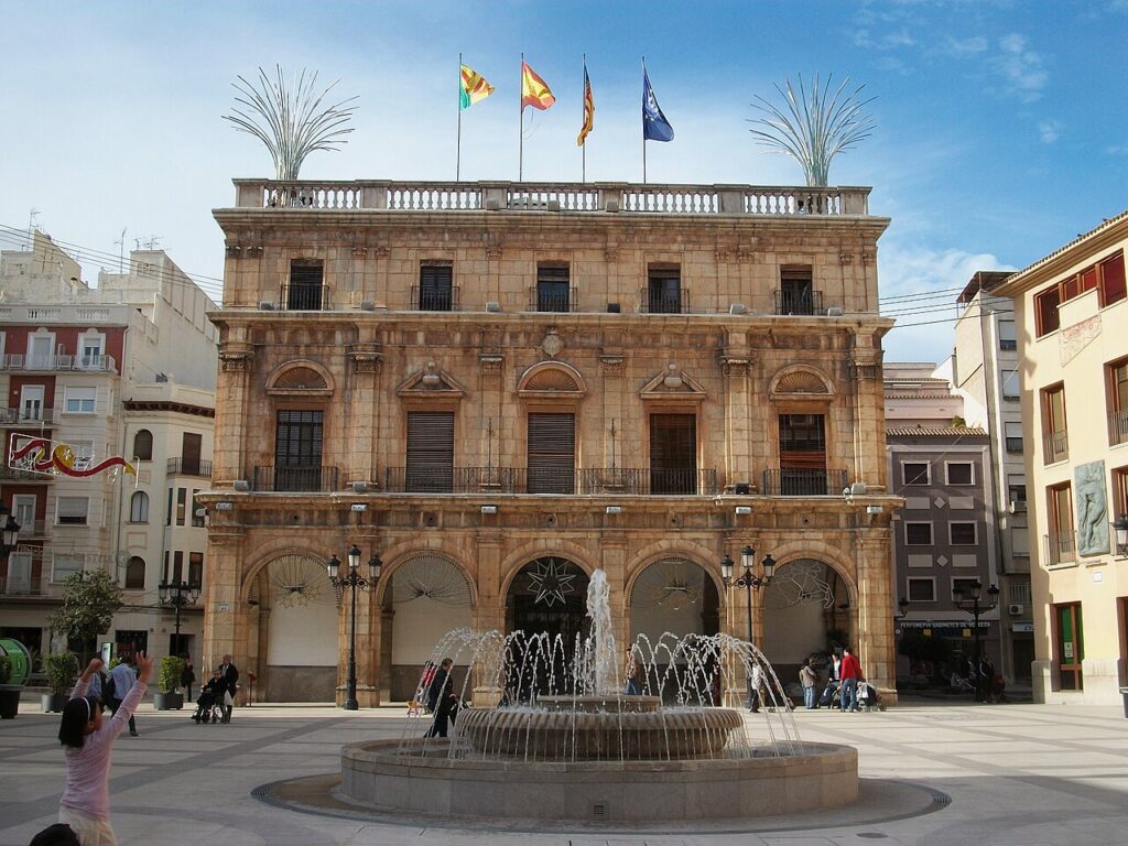
Quick facts
- Where: Castelló de la Plana, capital of the province of Castellón, in the La Plana Alta district of the Valencian Community.
- Residents: 183,711 (2025 municipal register, Generalitat Valenciana Argos statistics portal).
- Beach: yes, but not in the old centre. The beaches (El Pinar, Gurugú, El Serradal) belong to the district of El Grao, about 4.7 km in a straight line from the main square (our own calculation from map points, not a road distance).
- Nearest airport: Castellón–Costa Azahar, about 27 km in a straight line to the north-west; Valencia airport is about 67 km away in a straight line.
- Neighbours: Benicàssim is about 12 km away in a straight line, Valencia city about 64 km.
- Trains: high-speed, long-distance and medium-distance services, plus Cercanías lines C3 and C6, at Castelló de la Plana station.
- Language: Valencian and Spanish; Spanish works everywhere.
- Climate: annual mean of 17.5 °C and 467 mm of rain a year (AEMET, 1981–2010).
Where to base yourself
The regional tourism site describes the city as three areas: the historic centre, the modern districts and El Grao by the sea. For a visitor the real choice is between the centre and the seafront, with the tram linking the two.
The historic centre
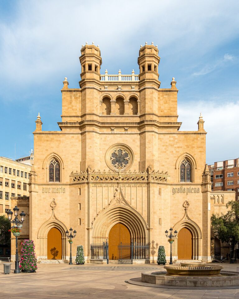
The Gothic co-cathedral and the bell tower of El Fadrí stand side by side here, and the Central Market, Ribalta Park and the Teatro Principal belong to the same city-centre itinerary. Stay here if you want the city itself and plan to reach the beach by tram or bus. The coast is a separate district, so do not expect sea views.
El Grao
El Grao is the port district. It has restaurants, the lighthouse that was moved to its present site piece by piece, and the beaches of El Pinar and Gurugú. It suits a beach-first stay, families and anyone who wants to eat rice dishes with local fish close to the water. It is quieter for sightseeing, so plan on a tram ride into the centre for the monuments.
For a resort-style week with a seafront promenade, look at Benicàssim or Oropesa del Mar and visit Castellón as a day out.
Things to do
The regional tourism site suggests a one-day plan: the historic centre and monuments, the Central Market, Ribalta Park, a rice lunch in El Grao, then the beach or the pine park. That is a realistic order for a day, and it also works as a checklist for a longer stay.
The old centre
El Fadrí is a freestanding Gothic tower that rises to almost 60 m; the climb is a spiral staircase of more than 200 steps, and it is considered a symbol of the city. Beside it, the co-cathedral of Santa María is a Gothic church with Baroque images. The Lonja del Cáñamo was built between 1606 and 1617 and was declared an Historic and Artistic Monument in 1984; the ground floor is used for exhibitions. The Teatro Principal reopened in 1999 after a full remodel that restored its original Italian layout. The Basilica of Nuestra Señora del Lledó honours the city’s patron saint and stands on the site of an older hermitage. Remains of the 19th-century Carlist walls survive as the Muralla Liberal.
Markets, parks and museums
The Central Market building dates from 1949 and sells produce from the surrounding farmland and from the sea. Ribalta Park is a 19th-century romantic park with Modernist buildings, a pond and shaded paths, and a good place to rest between monuments. The Museo de Bellas Artes and the MUCC city museum, set in an 18th-century town house, cover art and local trades and customs. Ask at a tourist office for current opening hours, as they change.
The hill where the city began
The Castell Vell and the Magdalena hermitage stand on the hill about 7 km from the centre where the city was first founded, with remains of a 10th-century castle. The hermitage is the goal of the Romeria de les Canyes, the pilgrimage that opens the Magdalena fiestas. The fiestas last nine days and honour the foundation of the city, with parades, concerts and fireworks. The sources read here give no fixed dates, so check the city’s current calendar before planning a trip around them.
Desert de les Palmes
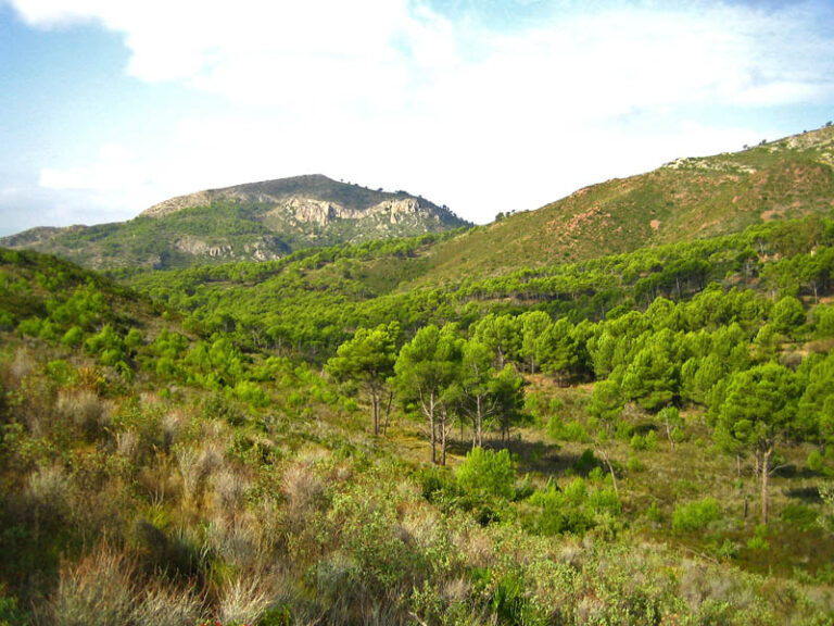
The Desert de les Palmes Natural Park lies north of the city and takes in land from Castelló de la Plana, Benicàssim, Borriol and La Pobla Tornesa, among others. Its two highest summits are El Bartolo (729 m) and Mola del Morico (694 m). The park’s La Bartola information centre is at km 8 of the CV-147 road to the Desert. The name refers to the area’s past as a retreat for Discalced Carmelite monks; despite it, the park is named after its many fan palms and is a mountain area rather than a desert.
Planetarium and the Columbretes
The Planetari de Castelló, next to the pine park in El Grao, has a dome with science and star shows and information on the Columbretes Islands. Local operators run boat trips to the Columbretes Nature Reserve; the tourism site advises checking access conditions in advance, so book with a company rather than turning up at the port.
Beaches and places nearby
The city has three beaches along El Grao, all reached by tram or a short drive rather than on foot from the centre.
El Pinar is the longest beach in the Grao and is backed by a park with restored dunes, centuries-old pines, sports facilities and children’s areas. Gurugú is about one kilometre of sand, described by the regional tourism site as particularly well suited to families, with beach bars on the sand. El Serradal is a semi-urban stretch with a protected dune system that is a habitat for the Kentish plover; keep to the paths and off the dunes. Water quality, lifeguards and flag status change from season to season, so check the current situation on the day rather than relying on any past award.
Skip the beaches if you come in winter hoping for a swim; they are a spring-to-autumn plan. For more coast, Benicàssim is the closest resort to the north, and Oropesa del Mar is further up the coast. Further south along the coast lies Burriana.
Other town guides nearby: Onda (about 20 km in a straight line), La Vall d’Uixó (about 25 km in a straight line), Canet d’en Berenguer (about 37 km in a straight line).
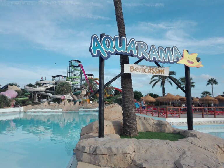
On CostaMap near Castellón de la Plana: Castelló Co-Cathedral (0 km) · Aquarama Water Park (10 km).
Food and drink
The regional tourism site ties the city’s food to two places. In El Grao you eat rice dishes made with the local catch, which is the standard lunch after a morning at the beach. In the centre, the Central Market is where farmland produce and fish come together, and it is worth a look even if you are not cooking. I have no sourced list of specific restaurants or prices, so pick a place by looking at what is on the plates and whether the menu is short and in season. Booking is sensible for weekend lunches in El Grao in summer.
Where to stay
Accommodation here is mostly city hotels and apartments rather than beach resorts. Choose by purpose:
- for sightseeing, a hotel or apartment in the centre, within walking distance of El Fadrí and the market;
- for a beach stay, the El Grao area near El Pinar, with the tram into town;
- for a quiet seafront resort stay, Benicàssim or Oropesa del Mar, with Castellón as a day trip.
Prices change with the season and the city fiestas, so compare dates before booking. This guide does not quote room prices because none were checked against a source.
Getting there and around
By air: Castellón–Costa Azahar airport lies about 27 km in a straight line from the city, and its own website says you can reach it by car, bus or taxi, with the car park in front of the passenger terminal. Routes change by season, so check the airport website for what is flying. Valencia airport is about 67 km away in a straight line and has a much wider choice of flights.
By train: Castelló de la Plana station has high-speed, long-distance and medium-distance trains, and connects with Cercanías lines C3 and C6. It is an interchange with the bus station, which makes onward trips along the coast simple.
Around the city: the TRAM de Castellón line T1 links Universitat Jaume I with El Grao, with variants to the beach and between El Grao and El Serradal. Check the operator’s timetable for the day you travel. The centre is compact and mostly flat, so you can walk between the main sights.
By car: useful for the Desert de les Palmes and the hill of the Castell Vell, less so for the centre. I did not read a source on parking costs, so check the signs and zones when you arrive.
Best time to visit
The nearest AEMET station, Castelló – Almassora, gives a mean of 25.6 °C in August, the hottest month, and 10.6 °C in January, the coolest, for the 1981–2010 period; the annual mean is 17.5 °C and the annual rainfall 467 mm. That makes late spring and early autumn comfortable for walking the city and for beach days, with July and August hot for climbing El Fadrí or the Castell Vell hill. The Magdalena fiestas are the main event of the year, but the sources read here give no dates, so confirm them with the city before booking.
FAQ
Is Castellón de la Plana a beach town?
Not in the usual sense. It is a provincial capital with its beaches in the El Grao district, about 4.7 km in a straight line from the main square, linked by tram.
How many days do I need?
One day covers the centre, the market, Ribalta Park and a rice lunch in El Grao, following the regional tourism site’s plan. Add a second day for the Desert de les Palmes or the Castell Vell hill.
Which airport should I use?
Castellón–Costa Azahar is the closest, about 27 km in a straight line, but its routes change by season. Valencia is about 67 km in a straight line and has more flights.
Can I get to the beach without a car?
Yes. The TRAM line T1 runs from the university through the centre to El Grao, and variants reach the beach area.
Sources and freshness
Last checked: October 2026. Distances marked as straight-line are our own calculation from map points and are not road distances.
- Turisme Comunitat Valenciana – Castelló de la Plana: sights, beaches, museums, parks, itinerary
- Turisme Comunitat Valenciana – city areas and monuments: districts, El Fadrí, Lonja del Cáñamo, Teatro Principal
- Turisme Comunitat Valenciana – what to see in the province: rice dishes in El Grao
- Turisme Comunitat Valenciana – Desert de les Palmes: summits, visitor centre
- Generalitat Valenciana Argos: municipal register 2025
- Renfe – Castelló de la Plana station: train services, Cercanías, bus interchange
- TRAM de Castellón: line T1 routes
- Castellón–Costa Azahar airport: access and parking
- AEMET – climate values, Castelló – Almassora: 1981–2010 normals
- OpenStreetMap – Plaça Major: coordinates for the distance calculations
Main photo: Joanbanjo, CC BY-SA 3.0, via Wikimedia Commons.
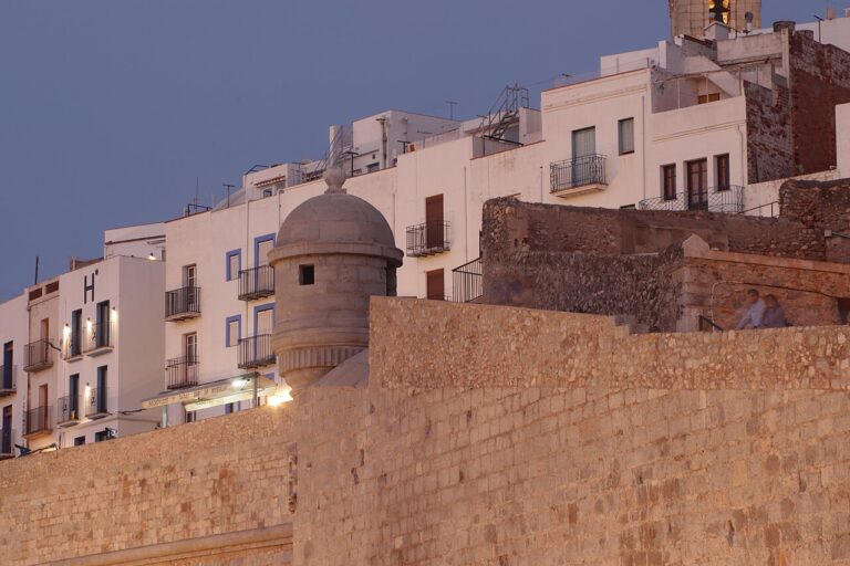
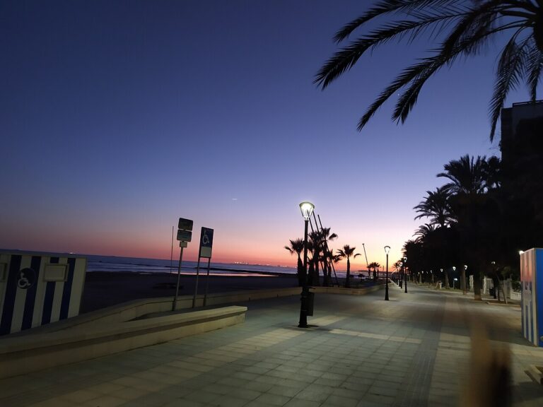
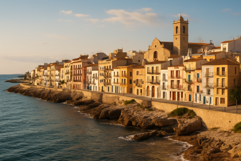
Nearby on the Costa del Azahar
Castellón de la Plana on the map
Places worth knowing near Castellón de la Plana
How this page is maintained. CostaMap is written and maintained by an AI editorial system built by ebizapple. Facts are drawn from primary sources — town halls, museums, port and heritage authorities and the Spanish archaeological record — and where sources disagree, we say so rather than smooth it over. Photographs marked as ours are taken on location. This page was last reviewed on 26 October 2026. Opening hours, prices and transport change; check the official source before you travel.