
Oropesa del Mar (Orpesa in Valencian) is a seaside town of about 12,640 residents in Castellón, and it suits beach holidays that mix long urban sand, small coves and an old hilltop centre within one municipality. It has 12 km of coastline, a ruined castle above the old town and a greenway that runs north to Benicàssim. It is part of our Costa Azahar guide.

Quick facts
- Where: Oropesa del Mar, La Plana Alta county, Castellón province, Valencian Community. Official name Orpesa/Oropesa del Mar.
- Residents: 12,640 on 1 January 2025 (INE).
- Beach: yes, in town. The municipality has 12 km of coastline, from a 2,000 m urban beach to small coves, according to the regional tourist board.
- Nearest cities: Castellón de la Plana is 22 km away and Valencia 72 km, according to the provincial tourist board.
- Airports: Valencia and Castellón airports both serve the province; Castellón Airport is at Vilanova d’Alcolea (provincial tourist board).
- Train: regional trains run towards Tortosa and Valencia, with long-distance links to Zaragoza, Madrid and Barcelona.
- Language: Valencian and Spanish.
- Walk and cycle: the Vía Verde del Mar links the town with Benicàssim on an 11 km trail.
Where to base yourself
The sources do not rank areas for visitors, so the three options below simply follow the layout the tourist boards describe. Check a map before booking.
La Concha and the marina
La Concha is a shell-shaped bay that shelters the beach from winds and currents. The regional tourist board puts it at 700 m long and about 80 m wide, with a promenade and hotels, apartments and restaurants around it; the provincial board gives 800 m and notes the marina beside it has 668 moorings. Choose it if you want to walk to the sea, the cafés and the old town without a car.
Morro de Gos and the northern seafront
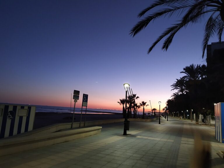
Morro de Gos lies north of the cape and is the town’s long beach, 2,000 m of fine golden sand with almost no waves, according to the regional board. It is flanked by a quiet promenade and has a Red Cross post, a playground and a bus stop. It suits families and swimmers who want calm water over scenery.
Les Amplaries and Marina d’Or
Les Amplaries is the biggest beach in the municipality, 2.4 km long and 40 m wide, with gardens along most of its length. Apartments, hotels and a spa belong to the Marina d’Or development, and the largest concentration of campsites in Oropesa is here. It suits campers and anyone who prefers a purpose-built resort to a town centre.
Skip the resort strips if you want a village atmosphere in the evenings: the old town sits on its own hill, back from the seafront, and the beach areas are built-up resort districts.
Things to do
Oropesa’s sights are a castle, a coastal tower and a railway-turned-greenway.
Castle and old town
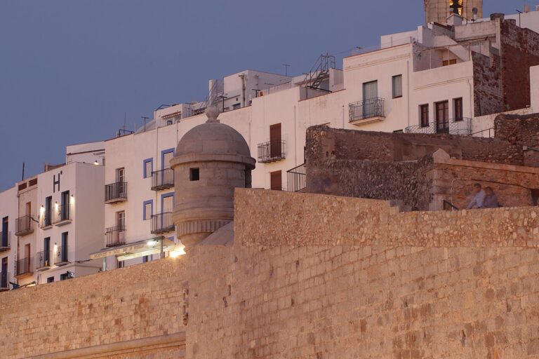
The ruins of Oropesa del Mar Castle and Walls sit on top of the historic centre. El Cid took the Islamic fortress in 1090, and King James I took it in 1233. Only the Islamic wall with its four towers remains, the result of an archaeological dig that also found a Bronze Age settlement. From the top you see the orange groves between the town and Marina d’Or, the coast and the nearby mountains. Close by are the Virgen de la Paciencia church, with a chapel decorated with L’Alcora ceramics, and the municipal museum in the old jailhouse. The provincial board also mentions the antique dealers’ quarter (Ciudad de los Anticuarios).
Torre del Rey
The King’s Tower was begun in 1413 on the order of Fernando de Antequera, King of the Crown of Aragon, to defend the coast against pirate attacks. In 1534 Juan de Cervellón reinforced it, leaving walls four metres thick, and in 1568 Philip II bought it for 10,000 ducats, which gave it its name (Oropesa del Mar tourist office). It is therefore a 15th-century tower in origin, with later reinforcement.
Watchtowers and Orpesa la Vella
The coast has more towers: La Colomera, La Cordà and El Rey, plus the Orpesa la Vella archaeological site, the remains of an Iberian settlement on the hill above El Retor cove.
Vía Verde del Mar
The Vía Verde del Mar follows a disused railway. The regional board describes an 11 km trail made of a bike path through Benicàssim and almost 6 km of greenway between the two towns. It is suitable for walkers, bikes and wheelchairs, passes Torre Bellver and Torre de la Corda, and includes a long illuminated tunnel, two false tunnels and a metal bridge. La Renegà is on the route. Benicàssim’s own page gives the Oropesa link as 5.5 km one way, so expect roughly 6 km.
On the water and the sea beyond
The tourist board lists sailing, windsurfing, canoeing and open-sea fishing trips from the town. Out at sea, the Columbretes volcanic islands lie 28 miles off Cabo de Oropesa, according to the park.
Beaches and places nearby
Beaches run from north to south, and the character changes at the cape. The tourist boards describe long open beaches to the north and cliffs, coves and pine groves to the south.
Beaches in town
Morro de Gos is the long one, 2,000 m with a bus stop and car park. La Concha is the sheltered bay, calm and shallow, with swings and slides for children and lifeguards in high season. Les Amplaries is the widest-open stretch, with dunes and campsites. A pedestrian walkway links La Concha and Morro de Gos, according to the provincial tourist board.
Coves
Orpesa la Vella cove is 120 m long and 50 m wide, a short walk from La Concha, and the regional board says it holds the first water swing in Spain. El Retor is 70 m by 45 m, with fine sand and shallow water, and it became the first smoke-free beach in the Region of Valencia in 2019. La Renegà is the wild one: 1,270 m of sandy and rocky coves among pines, reached by car or along the Vía Verde.
Nearby towns
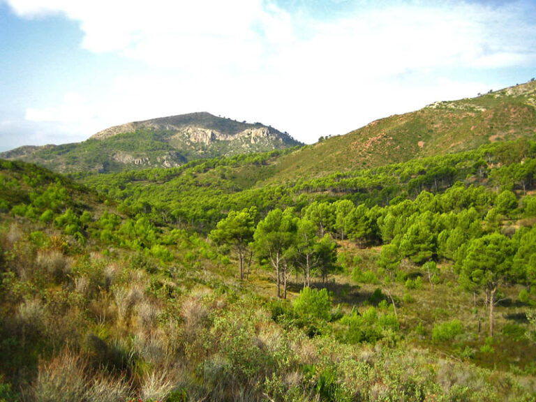
Benicàssim is next door to the south, with its villa route and the Desert de les Palmes park behind it, which also covers part of Oropesa’s municipality according to the regional tourist board. See our page on the Desert de les Palmes for walks. Castelló de la Plana is the provincial capital, and Torreblanca lies to the north.
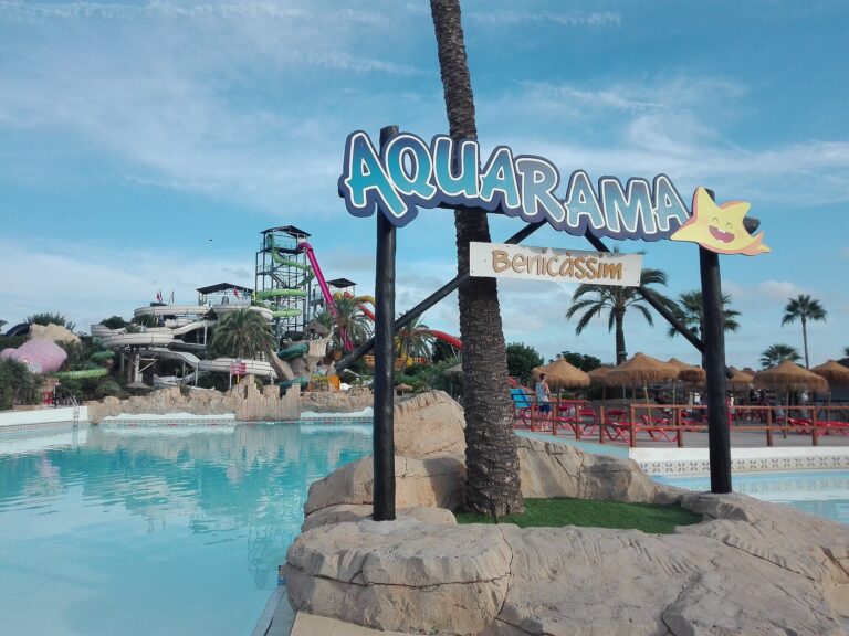
On CostaMap near Oropesa del Mar: Desert de les Palmes Natural Park (8.1 km) · Aquarama Water Park (8.8 km).
Food and drink
The provincial board says Oropesa has a wide range of restaurants built around sea produce and local farm products, but it names no dishes specific to the town, and we found no source for a signature recipe. For regional food, the Costa Azahar itinerary points to Castelló de la Plana: its Central Market, the coca de Castelló made with potatoes, and a seafood rice dish in the seaside district of El Grao. La Concha is ringed by restaurants serving Mediterranean cuisine, and Morro de Gos has a selection close by. We could not find a market day for Oropesa on the provincial market list, so ask at the tourist office.
Where to stay
Accommodation is mostly on the coast: hotels and apartments around La Concha, hotels along Morro de Gos, and apartments, hotels, a spa and campsites at Marina d’Or and Les Amplaries. We give no prices because the tourist board pages do not list any, and rates swing with the season. A stay on the Morro de Gos side suits those who want a long beach; La Concha suits those who want the marina and restaurants on foot.
Getting there and around
By road, Oropesa is on the AP-7 and the N-340, 22 km from Castellón and 72 km from Valencia, per the provincial board. Valencia Airport and Castellón Airport serve the province, and we found no official transfer distance for either, so check a route planner.
By rail, regional trains run towards Tortosa and Valencia, with long-distance links to Zaragoza, Madrid, Barcelona and international connections. By bus, Autos Mediterráneo line A runs Oropesa, Benicàssim and Castellón, and line B continues north through Torreblanca and Alcalà de Xivert to Benicarló and Vinaròs; tickets are bought on board. HIFE coaches go to Tarragona, Zaragoza and the Basque Country, and Avanza runs to Madrid. An urban bus, a tourist train and several taxi firms cover the town and the beach areas (provincial tourist board).
On foot or by bike, the seafront promenades and the Vía Verde are the easiest way to link the beaches.
Best time to visit
For climate we use AEMET standard values for the Castelló-Almassora station (1981 to 2010), on the same coast. The year averages 17.5 °C and 467 mm of rain, with 2,755 hours of sunshine. August averages 25.6 °C, with an average high of 30.3 °C and 24 mm of rain; July is the driest month at 9 mm. January averages 10.6 °C with a high of 15.3 °C. September and October are the wettest, at 71 mm and 70 mm.
July and August are the beach months, with the busiest promenades. Late spring and early autumn suit the Vía Verde and the castle walk. The town’s calendar includes the fiestas of San Jaime, the Virgen de la Paciencia, the Noche de San Juan, the Virgen del Carmen and a Fiesta del Mar, but the provincial listing gives no dates, so check the town hall for the current ones.
FAQ
Is Oropesa del Mar a good base without a car?
Yes, for beaches. The promenades, the old town and the Vía Verde are walkable, and local buses and taxis cover the coast. The Autos Mediterráneo intercity buses link Benicàssim and Castellón.
Which beach is best for families?
La Concha has calm, shallow water, swings and slides, and lifeguards in high season. Morro de Gos has a playground and almost no waves.
How far is Oropesa from Valencia and Castellón?
The provincial tourist board gives 72 km to Valencia and 22 km to Castellón de la Plana.
How long is the Vía Verde to Benicàssim?
The regional tourist board describes an 11 km trail, including almost 6 km of greenway between the two towns. Benicàssim’s board gives the link as 5.5 km one way.
Can I visit the castle?
Yes, the ruins of Oropesa del Mar Castle and Walls can be visited. Opening hours change, so ask the tourist office before you go.
Sources and freshness
Last checked: October 2026.
- INE, population by municipality (1 January 2025)
- Castellón provincial tourist board, Oropesa del Mar
- Castellón provincial tourist board, access and transport
- Comunitat Valenciana tourist board, Oropesa del Mar
- Comunitat Valenciana tourist board, Vía Verde del Mar
- Comunitat Valenciana tourist board, La Concha beach
- Oropesa del Mar tourist office, Torre del Rey
- AEMET, climate values
Nearby on the Costa del Azahar
Oropesa Del Mar on the map
Places worth knowing near Oropesa Del Mar
How this page is maintained. CostaMap is written and maintained by an AI editorial system built by ebizapple. Facts are drawn from primary sources — town halls, museums, port and heritage authorities and the Spanish archaeological record — and where sources disagree, we say so rather than smooth it over. Photographs marked as ours are taken on location. This page was last reviewed on 29 October 2026. Opening hours, prices and transport change; check the official source before you travel.