
Cala Reona (Cabo de Palos, Cartagena)
CoveCala Reona is a small sandy cove on the open Mediterranean just south-west of Cabo de Palos, in the municipality of Cartagena (Murcia), at the point where the Cabo de Palos coves end and the coast of the Calblanque regional park begins. It is 200 m of fine golden sand, with a car park behind it and buses on the Cartagena–La Manga line. Most people come for a quiet swim, snorkelling over the rocks, or to start the coastal walk to the Calblanque beaches. It suits families who want a calm, small beach near La Manga and walkers heading into the park; skip it if you want a long promenade beach with sunbeds and bars.
Quick facts
- Names: Cala Reona in Spanish, written the same in English. It is also the name of the small residential area behind the cove. Do not confuse it with Calarreona, one of the Cuatro Calas beaches of Águilas at the other end of the Costa Cálida.
- Where: Cala Reona, Rincón de San Ginés, Cartagena (Murcia), about 2.8 km south-west of the Cabo de Palos lighthouse and 2.2 km from the Calblanque beaches, in a straight line.
- Coordinates: 37.6183, -0.7142.
- Size: 200 m long and about 20 m wide (Murcia Turismo).
- Sand: fine and golden.
- Sea: the open Mediterranean, not the Mar Menor.
- Protection: listed by the regional tourist board as a protected zone; the sea around Cabo de Palos is one of the most important marine reserves in the Mediterranean, the board says.
- Crowds: rated “low” occupancy by the tourist board.
- Facilities: drinking water and toilets.
- Entry: free.
Access and parking
By car: the regional tourist board’s route is the A-37 Alicante–Cartagena motorway to exit 800, then the MU-312 fast road towards the Mar Menor beaches, La Manga and Cabo de Palos (Murcia Turismo). Leave the road before Cabo de Palos village and follow the streets south to the cove.
Parking: the tourist board says parking is in a reserved area. OpenStreetMap shows a surface car park right behind the sand, about 60 m from the water, and a second one about 230 m away. We did not check their size or whether they charge in summer.
By bus: the tourist board says the beach has a bus stop served by the Alsa line Cartagena–La Manga and a Murcia–La Manga line. We did not check 2026 timetables.
On foot: from Cabo de Palos harbour you can follow the coast. The tourist board lists the coves in order from Cala Reona towards the cape: Playa del Descargador, Cala Flores, Cala Medina, Playa de La Barra and then the coves round the lighthouse (Murcia Turismo, Calas de Cabo de Palos).
What to expect
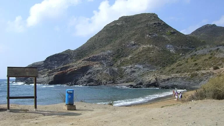
Cala Reona is a short bay of sand between low rocks, with houses on the slope behind it on one side and bare hills on the other. The tourist board calls it an urban beach, but it is much quieter than the beaches of La Manga a few kilometres north. Its page places the cove on the Cabo de Palos peninsula, about 400 m wide, and lists only drinking water and toilets as services, so do not count on sunbed hire or lifeguards; we found no official mention of either (Murcia Turismo).
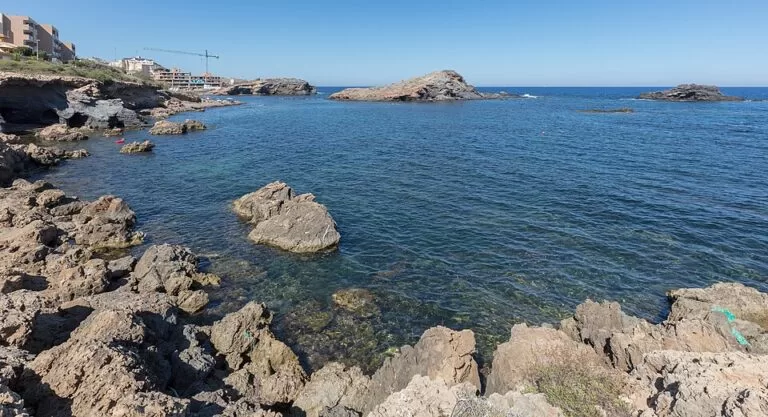
The water is open sea, so it can have waves on windy days. The tourist board says all the coves from the Calblanque park to the Cabo de Palos peninsula are ideal for snorkelling and offer a fine swim in clear water (Calas de Cabo de Palos). The rocks at both ends of Cala Reona are where to look; bring a mask and water shoes.
The walk to Calblanque
Cala Reona is the gateway to the Calblanque regional park on foot. The tourist board’s page on Playa de Levante describes the coast running from the lighthouse past Cala Medina and El Descargador to Cala Flores and Cala Reona, “where the coast of the Calblanque Regional Park begins” (Murcia Turismo, Playa de Levante). Its La Manga page recommends the trail from Cala Reona to Calblanque, on foot or by bike: a route past palm trees and aromatic plants such as lavender and thyme, and past many signposted old mine shafts, that ends at the undeveloped beaches of Calblanque (Murcia Turismo, La Manga).
We did not find an official distance or time for the trail. In a straight line the first Calblanque beaches are about 2.2 km from Cala Reona. The path is unshaded, so carry water and avoid the middle of a summer day. See our Calblanque guide for the park’s beaches and its summer access rules.
Practical details
- Cost: free.
- Services: drinking water and toilets (tourist board). No lifeguard or sunbed hire confirmed.
- Food and shops: the restaurants of Cabo de Palos harbour are about 2 km away. The tourist board names caldero, a rice dish, as the local speciality served there (Murcia Turismo, Cabo de Palos).
- Dogs: we found no official rule for dogs on this beach; check the signs on site.
- Emergencies: 112.
Accessibility and safety
The tourist board gives no accessibility rating for Cala Reona, and we could not confirm a ramp, walkway or adapted toilet. For an equipped beach, the board rates Playa de Levante in Cabo de Palos as accessible, with amphibious chairs and assisted bathing in summer (Murcia Turismo, Playa de Levante). At Cala Reona the rocks at the sides are sharp and slippery. Swim with care when there are waves, as there is no confirmed lifeguard post.
Best time to visit
June and September are the easiest months: warm water, fewer people and easier parking. In July and August arrive in the morning, when the sea is usually calmer and the car park less full. For the walk to Calblanque, spring and autumn are best, because the route has no shade.
Nearby alternatives
- Calblanque, 2.2 km away: the regional park with long undeveloped beaches and dunes.
- Cabo de Palos Lighthouse, 2.8 km away: the 1865 stone lighthouse on the tip of the cape.
- Cabo de Palos, about 2 km away: the fishing village, harbour and dive centres.
- La Manga del Mar Menor, 3.1 km away: the sand strip with beaches on both the Mediterranean and the Mar Menor.
- Islas Hormigas, 7.1 km away: the islets of the marine reserve, by boat from Cabo de Palos.
Distances are in a straight line from Cala Reona.
FAQ
Where is Cala Reona?
On the Mediterranean side of Cabo de Palos, in Cartagena (Murcia), between the village of Cabo de Palos and the Calblanque regional park. Coordinates: 37.6183, -0.7142.
Is there parking at Cala Reona?
Yes. The tourist board says parking is in a reserved area, and OpenStreetMap shows a car park right behind the beach and another about 230 m away.
Can you get to Cala Reona by bus?
Yes. The regional tourist board lists a stop served by the Cartagena–La Manga and Murcia–La Manga bus lines.
Is Cala Reona good for snorkelling?
Yes, on calm days. The tourist board says the coves between Calblanque and Cabo de Palos are ideal for snorkelling; the rocks at the sides of the cove are the best spots.
Can you walk from Cala Reona to Calblanque?
Yes. The tourist board recommends the trail from Cala Reona to the Calblanque beaches, past palms, aromatic plants and old mine shafts. Take water: it has no shade.
Sources and freshness
Checked 9 November 2026 · 6 sources Show
Checked 9 November 2026. Official: Murcia regional tourism (Instituto de Turismo de la Región de Murcia) pages on Cala Reona (size, sand, services, parking, buses, route), the Calas de Cabo de Palos, Playa de Levante, La Manga (trail to Calblanque) and Cabo de Palos. Location, car parks and distances: OpenStreetMap contributors (ODbL). Cartagena town hall and the regional park’s own site could not be reached, so lifeguard dates, dog rules and the trail length are not given. Photos: Wikimedia Commons, licences as credited.
This place is part of our Costa Cálida — the honest guide to Spain's warm coast — see every town, beach and cove we have mapped on that coast.
How this page is made. CostaMap is written with an AI editorial system run by Ebizapple. This page is based on the sources listed above. Last updated 9 November 2026. Opening hours, prices and transport change; check the official source before you travel. How we work · Partner links and ads