
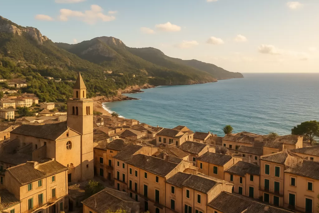
Alaró: Mallorca mountain town below its castle
Alaró is an inland town of about 6,100 people in the Raiguer district of Mallorca, 19 km north-east of Palma, at the foot of the Serra de Tramuntana. Most visitors come for one thing: the walk up to the Castell d’Alaró, a ruined rock fortress on the 822 m Puig d’Alaró. The town itself is a working, residential place with a Saturday market, old shoe-industry history and a quiet main square.
Alaró at a glance
- Municipality in the Raiguer, between Mallorca’s central plain and the Serra de Tramuntana. Population 6,121 (INE 2025).
- Skyline: the twin peaks of Puig d’Alaró (about 822 m, with the castle) and Puig de s’Alcadena (817 m).
- Castell d’Alaró: documented since 902, a protected monument (BIC) since 1931, with a 1622 chapel and a small hostel inside the walls.
- First town on Mallorca with an urban electricity network, switched on 15 August 1901.
- Nearest train: Consell/Alaró station on the SFM Palma–Inca line, 3.6 km away, linked by bus 342.
- Palma airport: 17.9 km straight line.
- No beach: the town is inland.
Before you plan
The lignite mines closed in 1989 and the shoe industry, which once had more than 30 factories and 2,000 workers, is now down to one major firm. The industrial past shows in the townscape, not in working sites. The castle is reached on foot: a road climbs part of the way, but the last stretch is a stony footpath.
Alaró on the map
Beaches, sights and nearby towns with a CostaMap page. Click a pin to open it, or switch to places to stay.
Things to do in Alaró
Plan Alaró as a half-day or full-day stop built around the castle walk, with time in the centre before or after. There are no large paid attractions; the sights are mostly outdoors and free to see from the street.
| Attraction | What it is | Price/entry | Best for |
|---|---|---|---|
| Castell d’Alaró | Ruined rock fortress on the Puig d’Alaró, with walls, five towers, cisterns, the Mare de Déu del Refugi chapel (1622) and a hostel | Path open to walkers; no entry fee found | Hikers, views, history |
| Puig de s’Alcadena | The second of the twin peaks (817 m), linked in local legend with witches | Free | Experienced walkers, photographers |
| Torre de l’electricitat | Chimney tower of the 1901 power plant, a BIC monument since 8 May 2000, restored in 2001 | Seen from the street | Industrial heritage |
| Plaça de la Vila | Main square with the late-19th-century town hall, a 1742 fountain and a 16th-century stone cross | Free | Short stroll, cafés |
| Saturday market | Weekly market in Plaça de la Vila (OpenStreetMap lists Saturday mornings) | Free | Local produce |
Hike to the Castell d’Alaró
The castle sits on the summit of the Puig d’Alaró, 2.9 km north of the town square in a straight line. A road with asphalt sections climbs from the town towards the Es Verger farm-restaurant; OpenStreetMap shows free surface car parks there, about 0.6 km below the castle, and from there you finish on a stony path. Walking the whole way from town is longer and steeper, so carry water and wear proper shoes.
The fortification is documented from 902, when its garrison held out for more than eight years against the Muslim conquest of the island. In 1231 it was one of the last strongholds to fall in the Christian conquest, and in 1285–86 it resisted Alfonso III of Aragon; its defenders Guillem Cabrit and Guillem Bassa were executed and are still remembered locally. Today you can see the walls, the keep known as “es Costipador”, several viewpoints over the Tramuntana and the Pla, and the chapel. The castle is also a stop on the GR 221 Ruta de Pedra en Sec long-distance trail.
Industrial heritage and the electricity tower
Alaró switched on Mallorca’s first urban electricity network on 15 August 1901, during the town’s summer festes. The steam plant, built by the brothers Gaspar and Josep Perelló Pol, also supplied Consell, Binissalem and Lloseta. Its tower, the Torre de l’electricitat, stands near the bus stop on the south side of the centre. The town was also a shoemaking centre from about 1870 (during the First World War several factories made boots for the French army) and, before that, a soap-making town using local olive oil.
Streets, squares and country estates
The centre around Plaça de la Vila holds the town hall, the Font de la Plaça (1742) and the Creu d’en Cós. The old upper quarter is called Los Damunt; Los Davall grew up below it from the 14th century around the parish church. On the roads out of town you pass old possessions (country estates) such as Son Antelm and Son Fiol on the Santa Maria road, Son Penyaflor and Son Curt on the castle road, and Son Forteza and Son Grau towards Lloseta. Most are private. The Son Palou family estate is one of them; its land also holds talaiot remains from the prehistoric Talaiotic period.
Best beaches in the area
Alaró has no coastline. The nearest sea is the Bay of Palma, roughly 18–20 km to the south-west. If you want a beach day, combine Alaró with Palma or plan a separate coastal day.
Alaró with kids
The castle walk suits children who already manage a couple of hours of uphill walking; starting from the Es Verger car parks shortens it to the final 0.6 km (straight line) of steep path. Smaller children are better off with the town squares and the Parc de ses Cases Noves in the centre. There are no theme parks or indoor family attractions in the town.
How to get to Alaró and get around
- Train + bus: take an SFM train on the Palma–Inca line to Consell/Alaró station, 3.6 km south-east, then TIB bus 342 to Alaró. Check times with TIB before you travel.
- Bus: line 331 runs between Alaró and the hamlet of Orient in the mountains.
- From the airport: Palma airport is 17.9 km away in a straight line; by public transport go via Palma and the train.
- By car: the main approach is from Consell; quieter secondary roads come in from Santa Maria del Camí and Lloseta.
- Parking: OpenStreetMap shows free surface car parks at Son Tugores and Plaça del Rosari near the centre, and free parking near Es Verger on the castle road.
In town everything is walkable; the main bus stop (ref. 1001) is on the south side of the centre.
Where to stay in Alaró
Inside the castle walls there is a small hostel (hostatgeria) next to the chapel, part of the Consell de Mallorca’s dry-stone route network; OpenStreetMap gives it about 30 places. It is basic and suits GR 221 walkers; its OpenStreetMap entry links to the Consell de Mallorca’s Camins de Pedra pages for bookings. In and around the town, accommodation is mainly rural houses and small hotels; Palma, 19 km away, has the widest choice if you only want a day trip.
Best time to visit Alaró
Alaró has a sub-humid Mediterranean climate: hot, dry summers and mild winters, with more rain in the mountains. For the castle walk, spring and autumn are the most comfortable; in summer start early. Two dates bring people up to the castle: the Pancaritat on the Sunday after Easter and a pilgrimage on 8 September for the Nativity of the Virgin. The town’s patron saint is Sant Roc, and the summer festes fall in mid-August.
| Season | Months | What to expect |
|---|---|---|
| Spring | March–May | Good walking weather; Pancaritat at the castle the Sunday after Easter |
| Summer | June–August | Hot and dry; walk early; town festes in mid-August |
| Autumn | September–November | Castle pilgrimage on 8 September; milder temperatures |
| Winter | December–February | Mild in town, wetter and cooler on the peaks |
History of Alaró
The name is pre-Catalan and probably pre-Roman: the Arab geographer al-Zuhri mentions a “hisn Alarun” (Alaró castle) in the 902 conquest. People lived here in the Talaiotic period, and talaiot remains survive at sites such as Son Palou and s’Alcadena. The town grew from the Muslim farmstead of Alārūn around the castle. After the Christian conquest it became an agricultural town known for olive oil. In the 19th century came soap making, lignite mines and shoe factories, and from 1881 a small railway linked Alaró with the Palma–Inca line at Consell. The population rose from about 4,000 in 1842 to over 6,000 in 1910, fell to about 3,200 by 1981 and has grown again since. Alaró and Consell were one municipality until 1925. The town also suffered harshly in July 1936: fourteen people, including the mayor Pere Rosselló Oliver, were executed. Today most residents work in Palma or Inca.
Practical info
- Distances (straight line): Palma 19.4 km, Palma airport 17.9 km, Inca 10.4 km, Bunyola 7.9 km.
- Castle access: the last stretch is on foot only. Bring water; there is no shop on the path apart from the restaurant at Es Verger and the castle hostel.
- The town hall is on Plaça de la Vila. Heritage buildings such as the electricity tower are protected; view them from outside.
Worth it for: one of Mallorca’s best castle walks, Tramuntana views and a real working town close to Palma. Less so if: you want beaches, nightlife or many indoor sights.
How we assess this guide
This is desk research, checked on 6 November 2026. History and figures come from the English, Spanish and Catalan Wikipedia articles on Alaró and the Castell d’Alaró; bus and train lines, car parks, the market and distances come from OpenStreetMap data, with straight-line distances we calculated. We have not visited in person, and we did not reach the town hall or TIB websites, so check bus times and hostel bookings with the operators.
Frequently asked questions
How do I get from Palma to Alaró by public transport?
Take the SFM train from Palma towards Inca and get off at Consell/Alaró, then take TIB bus 342 for the last 3.6 km into Alaró.
How long is the walk to the Castell d’Alaró?
From the Es Verger car parks it is about 0.6 km in a straight line, but steep and stony. From the town square the castle is 2.9 km away in a straight line, with a much bigger climb to the 822 m summit.
Is there parking for the castle?
Yes. OpenStreetMap shows free surface car parks near the Es Verger restaurant on the castle road, below the final footpath.
Can you stay overnight at the castle?
Yes. A small hostel next to the Mare de Déu del Refugi chapel offers basic beds (about 30 places per OpenStreetMap) and is run within the Consell de Mallorca’s dry-stone route network.
Is Alaró worth visiting?
Yes if you like walking and history: the castle walk is the highlight. If you want shopping or beaches, Palma or the coast suit you better.
Does Alaró have a beach?
No. The town is inland; the nearest coast is the Bay of Palma, about 18–20 km away.
When is the market in Alaró?
OpenStreetMap lists a Saturday morning market in Plaça de la Vila.
What is the tower in the middle of town?
It is the tower of the 1901 power plant that gave Alaró Mallorca’s first urban electricity network. It was declared a monument of cultural interest on 8 May 2000 and restored in 2001.
Plan the wider trip
Sources and freshness
Checked 6 November 2026 · 5 sources Show
Checked 6 November 2026. Wikipedia: Alaró (English), Alaró (Spanish) and Alaró (Catalan); Castell d’Alaró (Catalan Wikipedia). Bus lines 331 and 342, SFM station, car parks, market and coordinates: OpenStreetMap, © OpenStreetMap contributors (ODbL); straight-line distances calculated by CostaMap. The town hall (ajalaro.net), TIB and Consell de Mallorca sites could not be reached when we checked, so timetables and hostel prices are not given.
Places worth knowing near Alaró
How this page is made. CostaMap is written with an AI editorial system run by Ebizapple. This page is based on the sources listed above. Last updated 6 November 2026. Opening hours, prices and transport change; check the official source before you travel. How we work · Partner links and ads