
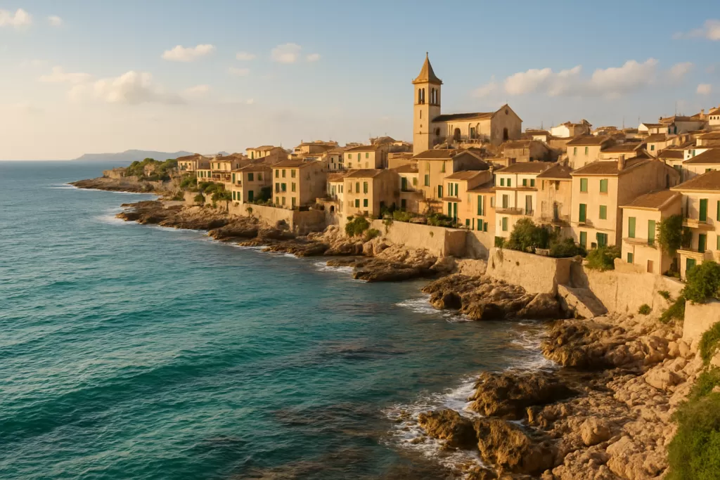
Sencelles: rural Pla de Mallorca village
Sencelles is a farming village of about 4,000 people (municipality) in the Pla de Mallorca, around 22 km north-east of Palma, reached by car or by TIB bus 304. It suits travellers who want inland Mallorca: the Talaiotic settlement of Son Fred, small hamlets with traditional rural architecture, windmills and wine country, with no beach and little nightlife.
Sencelles at a glance
- Where: central Mallorca, in the Pla de Mallorca district, Balearic Islands.
- Population: 3,973 (INE, 1 January 2025), across Sencelles village and the hamlets of Biniali, Ruberts, Jornets, Cascanar and Laiar.
- Distances (straight-line): Palma centre about 22 km; Palma airport about 18 km; Platja de Palma, the nearest big beach, about 20 km.
- Bus: TIB line 304 (Palma–Sencelles–Inca) stops in Plaça d’Espanya, the main square.
- Main sights: parish church of Sant Pere, the Son Fred Talaiotic settlement, wayside crosses and windmills, and the hamlet of Ruberts.
- Local figure: Blessed Francinaina Cirer (1781–1855), born, lived and died in Sencelles; beatified in 1989.
- Markets: Wednesday morning in Plaça Nova and Saturday morning in Plaça de la Vila.
Before you plan
Market days and festival dates below come from Wikipedia’s Spanish and Catalan articles (which cite the Consell de Mallorca); they can change, so confirm locally. We could not find published opening hours for the parish church or a staffed visitor centre at Son Fred: the archaeological sites are open countryside sites. Bus times change by season; check the current TIB timetable for line 304 before relying on it.
Sencelles on the map
Beaches, sights and nearby towns with a CostaMap page. Click a pin to open it, or switch to places to stay.
Things to do in Sencelles
A visit here is short and slow: the village square, the church, a drive or walk out to the prehistoric sites and the hamlets, then lunch. The Balearic tourist board recommends Son Fred, the windmills, the church of Sant Pere and the local wineries.
| Sight | What it is | Where | Best for |
|---|---|---|---|
| Son Fred Talaiotic settlement | One of Mallorca’s largest archaeological sites, inhabited around 1000 BC | About 2 km north-east of the village | Prehistory, walks |
| Church of Sant Pere | Parish church built in 1705 on a site recorded as a church of Sant Pere in 1248 | Next to Plaça d’Espanya | Architecture |
| Statue of Francinaina Cirer | Statue of the local beata, covered in flowers every 27 February | Church square | Local tradition |
| Ruberts and Biniali | Small hamlets with 16th–19th-century rural architecture | Biniali 3.4 km south-west; Ruberts on the Algaida/Costitx border | Photography, quiet lanes |
| Wayside crosses and windmills | Creu de Can Maví, Creu de sa Cometa and others; mills such as Ca’n Picapebre | Around the village edge | Short walks |
The village and the church of Sant Pere
The centre is Plaça d’Espanya, with the town hall and the parish church of Sant Pere. A papal bull of Innocent IV in 1248 already records a church of Sant Pere here; the present building dates from 1705. The parish moved here from Costitx in 1238, after the Christian conquest of 1229. Beside the church stands a statue of Francinaina Cirer, and the Convent de la Caritat is a short walk to the south-west. Four old wayside crosses (Creu de Can Maví, Creu de sa Cometa, Creu de s’Era d’en Pelat and Creu des Rafal) mark the roads out of the village.
Son Fred and the Talaiotic sites
The Talaiotic period (the Bronze and Iron Age culture named after its stone towers, or talaiots) left many traces in the municipality. The most important is Son Fred, which the Balearic tourist board describes as one of the largest archaeological sites in Mallorca, inhabited around 1000 BC. Others include the talaiots of Binifat, two at Cascanar and the Cova des Camp del Bisbe, about 700 m east of the village. The town halls of Sencelles and Costitx have created a joint Sencelles–Costitx Archaeological Route to link them. These are open-air sites without staff or ticket desks, so bring water and good shoes.
The hamlets: Ruberts, Biniali, Jornets
The municipality includes several tiny settlements that grew around farm estates when vines and cereals made the area prosperous. Phylloxera destroyed the vineyards in 1891 and many people left. Spanish Wikipedia describes Ruberts as one of the best-preserved examples of Mallorcan rural architecture of the 16th–19th centuries: a hilltop hamlet in a closed valley near the Torrent de Pina, built around the Son Jordà estate (now an agritourism) with narrow, short streets and an oratory of the Virgen del Carmen. Biniali, which had become a small town by the late 16th century, has its own parish church of Sant Cristòfol. Some hamlets have revived in recent decades with second homes.
Wine and food
Vines have been grown here since at least the 18th century, and the Balearic tourist board lists visiting wineries and vineyards as one of the essential things to do, paired with local restaurants.
Sencelles with kids
There are no attractions aimed at children, but Son Fred and the talaiots work well as an outdoor “stone age” outing for school-age children, and the Wednesday and Saturday morning markets make an easy stop. Families wanting a beach should allow about 20 km to Platja de Palma.
How to get to Sencelles and get around
- Bus: TIB line 304 runs between Palma and Inca station via Sencelles and Costitx, stopping at Plaça d’Espanya in the centre and at a second stop on the south side of the village (route data from OpenStreetMap). Biniali also has a stop on the Ma-3020.
- Train: Sencelles has no station. Bus 304 connects with the Palma–Inca railway at Inca station.
- Car: Palma is about 22 km south-west and Palma airport about 18 km straight-line; inland roads link Sencelles with Santa Eugènia, Binissalem, Inca, Costitx, Lloret de Vistalegre and Algaida.
- On foot or bike: the village is small and flat; the archaeological sites and hamlets are reached on quiet country lanes.
Parking
OpenStreetMap shows parking along Plaça d’Espanya, in Plaça Nova and Plaça de Son Morei, and several surface car parks around the edge of the centre, including a free one on the south side. On market mornings the squares fill up, so use the outer car parks.
Where to stay in Sencelles
Accommodation is rural: the old Son Jordà estate in Ruberts now operates as an agritourism, and the municipality has country houses and village homes. Hotels and beach resorts are in Palma and on the coast, 20 km or more away. Stay here if you want quiet and a car-based tour of inland Mallorca.
Best time to visit Sencelles
July is the driest month (about 8.8 l/m² on average) and October the wettest (about 100 l/m²). Spring and autumn suit walks to the archaeological sites. Main dates in the local calendar:
| Event | When | What to expect |
|---|---|---|
| Santa Àgueda (patron saint) | Early February, Saturday and Sunday | Bonfire and correfoc (fire run) on Saturday, mass on Sunday |
| Homage to Francinaina Cirer | 27 February | Her statue in the church square is filled with flowers |
| Romeria de la Casa Blanca | Second Sunday in May | Pilgrimage on foot, on horseback or by cart |
| Fira (annual fair) | Third Sunday in May, with a smaller “Firó” on the Monday | Agricultural fair |
| Sant Pere | 29 June | Feast of the parish patron, with mass |
| Embala’t | August (second Sunday, with the Mare de Déu d’Agost fiestas) | Straw-and-water fight recalling the harvest |
History of the village
Talaiotic villages such as Son Fred show settlement here from around 1000 BC. Under Muslim rule the area belonged to the district of Qanarûsha, with Binissalem, Alaró, Santa Maria, Santa Eugènia, Costitx and Lloseta; the name survives in the hamlet of So na Rossa. After James I’s conquest of 1229 the land went to the Viscount of Béarn, and in 1238 the parish seat moved from Costitx to Sencelles. In 1309 James II’s reorganisation added Biniali, Costitx, Cascanar and other farmsteads to the municipality. Vineyards spread from the 18th century until phylloxera struck in 1891, a blow that emptied the smaller hamlets. Costitx gained its independence after a long rivalry, confirmed by royal order in 1858. Sencelles is the home village of Sister Francinaina Cirer (1781–1855), venerated across Mallorca for cures attributed to her and beatified by Pope John Paul II on 1 October 1989. The population fell from about 3,000 in the late 19th century to a low of about 1,600 in the 1980s, and has since grown back with new residents and second homes.
Practical info
- Markets: Wednesday morning in Plaça Nova; Saturday morning in Plaça de la Vila (since 2015).
- Bus: TIB line 304 to Palma and Inca; stops at Plaça d’Espanya.
- Language: Catalan (Mallorcan) is the local language; Spanish is widely spoken.
- Archaeology: the Sencelles–Costitx Archaeological Route links Son Fred and the other talaiots; sites are unstaffed.
Worth it for: travellers touring inland Mallorca by car, prehistory fans, walkers and anyone who wants to see rural Mallorcan villages without crowds. Less so if: you want beaches, big museums or nightlife — Palma and the coast are 20 km or more away.
How we assess this guide
Desk research, checked on 6 November 2026; we have not visited. The main sights come from the Balearic Islands tourist board (illesbalears.travel); history, hamlets, population (INE 2025), climate averages, markets and festival dates from the English, Spanish and Catalan Wikipedia articles, which cite the town hall and Consell de Mallorca; the bus route, stops, car parks and straight-line distances from OpenStreetMap. We dropped earlier claims about specific wine appellations, almond-blossom viewing and a pilgrimage house, which we could not confirm.
Frequently asked questions
How far is Sencelles from Palma?
About 22 km straight-line to central Palma (Wikipedia gives 24 km). By public transport, take TIB bus 304.
Can I get to Sencelles by bus?
Yes. TIB line 304 links Palma, Sencelles, Costitx and Inca station, stopping at Plaça d’Espanya in the village centre. Check the current timetable with TIB.
How far is the airport?
Palma de Mallorca airport (Son Sant Joan) is about 18 km south-west in a straight line.
Which is the nearest beach?
Sencelles is inland. The nearest large beach is Platja de Palma, about 20 km south-west in a straight line.
What is Son Fred?
A Talaiotic (prehistoric) settlement about 2 km north-east of the village, one of the largest archaeological sites in Mallorca, inhabited around 1000 BC. It is part of the Sencelles–Costitx Archaeological Route.
Is there parking in Sencelles?
Yes. There is parking in Plaça d’Espanya, Plaça Nova and Plaça de Son Morei, plus several car parks around the centre, one of them mapped as free. Squares fill on market mornings.
When is the market?
Wednesday mornings in Plaça Nova and Saturday mornings in Plaça de la Vila.
Who was Francinaina Cirer?
A religious sister born in Sencelles in 1781, who lived and died here in 1855. She is venerated across Mallorca for cures attributed to her and was beatified by John Paul II in 1989; her statue stands in the church square and is filled with flowers each 27 February.
Plan the wider trip
Sources and freshness
Checked 6 November 2026 · 5 sources Show
Checked 6 November 2026. Illes Balears tourist board: Sencelles; Wikipedia (English), Wikipedia (Spanish) and Viquipèdia (Catalan) for history, hamlets, population (INE 2025), climate, markets and festivals; TIB bus route 304, stops, car parks, crosses and straight-line distances from OpenStreetMap and Nominatim, © OpenStreetMap contributors (ODbL).
Places worth knowing near Sencelles
How this page is made. CostaMap is written with an AI editorial system run by Ebizapple. This page is based on the sources listed above. Last updated 6 November 2026. Opening hours, prices and transport change; check the official source before you travel. How we work · Partner links and ads