
L’Escala is a fishing and beach town of about 10,600 people on the Gulf of Roses, and it suits travellers who want swimming, a Greek and Roman ruin site and anchovy salting in one place. Base yourself here if you like a small harbour town with 16 beaches and coves, Empúries within reach on foot or by bike, and a coastal path to walk. Skip it if you expect a compact walled old town: the town itself is a seaside resort, and the oldest layers lie outside the centre. It is part of our Costa Brava guide.
Quick facts
- Where: L’Escala, Alt Empordà comarca, Girona province, Catalonia, on the south side of the Gulf of Roses.
- Residents: about 10,600 (10,641 in 2025, Idescat).
- Beaches: yes, in town and along the coast. The town tourism site lists 16 beaches and coves, from fine sand to pebbles.
- Nearest airport: Girona–Costa Brava, 55 km away; the town tourism site gives a bus to Girona and a direct bus on from there, and no direct airport bus.
- Hub cities: Girona 47.3 km by road (45 min), Figueres 28.6 km (30 min), Barcelona 144 km (1 h 30 min), all from the town tourism site.
- Language: Catalan and Spanish; Spanish works everywhere.
- Main sight: the Empúries archaeological site, part of the Museu d’Arqueologia de Catalunya (MAC); opening hours and tickets are on the MAC site.
- Tourist office: Plaça de les Escoles 1, phone +34 972 770 603.
Where to base yourself
The town is spread along a bay, so the choice is about which beach and which side of town you want. Four areas make sense.
The town centre and the harbour
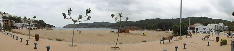
The centre has the harbour, the town beach (La Platja, also called Platja de les Barques), Port d’en Perris next to the old centre and the anchovy factories and museums. It is the best base without a car: shops, restaurants and the Sarfa bus stop at Plaça de les Escoles are within walking distance.
Riells
Riells is described by the tourism site as the central tourist resort, with a fine sand beach and shallow water that suits children. It fits families who want a beach day without driving, with the trade-off that you are further from the harbour and the museums.
Montgó
Montgó is the southernmost point of the municipality, with a fine sand beach sheltered from the tramontana wind. It suits people who want a quieter base and are happy to drive or take a long coastal walk into town. It is also the start of the town’s coastal path (see below).
Near Empúries and Sant Martí d’Empúries
North of the centre lie the Empúries beaches and Sant Martí d’Empúries, which the tourism site describes as a neighbourhood of L’Escala preserved as a mediaeval town. This is the choice if the ruins are the reason for the trip. Restaurants and shops are fewer, so you will often go back into town for dinner.
Things to do
A visit here has three strands: the ruins, the old fishing and anchovy culture, and the sea. Most of it is easier on foot or by bike than by car.
Empúries
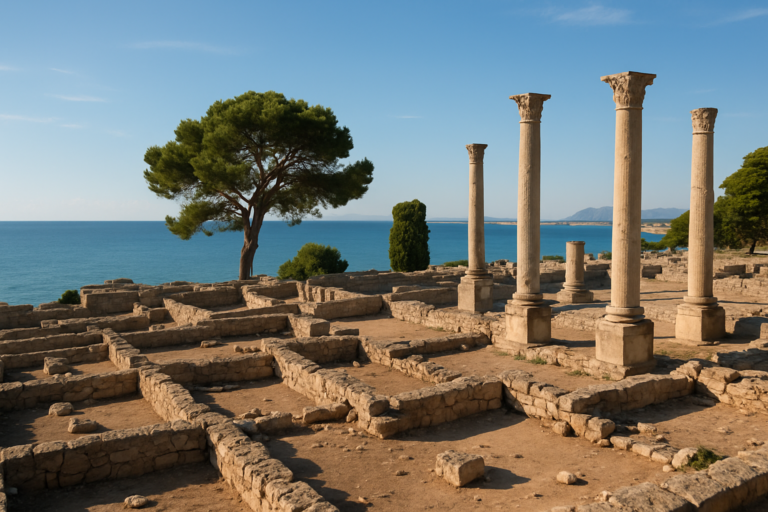
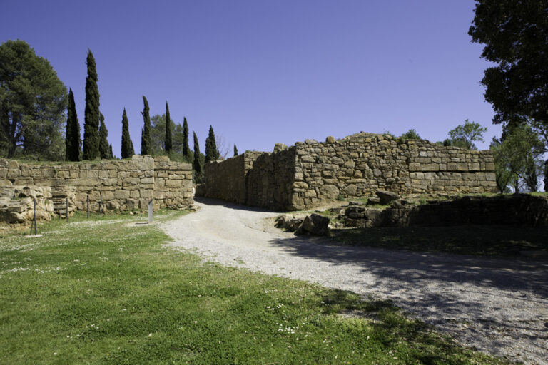
Empúries is the only archaeological site on the Iberian Peninsula where a Greek city (Empòrion) and a Roman city (Emporiae) lie side by side. The first Greek settlers arrived in the 6th century BCE, on a small island in the Gulf of Roses, and the Second Punic War brought the first Roman army here in 218 BC (Catalunya.com). On the site you walk past the precincts of Asclepius and Serapis, the agora, the forum, the basilica and the shops of the Roman town, and halfway along the route the site museum holds the original sculpture of Asclepius found here (Catalan heritage service). The MAC says the site keeps nearly 170 mosaic floors. It also runs guided tours and family activities; check the MAC site for the current programme, opening hours and prices before you go.
Sant Martí d’Empúries
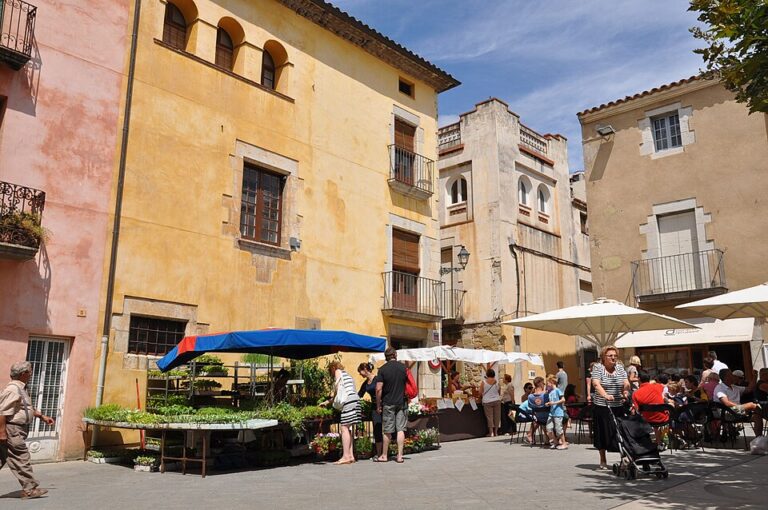
Sant Martí d’Empúries has been inhabited without interruption for more than 2,600 years (Costa Brava tourism site). It makes a short stop on its own and combines well with the ruins and the beaches around them. A pedestrian avenue, the Passeig d’Empúries, links the village with the town of L’Escala.
Anchovy factories and museums
The town has long been known for salted anchovies. A traveller’s diary from 1757–1812 already notes that L’Escala did a lot of fishing and trade in anchovies, and several factories still pack them: Salaons Solés since 1888, Anxoves l’Escala since 1940 and El Xillu since 1974. The tourism site invites visitors to tour a factory; ask at the tourist office which ones take visitors. The town also has an Anchovy and Salt Museum (MASLE) and a fishing interpretation centre (MARAM), listed on the tourism site, with no opening times given there.
Coastal path and the sea
The town’s coastal path runs 8 km one way from Cala Montgó to Sant Martí d’Empúries; the tourism site rates it easy and gives 4 hours. The Empúries route from les Corts is a 6 km circular walk of about 3 hours. At Les Planasses (Salpatx) a footpath follows coastal cliffs and passes preserved bunkers. The Costa Brava tourism site also lists kayaking, sailing, diving and boat trips to the Medes Islands from L’Escala. The Montgrí, Medes Islands and Baix Ter Natural Park, declared in 2010, covers more than 8,000 hectares, 2,000 of them marine, and stretches from L’Escala in the north to Pals in the south (Catalan parks service).
Beaches and places nearby
The beaches fall into three groups. In town, La Platja and Port d’en Perris (coarse sand and pebbles) sit next to the old centre, and Riells has fine sand. To the north are the Empúries beaches: Rec del Molí (fine sand, with dunes and rocks), Portitxol, Pedrigolet (pebbles), Moll Grec and Les Muscleres (fine sand). Platja del Moll Grec lies beside a Hellenistic quay over 2,000 years old, is about 400 m long and 30 m wide, has fine sand and is 2 km from the town (Costa Brava tourism site). To the south, Les Planasses has rocky and large-pebble coves such as Bol Roig and Illa Mateua, and Montgó has fine sand. The tourism site gives no sizes or flag status for most beaches, so check on arrival.
For day trips, Torroella de Montgrí sits on the park side and Figueres is 28.6 km by road. Around the Gulf of Roses you reach Roses, and further north Cadaqués. South of the park lie Begur and Palafrugell, and inland Girona is 47.3 km away. The archaeological site has its own page: Empúries guide.
Other town guides nearby: Palamós (about 31 km in a straight line), Salt (about 33 km in a straight line), Besalú (about 37 km in a straight line).
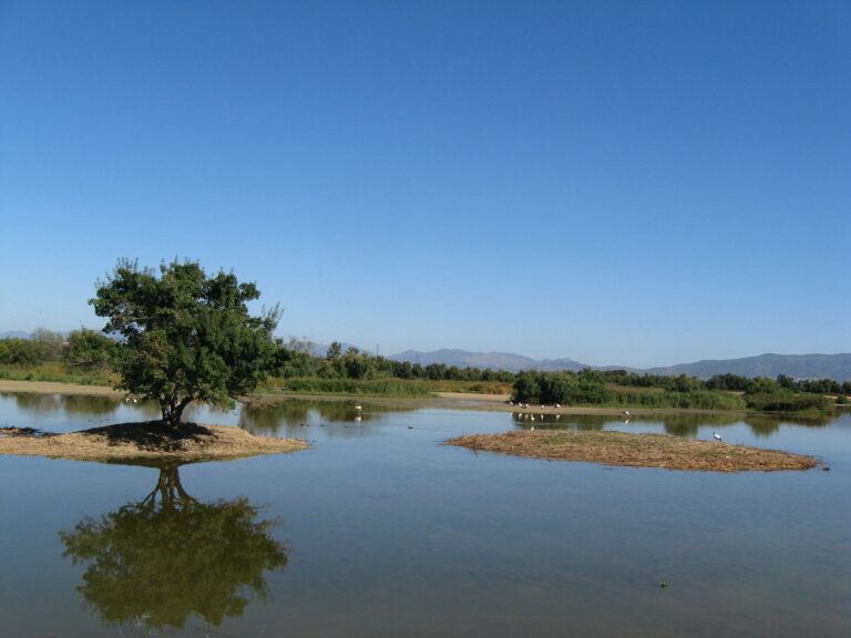
On CostaMap near L’Escala: Empúries (1.5 km) · Aiguamolls de l’Empordà Natural Park (11 km).
Food and drink
Anchovies are the local product, and the Alt Empordà cooking list on the Costa Brava tourism site names fish suquet (a fish stew) and anchovies from L’Escala. The town tourism site lists an Anchovy Festival with an Anchovy Tapa Trail, a Salt Festival and Fish Suquet gastronomic days, and gives no dates, so check the activities calendar on the town site before planning around them. We do not name restaurants we could not verify; the town tourism site has a restaurant directory by area. The tourist office can say which anchovy factories take visitors.
Where to stay
The right type depends on the area you pick above: the centre for staying on foot, Riells or Montgó for a beach-first stay. Book early for July and August. For Empúries and Sant Martí, check the distance to the beach before booking, because the ruins and the old village lie outside the centre. The town tourism site keeps an accommodation directory. This page contains no booking links, and we have not checked current rates.
Getting there and around
By road from Barcelona or France, take exit 5 of the AP-7 at Orriols (20 km from L’Escala), then the GI-623. The nearest airport is Girona–Costa Brava, 55 km away; the town tourism site describes a bus from the airport to Girona station and a direct bus on to L’Escala. Barcelona El Prat is 150 km away and has direct Sarfa buses to L’Escala, Figueres or Girona. Sarfa buses stop at Plaça de les Escoles.
There is no train to the town. The closest stations are Figueres and Flaçà on the Barcelona–Portbou line, with a bus on from either. The high-speed station Figueres-Vilafant is about 30 km away, with direct buses from Figueres and Girona. Check Sarfa’s current timetable before you travel.
In town you can reach most places on foot or by bike, and the tourism site mentions two large free car parks a short distance from the centre. In summer a tourist train, El Carrilet, serves places further out.
Best time to visit
July and August are the beach months and the busiest. May, June and September are better months for walking the coastal path and visiting Empúries, away from the peak beach crowds. In winter the tramontana wind can blow hard; Montgó beach is the one sheltered from it. The tourism site lists a calendar with festivals, among them the Anchovy Festival and the Salt Festival, but not their dates, so use the activities calendar to plan. For forecasts and monthly climate averages, see AEMET.
FAQ
Is L’Escala worth visiting?
Yes, if you want a beach town with the Empúries ruins and the anchovy tradition nearby. It is a town of about 10,600 people rather than a compact old centre, so it suits a stay of a few days better than a quick stop.
What is Empúries?
It is an archaeological site with the remains of a Greek city and a Roman city side by side, run by the Museu d’Arqueologia de Catalunya. The first Greek settlement dates to the 6th century BCE.
How far is L’Escala from Girona and Barcelona?
By road, Girona is 47.3 km (45 min) and Barcelona 144 km (1 h 30 min), according to the town tourism site.
Is there a train to L’Escala?
No. The closest stations are Figueres and Flaçà, with a bus on from either.
Why is L’Escala known for anchovies?
Salting and trading anchovies goes back at least to the 1700s in the town’s records, and several factories still pack them, the oldest of those listed dating to 1888.
Sources and freshness
Last checked: October 2026. Sources: L’Escala tourism, getting there, beaches, Empúries, museums, anchovy factories and mobility; Costa Brava tourism, L’Escala and Platja del Moll Grec; Catalan heritage service, Empúries; Museu d’Arqueologia de Catalunya; Catalunya.com, Costa Brava; Catalan parks service; Idescat, municipal figures; AEMET.
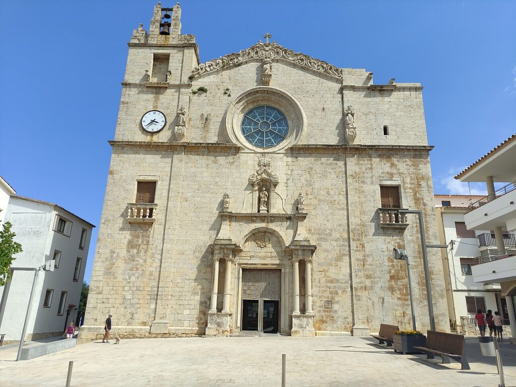
Main photo: Utolotu, CC BY-SA 4.0, via Wikimedia Commons.
Nearby on the Costa Brava
Lescala on the map
Places worth knowing near Lescala
How this page is maintained. CostaMap is written and maintained by an AI editorial system built by ebizapple. Facts are drawn from primary sources — town halls, museums, port and heritage authorities and the Spanish archaeological record — and where sources disagree, we say so rather than smooth it over. Photographs marked as ours are taken on location. This page was last reviewed on 26 October 2026. Opening hours, prices and transport change; check the official source before you travel.