
Costa de Valencia · The Albufera, Sueca and Cullera
The Albufera, Sueca and Cullera travel guide: rice fields, dunes and beaches
A freshwater lagoon ringed by rice fields, a sand bar of dunes and pine woods, the village of El Palmar and long beaches down to the castle hill of Cullera.
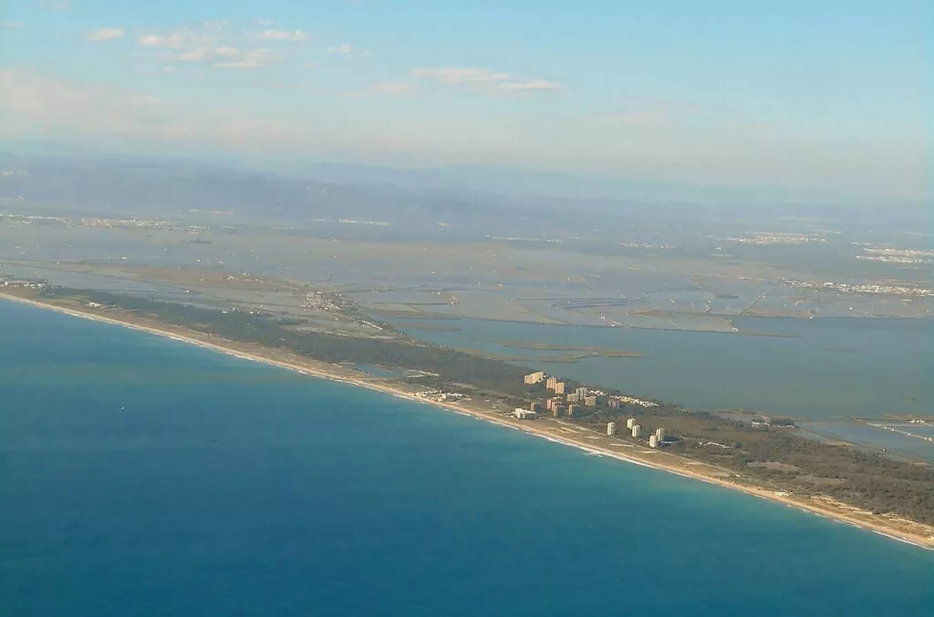
The Devesa del Saler and the Albufera from the air · Photo: Enrique Íñiguez Rodríguez (Qoan), CC BY-SA 3.0
Part of the Costa de Valencia guide · The Albufera, Sueca and Cullera
The Albufera, Sueca and Cullera is the southern stretch of the Costa de Valencia, from El Saler, just south of the city of Valencia, to Cullera at the mouth of the Júcar. At its heart is L’Albufera Natural Park, a freshwater lagoon linked to the sea by channels, surrounded by rice fields and cut off from the Mediterranean by a sand bar of dunes and pine woods that Spain.info puts at about 30 km between Valencia and Cullera (Spain.info). This guide covers the villages and towns from north to south, the beaches, boat trips and rice dishes, where to stay, how to get there and a two-day route.
At a glance
- Where the coast south of Valencia, from El Saler and the Devesa to the mouth of the Júcar at Cullera, with the Albufera lagoon behind the beaches.
- Towns El Saler, El Palmar, Catarroja, Silla, Sollana, El Perellonet, El Perelló, Sueca with its beach villages, and Cullera.
- Best for boat trips and birds on the lagoon, paella, dune beaches near the city and a beach week in Cullera.
- Getting there Valencia Airport is about 18 km from El Saler and 41 km from Cullera in a straight line; the CV-500 runs along the sand bar, and EMT city buses 24 and 25 reach El Saler and El Palmar.
- On CostaMap guides to the Albufera Natural Park, El Palmar, El Saler Beach, Cullera and Aquopolis Cullera.
Map of the Albufera, Sueca and Cullera
The map shows the places in this stretch that have a CostaMap page. Tick a place type to filter, and click a marker to see the place in the panel.
Place type
Area · next level
 Area map
The Albufera, Sueca and Cullera
Click a marker to see the place here. From El Saler and the lagoon to El Palmar, El Perelló and the castle hill of Cullera.
Towns and villagesTowns and villages
From north to south. Thirteen municipalities share the natural park, according to the regional tourist board (Comunitat Valenciana).
El Saler and the Devesa
El Saler is a district of the city of Valencia on the sand bar between the sea and the lagoon. The Devesa del Saler, the strip of pine woods and dunes here, is the part of the bar the tourist board’s route from Valencia to Sueca singles out: mobile dunes nearest the sea and dense pine woods on the fixed dunes towards the lagoon (Comunitat Valenciana). Its beach, reached on EMT buses 24 and 25, is one of the most popular near the city (Comunitat Valenciana). See our El Saler Beach guide.
El Palmar
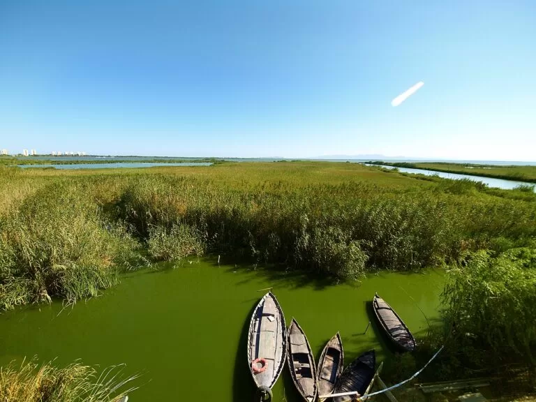
El Palmar is a small fishing village of the city of Valencia on an island in the rice fields. The tourist board calls it the home of paella and recommends its barracas, traditional houses of wattle and daub, boat trips past the rice fields, and the sunset from the jetty. Besides paella, try all i pebre, a stew of eel and potato (Comunitat Valenciana). See our El Palmar guide.
Catarroja
Catarroja borders the park on the north-west shore. Its freshwater port is one of the main ways onto the lake, once linked to the other lakeside towns by canals, and from it you can watch the vela latina, the traditional lateen-sail boats. In town see the 18th-century Casa Palacio de Vivanco and the 17th-century church of San Miguel (Comunitat Valenciana). On 19 September 2026 the port hosts the Allipebre International Competition (Comunitat Valenciana). See our Catarroja guide. Neighbouring Alfafar, Massanassa and Albal also reach into the park’s rice fields.
Silla
Silla, in the Horta Sud, has a tower built between the 11th and 12th centuries on a Roman structure, which houses part of the MARS history and archaeology museum, with Roman, Islamic and Christian finds. The parish church was built around 1751 for the Order of Montesa. Silla Port, where the huerta meets the rice fields, is a place to watch the sunset with lateen-sail boats on the water (Comunitat Valenciana). See our Silla guide.
Sollana
Sollana, on the south-western edge of the park, dates back to Arab times. Out in the wetlands, the Portet de Sollana and Motor de Bala are places for boats, rice fields and sunsets, and the Tancat de Mília is an enclosed reserve and green filter where you may see flamingos, ospreys and herons; book before you visit. Sollana holds a paella night on 14 August (Comunitat Valenciana).
El Perellonet and El Perelló
El Perellonet belongs to Valencia; its beach, Recatí-Perellonet, runs for more than 3 km between the El Perellonet and El Perelló channels and suits surfing, paddleboarding and kitesurfing (Comunitat Valenciana). El Perelló belongs to Sueca. The tourist board says it has fewer than 2,000 inhabitants in winter and up to 40,000 in summer; its 850 m beach has shallow water, moderate waves and the Garbí wind for windsurfing, and is reached by the CV-500, metrobus 190 or EMT line 25 (Comunitat Valenciana).
Sueca
Sueca, the capital of the Ribera Baixa, is ringed by the park’s rice fields. A Modernism tour takes in its Modernist and Art Deco buildings. Museums include the Museo Fallero, the Comes chocolate museum-factory and the house museum of the writer Joan Fuster (Comunitat Valenciana), whose collection includes works by Picasso and Miró (Comunitat Valenciana). Sueca has about seven kilometres of beaches, and in September it holds the Fiestas del Arroz, with an international paella competition; 2026’s ran from 11 to 13 September (Comunitat Valenciana). See our Sueca guide.
Cullera
Cullera closes the stretch at the mouth of the Júcar. Above the town, the castle houses the Municipal History and Archaeology Museum in its Gothic chapel, next to the 19th-century Sanctuary of La Mare de Déu del Castell; the tourist board’s pages date the fortress variously from the 9th to the 12th century (Comunitat Valenciana). The Alt del Fort viewpoint, called the balcony of the Júcar, looks over the coast, rice fields and orange groves (Comunitat Valenciana), and the Marenyet Tower was built in 1577 to guard the river mouth against Barbary pirates (Comunitat Valenciana). Down by the river are the fish market and boat trips on the Júcar (Comunitat Valenciana). See our Cullera guide and the Cullera town page; on the north edge of town is Aquopolis Cullera, a summer water park.
Beaches
From north to south. Lengths and services are as the regional tourist board gives them, checked in November 2026.
El Saler
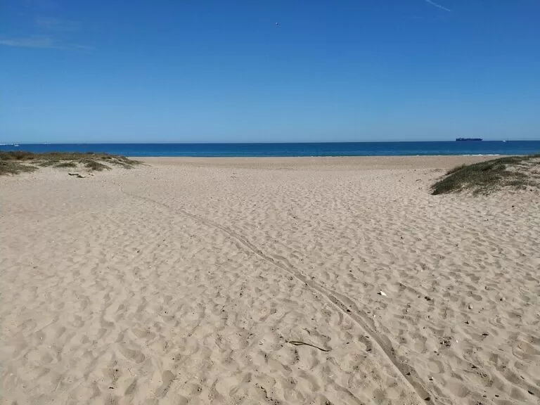
2,700 m of fine golden sand, 35 m wide, inside the natural park, with dunes and pine forest behind. Blue Flag, lifeguards, medical point and accessible toilets (Comunitat Valenciana).
See the beach guide →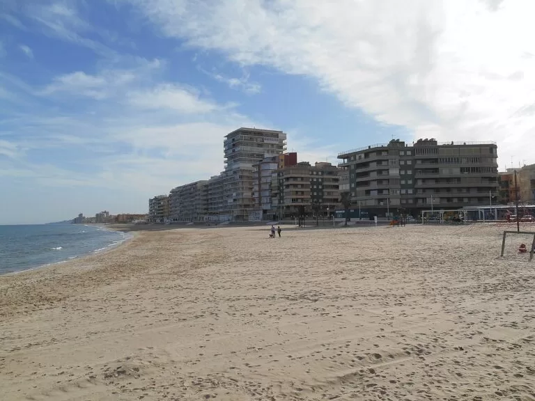
El Perelló
850 m long and 25 m wide on average, with shallow water and moderate waves. The Garbí wind makes it a windsurfing and kitesurfing beach; lifeguards and bathing help for people with disabilities (Comunitat Valenciana).
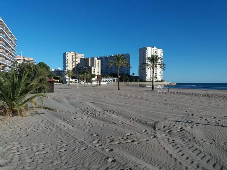
San Antonio
Cullera’s town beach in the bay: 1,820 m long and 75 m wide, with a long promenade, a tourist office, a health centre and full accessibility, including amphibious chairs (Comunitat Valenciana).
See the Cullera guide →- L’Arbre del Gos, La Garrofera and La Devesa – the dune beaches either side of El Saler: L’Arbre del Gos is a quiet Blue Flag beach with a cycle track; La Garrofera has 2.5 km among pines, with naturism listed among its services; La Devesa runs almost 5 km beside the malladas, the damp hollows between the dunes (Comunitat Valenciana).
- Recatí-Perellonet – more than 3 km between the El Perellonet and El Perelló channels, for surfing and kitesurfing (Comunitat Valenciana).
- The Sueca beaches – La Llastra, Les Palmeres (1,500 m, beach bars, campsites nearby), Mareny de Vilxes or Mareny Blau (720 m), Bega de Mar and El Rey at Mareny de Barraquetes (900 m, with a dune cordon) (Comunitat Valenciana).
- Mareny de Sant Llorenç and El Dosser – the wild northern beaches of Cullera inside the park: 2,700 m of dunes and no buildings at Mareny de Sant Llorenç, Cullera’s only nudist beach, then the fenced dunes of El Dosser (Comunitat Valenciana).
- Cap Blanc, Los Olivos and El Faro – north of the lighthouse: Cap Blanc (630 m) for windsurfing in the Garbí, Los Olivos (510 m) sheltered by breakwaters, and El Faro, a 100 m cove under the cliffs (Comunitat Valenciana).
- Marenyet–L’Illa, L’Estany and El Brosquil – south of the Júcar: 1,030 m for surfing, 1,200 m beside the Estany lagoon, and 2,220 m of quiet sand at El Brosquil, where pets are not allowed (Comunitat Valenciana).
Things to do
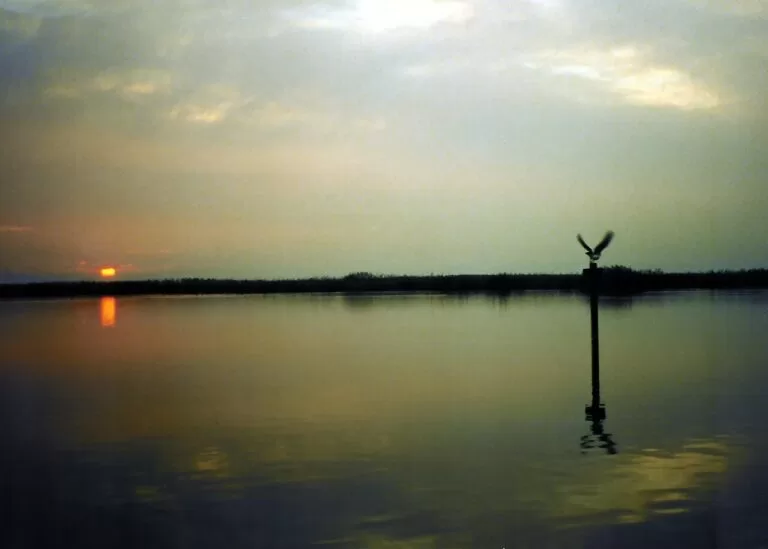
Nature: the lagoon, the rice fields and the birds
The tourist board counts more than 350 bird species in the park; Spain.info gives nearly 300. In the rice fields look for greater flamingos, purple herons, little ringed plovers and glossy ibises; the restored Tancat de la Pipa and Tancat de Mília are refuges for them (Comunitat Valenciana). The Racó de l’Olla visitor centre on the El Palmar road has a 50-hectare reserve (Spain.info). Boat trips leave from El Palmar and the other lakeside ports; see our Albufera guide for the details. In Cullera, signposted trails include an 11 km loop through the northern marsh and a 3.5 km path round the Estany lagoon (Comunitat Valenciana).
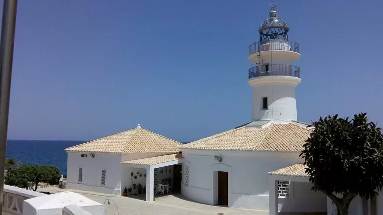
History: castles, towers and Modernism
Cullera has most of it: the castle with its towers, among them the Torre de la Reina Mora, and the museum in its Gothic chapel (Comunitat Valenciana). The 15-metre Marenyet Tower of 1577 is a Site of Cultural Interest, and the lighthouse stands in a plant micro-reserve above a rocky cove (Comunitat Valenciana).
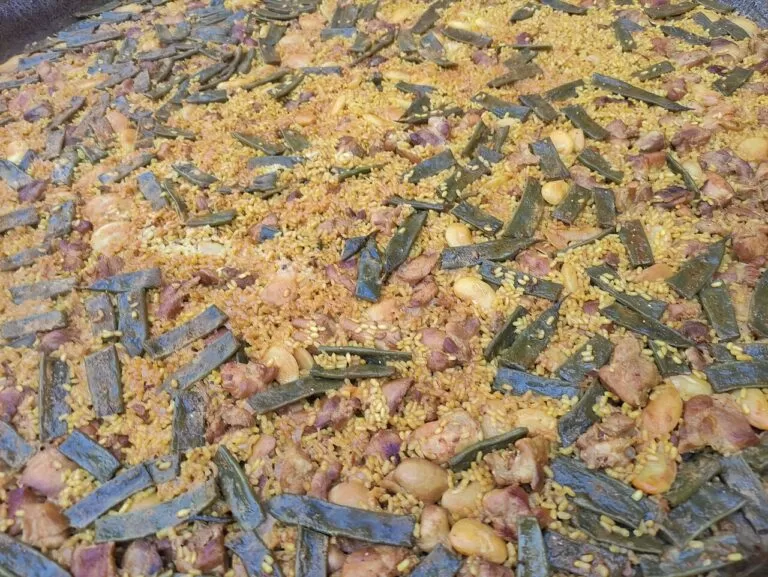
Food: rice, eel and the paella contests
Rice has been grown around the Albufera since the 8th century, when it was introduced by the Muslims (Comunitat Valenciana). The area is the home of the Arroz de Valencia Designation of Origin; bomba, senia and albufera are the best-known varieties (Comunitat Valenciana). Beyond paella, look for all i pebre, the eel stew of the lagoon villages. The food calendar follows the harvest: Sollana’s paella night on 14 August, Sueca’s Fiestas del Arroz in September and Catarroja’s all i pebre contest in the port.
Where to stay by town
Three bases, from north to south. We do not name hotels.
El Saler
Pine woods and dunes 11 km from the city, on the EMT bus, with campsites and a camping resort with bungalows (Comunitat Valenciana).
Nature near the cityEl Perelló and the Sueca beaches
Small summer resorts between the lagoon and the sea, with campsites near the beach at Les Palmeres (Comunitat Valenciana) and El Palmar 5 km away.
Quiet beach, water sports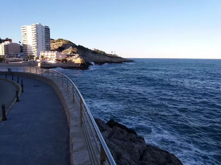
Cullera
The resort town of this stretch, with a train station, the castle and many beaches; the tourist board says places to eat and stay on San Antonio beach open in winter too.
Beach week, all yearFor museums and nightlife, stay in Valencia and come down for the day.
Getting there and around
By air
Valencia Airport (VLC) at Manises is the nearest. In a straight line it is about 18 km from El Saler, 24 km from El Palmar and 41 km from Cullera (OpenStreetMap coordinates).
By car
The CV-500 runs south from Valencia along the sand bar through El Saler, past El Palmar and on to El Perelló, the old Nazaret–Oliva road. South of El Perelló the coast road continues to Cullera; the CV-605 serves the southern beaches of Cullera (Comunitat Valenciana).
By bus and train
EMT Valencia lines 24 and 25 run from the city to Pinedo, El Saler and El Palmar; Renfe Cercanías trains stop at Silla and Catarroja, good starting points for walks in the rice fields (Comunitat Valenciana). El Perelló is on metrobus line 190 and EMT line 25. Cullera has a station on the Valencia–Gandia line, west of the town centre (OpenStreetMap). Check timetables before you travel.
A two-day route
By car from Valencia, north to south: about 18 km in a straight line on day 1 and 18 km more on day 2.
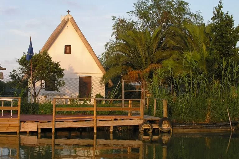
Day 1
El Saler, the Devesa and El Palmar
Start at El Saler: park behind the dunes, walk one of the marked trails through the pine woods and swim if the season allows. Drive south on the CV-500 to El Palmar for a rice lunch, then take a boat out onto the lake. Stay for the sunset from the jetty, or at the Gola de Pujol jetty on the way back, which the tourist board names as one of the best sunset spots.
Day 2
El Perelló, Sueca and Cullera
Spend the morning on the beach at El Perelló or Mareny Blau, then drive to Sueca for the Modernist centre and the Joan Fuster museum. In the afternoon climb through El Pou to Cullera Castle, walk to the lighthouse, and end at the Júcar mouth as the boats return to the fish market, as the tourist board suggests.
FAQ
How do I get from Valencia to the Albufera?
By car on the CV-500, or on EMT Valencia bus 24 or 25 to El Saler and El Palmar. Cercanías trains stop at Silla and Catarroja.
What is the best beach near the Albufera?
El Saler, 2,700 m of Blue Flag sand backed by dunes, is the best known; La Devesa is wilder, and El Perelló suits windsurfers.
Where do the Albufera boat trips leave from?
From El Palmar and from the ports of the lakeside towns, among them Catarroja and Silla. The tourist board names the Gola de Pujol jetty and the paths around the port of Catarroja for the sunset.
Is El Palmar the birthplace of paella?
The regional tourist board calls El Palmar the home of paella, and Spain.info says paella valenciana originates in the Albufera, made with rice grown there.
Is Cullera worth visiting?
Yes, for a beach stay with sights: the castle and its museum, the lighthouse cove, the mouth of the Júcar and beaches from the urban San Antonio to the wild dunes of the park.
When is the best time to see the rice fields?
May to September, when they are green and then golden before the September harvest, or November and December, when they are flooded and turn into a mirror, according to the tourist board.
Other areas of the Costa de Valencia
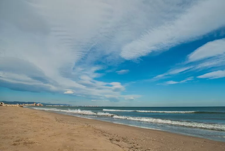
Costa de Valencia
From Sagunto to Oliva, with the map, the beaches, the Albufera and routes.
Costa de Valencia guide →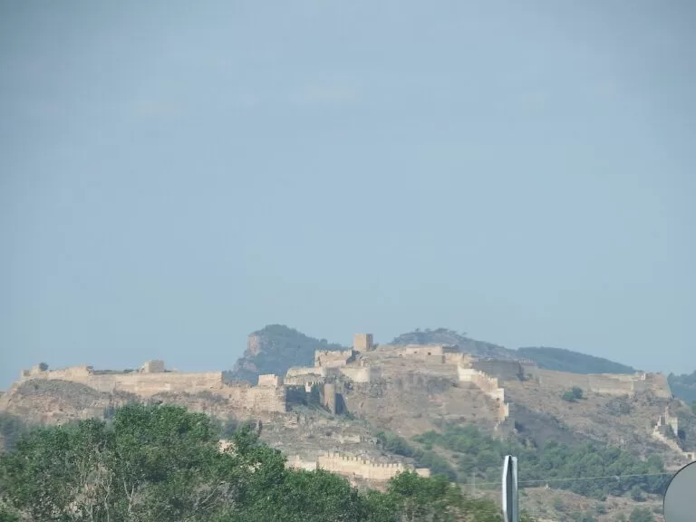
Sagunto and the northern beaches
Roman Sagunto above its port, then calm, mostly Blue Flag beaches south towards the city.
Sagunto guide →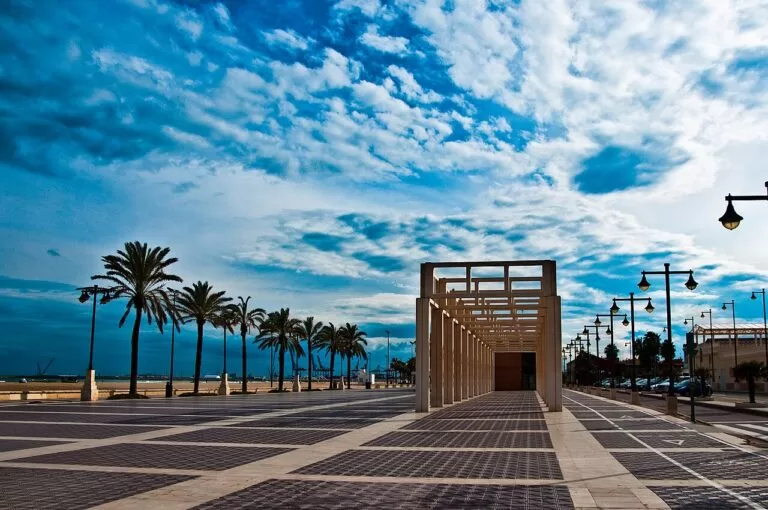
València and its city beaches
El Cabanyal, La Malvarrosa and La Patacona, a tram ride from the old town.
València beaches guide →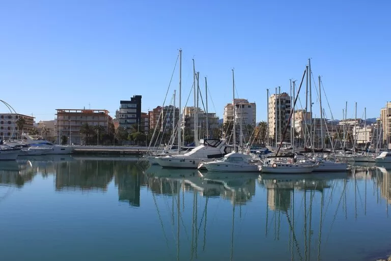
La Safor: Tavernes, Gandia and Oliva
Long, wide sandy beaches with dunes, the Borgia town of Gandia and the quieter shore of Oliva.
La Safor guide →Sources and freshness
Checked 7 November 2026. Comunitat Valenciana tourist board on L’Albufera Natural Park, the rice fields, the route from Valencia to Sueca, El Palmar, Catarroja, Silla, Sollana, Sueca, Cullera, a weekend in Cullera, Cullera nature trails, Cullera lookout points, rice dishes; the beach, monument, museum and festival pages linked above. Spain.info on the Albufera and Cullera. Map data, campsites, stations and straight-line distances: OpenStreetMap. Photos: Wikimedia Commons, credited on the files linked from each image. Not confirmed: bus and train timetables, boat-trip prices, opening hours of the castle and museums, and the castle’s exact date, which the tourist board gives differently on different pages.