
Costa de Valencia · València and its city beaches
València and its city beaches travel guide: old town, Malvarrosa and L’Horta Nord
A Gothic and Art Nouveau old town, a 9 km park in an old riverbed, and city beaches a tram ride away, with the tiger-nut fields and quiet beaches of Alboraya, Meliana and Foios just north.
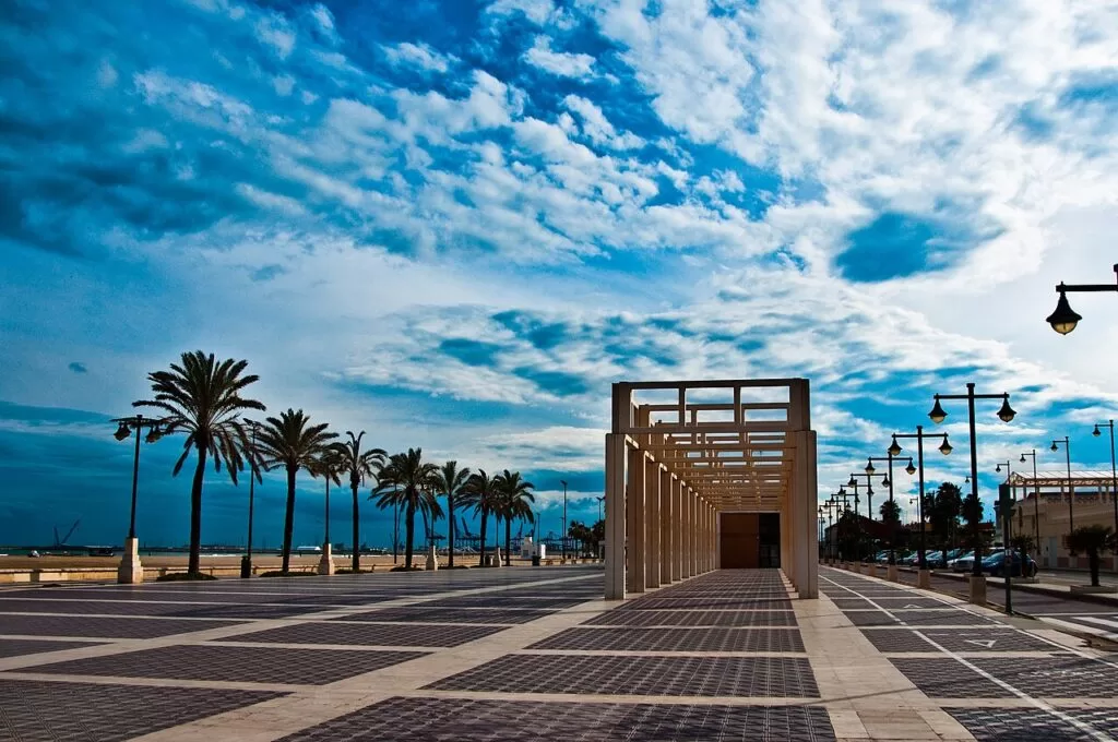
The seafront promenade, València · Photo: Raffaele Nicolussi, CC BY 3.0
Part of the Costa de Valencia guide · València and its city beaches
This is the middle of the Costa de Valencia: the city of València and the coast just north of it, from the beaches of Foios and Meliana south past Alboraya’s Port Saplaya and La Patacona to La Malvarrosa, El Cabanyal and the port, about 7 km of shore in a straight line. València itself has UNESCO-listed heritage, the City of Arts and Sciences and urban beaches you reach by tram (Comunitat Valenciana), while the towns of L’Horta Nord behind the beaches are farming country, known for tiger nuts and horchata (Comunitat Valenciana). This guide covers each place from north to south, the beaches, what to do, where to stay, how to get there and a two-day route.
At a glance
- Where the centre of the Costa de Valencia, from the beaches of Foios and Meliana in L’Horta Nord south to the port of València.
- Towns València, Alboraya with Port Saplaya, Almàssera, Tavernes Blanques, Meliana and Foios.
- Best for a city break with a beach, Gothic and Art Nouveau buildings, the Oceanogràfic, horchata and cycling through the huerta.
- Getting there Valencia Airport is 8 km from the city, with metro lines 3 and 5 into the centre in about 20 minutes (Spain.info); no car needed.
- On CostaMap guides to València, the cathedral, the Serranos Towers, the Silk Exchange, the Central Market, the City of Arts and Sciences, the Oceanogràfic, Bioparc, the Marina, La Malvarrosa, Alboraya and Foios.
Map of València and its city beaches
The map shows the places in València and on its city coast that have a CostaMap page. Tick a place type to filter, and click a marker to see the place in the panel.
Place type
Area · next level
 Area map
València and its city beaches
Click a marker to see the place here. The old town, the Turia Gardens and the beaches from El Cabanyal and La Malvarrosa north to La Patacona.
Towns and villagesTowns and villages
From north to south, following the coast towards the city, with the inland huerta towns where they are reached from.
Foios
Foios is a town of L’Horta Nord a few kilometres north of València. Its municipality reaches the sea beyond the fields, where Platja de Foios lies next to Meliana beach (OpenStreetMap). The regional tourist board picks out three things: its food, its cultural life and the huerta, the irrigated market gardens around it. Foios has one of the best-known kitchens of the Horta Nord; look for arròs amb fessols i naps (rice with beans and turnips) and pastissets de moniato (sweet-potato pastries) (Comunitat Valenciana). Come for the food and the countryside. See our Foios guide.
Meliana
Meliana is where the huerta meets the sea. In town, start at the blue-tiled façade of the old Bernardo Vidal tile factory next to the metro station, then the 16th-century church of Santos Juanes on the main square and MOSMEL, the local fine-art gallery. Walk or cycle out through the farming district of Roca to the beach, or visit the Palau de Nolla, named after the Nolla mosaic tiles first made here (Comunitat Valenciana). Meliana beach is 1,200 m long and 50 m wide, detached from the village and surrounded by fields; a Greenpeace report called it one of the few virgin beaches left on the Valencian coast. (Comunitat Valenciana).
Almàssera and Tavernes Blanques
Almàssera lies on the left bank of the Barranc del Carraixet. See the 18th-century church of the Santísimo Sacramento, Casa Llopis on the town-hall square with its trencadís tiles from the Nolla factory, and the Museu de l’Horta, an ethnology museum in the old slaughterhouse (Comunitat Valenciana). The Lladró brothers started making porcelain in a house in Almàssera in 1953. Their museum is next door in Tavernes Blanques, about 15 minutes from the centre of València, in the company’s workshops, with pieces that trace the brand’s history (Comunitat Valenciana).
Alboraya, Port Saplaya and La Patacona
Alboraya sits between tiger-nut fields and the sea. The tiger nut is the main ingredient of horchata, a drink with Designation of Origin status, and you can walk or cycle here from València along the Vía Verde Xurra past farmhouses, irrigation channels and mills. The old centre has an 18th-century parish church and ceramic street altars (Comunitat Valenciana). On the coast, Port Saplaya has an inland marina and a beach of 600 m. By the mouth of the Carraixet stands the Ermita dels Peixets, a neo-Gothic chapel of 1901 that recalls a 14th-century miracle of fish carrying communion wafers; it opens only on its feast day (Comunitat Valenciana). La Patacona beach runs south into La Malvarrosa. See our Alboraya guide.
València: La Malvarrosa, El Cabanyal and the Marina
The city’s seafront begins at La Malvarrosa, about 1 km of fine golden sand with a promenade of rice and seafood restaurants, then El Cabanyal beach (Comunitat Valenciana). Behind the sand, El Cabanyal is an old fishing village that keeps its character and its Art Nouveau houses. South of the beach is La Marina de València, the city’s seafront marina and home of the Casa de la Copa, which tells the story of the America’s Cup: the Veles e Vents building, about 15 restaurants, boat trips and the Art Nouveau dry dock, clock building and fish market (Spain.info). See our guide to Marina Real Juan Carlos I. In the Grau, the 14th-century Gothic shipyards, the Atarazanas, host exhibitions (Comunitat Valenciana).
València: the old town
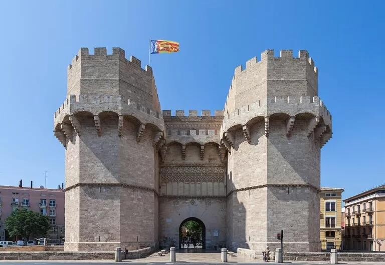
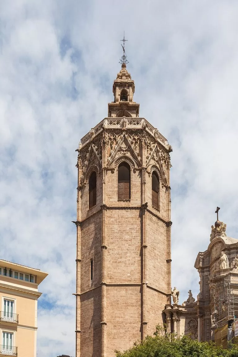
Most of the monuments are in the historic centre. Valencia Cathedral was built from the 13th to the 15th century and has kept the Holy Chalice since 1437; every Thursday at noon the Water Tribunal, listed by UNESCO, meets at its Apostles’ Door (Comunitat Valenciana). Its bell tower, the Miguelete, has 207 steps (Spain.info). A few minutes away are the Silk Exchange, a UNESCO World Heritage Site, and the 1928 Central Market. Two gates of the medieval walls survive: the 14th-century Serranos Towers and the Quart Towers of 1441–1460. Our Valencia guide and València town guide cover the whole city.
València: the Turia Gardens and the City of Arts and Sciences
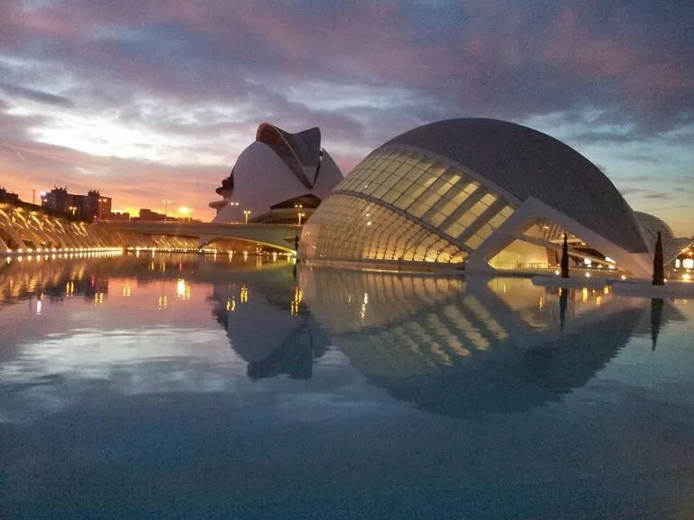
The River Turia once ran round the old town. Its former bed is now a park of nine kilometres that you can walk or cycle end to end (Comunitat Valenciana). At its western end, in the Parque de Cabecera, Bioparc Valencia, opened in 2008, keeps more than 70 species in recreated African habitats over 100,000 m² (Comunitat Valenciana). At the eastern end, the City of Arts and Sciences stretches for almost 2 km with six venues, designed by Santiago Calatrava and Félix Candela (Comunitat Valenciana). Its Oceanogràfic is Europe’s largest aquarium, with an underwater tunnel and belugas (Comunitat Valenciana).
Around the city, CostaMap also has town guides to Mislata, Quart de Poblet, Paterna, Burjassot, Godella, Moncada, Benetússer and Paiporta, all in the metropolitan area.
Beaches
From north to south. Sizes and services are as the regional tourist board gives them, checked in November 2026.
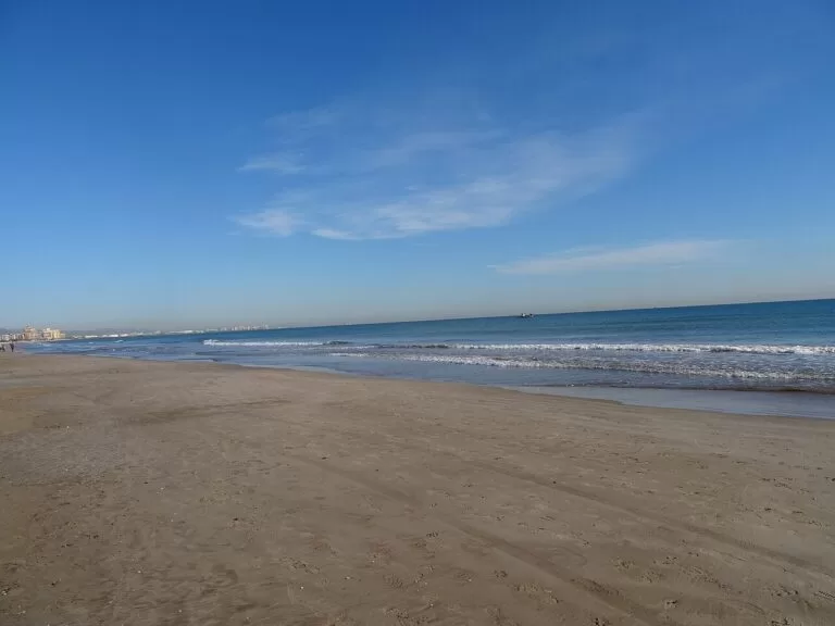
La Patacona
More than 1 km long and 110 m wide, next to La Malvarrosa, with a promenade busy all year, beach bars in summer, an accessible area and free bathing assistance with amphibious chairs. Intercity buses stop nearby (Comunitat Valenciana).
See the Alboraya guide →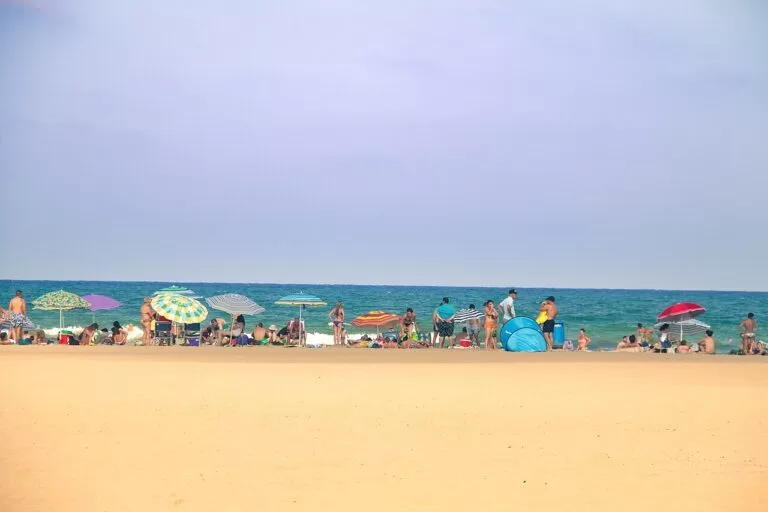
La Malvarrosa
The city’s best-known beach: about 1 km of fine golden sand, 135 m wide on average, with a Blue Flag, lifeguards, accessible points and a swimming programme for disabled people. Tram stops run one street behind it (Comunitat Valenciana).
See the beach guide →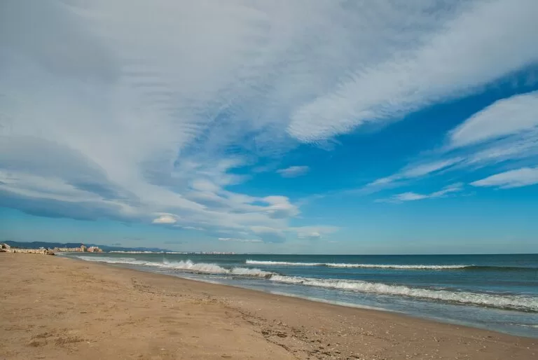
El Cabanyal (Las Arenas)
A large beach of fine sand south of La Malvarrosa, with lifeguards, loungers, parasols and beach bars in the high season, a walk or short ride from the old town and next to the water-sports companies of the Marina (Comunitat Valenciana).
- Meliana – 1,200 m of coarse sand among fields, quiet and largely undeveloped, with a large car park; reached on foot from Meliana or by car off the V-21 (Comunitat Valenciana).
- Port Saplaya – 600 m by 90 m of fine sand south of the marina, with lifeguards, first aid and adapted walkways, toilets and showers in summer (Comunitat Valenciana).
- Pinedo, El Saler and La Devesa – south of the port the city’s beaches turn wilder. Pinedo, sheltered by the port, keeps a strip of dunes and is listed as dog-friendly (Comunitat Valenciana); El Saler and La Devesa lie inside the Albufera Natural Park and are covered in our guide to the Albufera, Sueca and Cullera.
Things to do
Nature: the Turia Gardens and the huerta
The Turia Gardens are the city’s green spine, nine kilometres of park in the old riverbed from Bioparc to the City of Arts and Sciences (Comunitat Valenciana). North of the city, the Vía Verde Xurra follows an old railway line for about 16 km through the orange groves and market gardens of L’Horta Nord, linking València with Alboraya, Almàssera, Meliana, Foios and towns as far as Puçol. It is suitable for walkers, bikes, scooters and wheelchairs (Comunitat Valenciana).
History: Gothic València and Art Nouveau
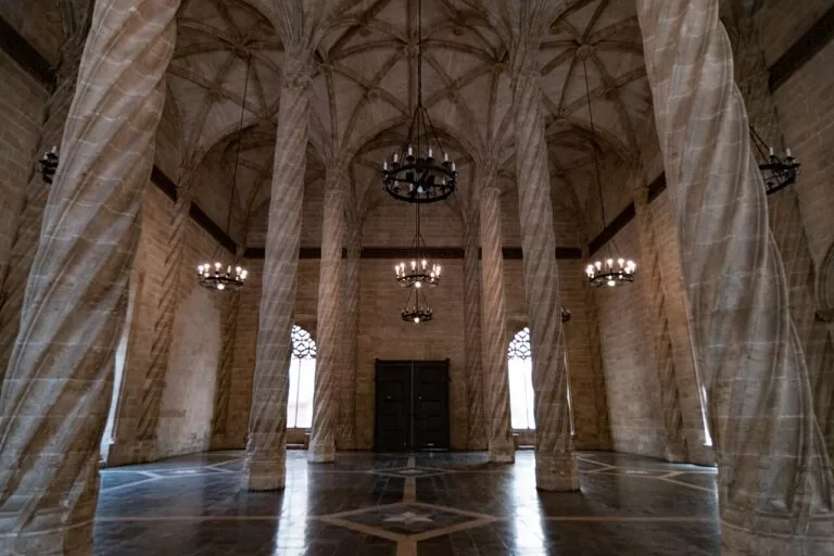
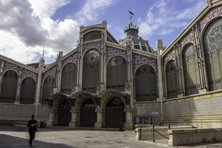
The Silk Exchange was built mostly between 1482 and 1492 under Pere Compte; Spain.info calls it one of Europe’s most beautiful examples of Gothic civil architecture (Spain.info). Under the city, the La Almoina centre shows Roman and Visigothic remains, and the Temple of San Juan del Hospital stands beside remains of the Roman circus. The Art Nouveau side of the city is the Central Market, the Colón Market and Estació del Nord, whose façade is decorated with oranges and orange blossom (Comunitat Valenciana).
Food: paella, horchata and the market
Spain.info’s two-day plan starts with cold horchata and fartons in the horchaterías of Plaza de la Reina, then the Central Market, where you can lunch at the market’s Central Bar, and paella by the sea at El Cabanyal on day two (Spain.info). For horchata at the source, go to Alboraya: its tiger-nut fields are lined with horchaterías (Comunitat Valenciana).
Festivals: the Fallas, listed by UNESCO as Intangible Cultural Heritage, fill the city with daily mascletàs, the Flower Offering and the burning of the monuments, the Cremà (Comunitat Valenciana); the main days fall around 19 March (Spain.info).
Where to stay by town
Where we would base a trip, from the centre outwards.
València old town (Ciutat Vella)
Everything on foot: the cathedral, the Silk Exchange, the Central Market and the Turia Gardens, with the beach a tram or bus ride away. Note the Low Emission Zones if you come by car.
A first visit, no car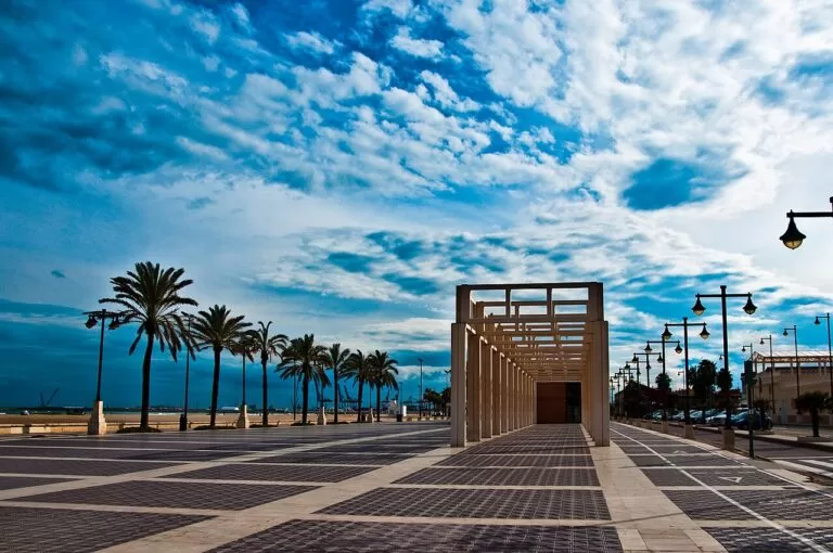
El Cabanyal and La Malvarrosa
Sleep by the sea and go into town by tram. Close to the Marina, the beach restaurants and the old fishing streets of El Cabanyal.
Beach and cityAlboraya: La Patacona and Port Saplaya
A beach base just outside the city limits, with Alboraya’s two tourist offices, the marina at Port Saplaya and the horchaterías inland.
Families, a beach weekGetting there and around
By air
Valencia Airport is 8 km from the city, about 15 minutes by car on the A-3 and V-11. Metro lines 3 and 5 run from the regional-flights terminal to the centre in about 20 minutes, and city bus 150 takes about 35 minutes (Spain.info).
By train
High-speed and long-distance trains use Joaquín Sorolla station; local Cercanías trains use Estació del Nord, by the Xàtiva metro stop (lines 3, 5 and 9) (Spain.info).
Metro, tram and bus
The metro and tram run from 4 am to 11:30 pm on weekdays, later at weekends; EMT has more than 40 bus routes. Bus lines 1, 2, 19, 31 and 32, plus summer lines, serve the beaches (Spain.info). The tram stops Platja Malva-rosa, Platja les Arenes and Neptú lie behind the beaches (OpenStreetMap).
By car and bike
The AP-7 links València with Barcelona and Alicante and the A-3 with Madrid. Large parts of the centre are Low Emission Zones. The city has an extensive cycle-lane network and the Valenbisi public bikes (Spain.info).
A two-day route
Day 1
The old town and the Turia
Start with horchata on Plaza de la Reina, then the cathedral and the Miguelete; on a Thursday, see the Water Tribunal at noon. Walk to the Silk Exchange and the Central Market opposite, and have lunch at the market or on the squares around the Lonja. In the afternoon walk up to the Serranos Towers and follow the Turia Gardens east, on foot or by bike, to the City of Arts and Sciences; finish with the Oceanogràfic or the Science Museum.
Day 2
The Marina, the beaches and the huerta
Take the tram to the sea. Walk La Marina de València and the Atarazanas, then the streets of El Cabanyal, and spend the middle of the day on El Cabanyal or La Malvarrosa beach with a rice dish on the promenade. Visit the Casa-Museo Blasco Ibáñez on the Malvarrosa seafront, then walk north along La Patacona to Port Saplaya. Finish inland in Alboraya with horchata, or cycle back along the Vía Verde Xurra.
FAQ
What is the best beach in Valencia city?
La Malvarrosa is the best known: about 1 km of fine sand with a Blue Flag, lifeguards and accessible bathing. El Cabanyal next to it is closest to the Marina, and La Patacona continues the sand north into Alboraya.
How do you get from Valencia city centre to the beach?
By tram to the Platja Malva-rosa, Platja les Arenes or Neptú stops, or by EMT bus 1, 2, 19, 31 or 32. You can also walk or cycle; La Malvarrosa is about 4.5 km from the cathedral in a straight line.
Where is the best area to stay in Valencia?
The old town for sightseeing on foot; El Cabanyal or La Malvarrosa to stay by the sea and ride the tram into town; Alboraya for a quieter beach base.
Where can I drink horchata in Valencia?
On Plaza de la Reina in the old town, or at the source in Alboraya, among the tiger-nut fields.
How far is Valencia Airport from the city?
8 km. Metro lines 3 and 5 take about 20 minutes to the centre; city bus 150 takes about 35 minutes.
Other areas of the Costa de Valencia
Costa de Valencia
From Sagunto to Oliva, with the map, weather, itineraries and campsites.
Costa de Valencia guide →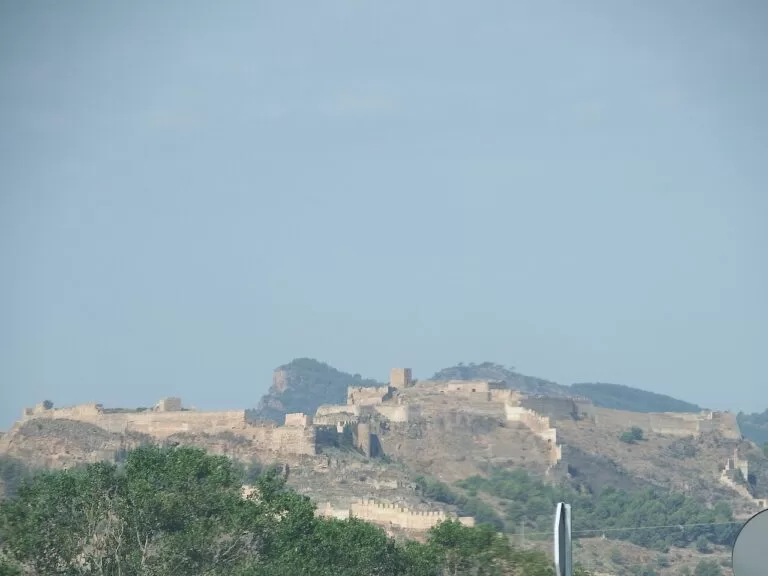
Sagunto and the northern beaches
Roman Sagunto above its port, then Canet, Puçol and El Puig on the way to the city.
Sagunto guide →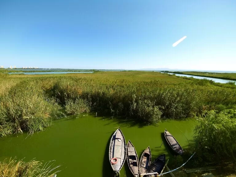
The Albufera, Sueca and Cullera
Rice fields, boat trips on the lagoon, the dune beaches of El Saler and the castle hill of Cullera.
Albufera guide →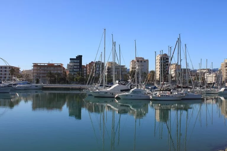
La Safor: Tavernes, Gandia and Oliva
Long, wide sandy beaches with dunes, the Borgia town of Gandia and the quieter shore of Oliva.
La Safor guide →Sources and freshness
Checked 7 November 2026. Turisme Comunitat Valenciana on València, Alboraya, Meliana, Almàssera and Foios; the beaches of La Malvarrosa, El Cabanyal, Pinedo, La Patacona, Port Saplaya and Meliana; the Vía Verde Xurra, the Ermita dels Peixets, the Museu Lladró, the Atarazanas, the Water Tribunal, Estació del Nord, the City of Arts and Sciences, the Oceanogràfic, Bioparc and La Patacona and horchata. Spain.info on València (transport), Valencia in two days, the Marina and the Silk Exchange. Locations, tram stops and straight-line distances: OpenStreetMap. Not confirmed: tram and bus line numbers for each stop, opening hours and prices of the monuments, the length of Foios beach.