
Costa Blanca · North · Marina Alta
Marina Alta: Dénia, Xàbia and Calp travel guide: coves, capes and the Peñón de Ifach
The northern Costa Blanca, where the mountains reach the sea: sandy beaches at Dénia, coves and capes around Xàbia, Moraira and Benissa, and the rock of Ifach at Calp.
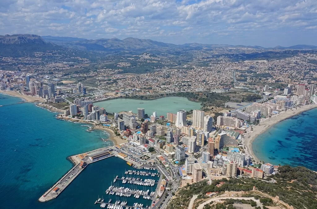
Calp from the Peñón de Ifach · Photo: Bjørn Christian Tørrissen, CC BY-SA 4.0
Part of the Costa Blanca guide · North: Marina Alta · Interactive map of the comarca
The Marina Alta is the northernmost comarca of Alicante province and the first stretch of the Costa Blanca coming from Valencia. Its coast runs from the long sandy beaches of Els Poblets and Dénia round the Montgó massif and the capes of Xàbia, then south past the cliffs and coves of El Poble Nou de Benitatxell, Moraira and Benissa to Calp and the Peñón de Ifach. This guide covers each town from north to south, the beaches and coves, what to do, where to base yourself, how to get there and a two-day route.
At a glance
- Where the coast of the Marina Alta, from Les Deveses beach on the Oliva border through Dénia, Xàbia and Moraira to Calp, about 23 km from Dénia to the Peñón de Ifach in a straight line.
- Towns Els Poblets, Dénia, Xàbia (Jávea), El Poble Nou de Benitatxell, Teulada-Moraira, Benissa and Calp (Calpe), with Pego, Xaló and the Vall de Laguar inland.
- Best for snorkelling coves, cliff walks and viewpoints, the climb up the Peñón de Ifach, Dénia’s food, and family beaches at Dénia, the Arenal and Calp.
- Getting there Alicante–Elche airport is about 68 km from Calp and 85 km from Dénia in a straight line, Valencia airport about 88 km from Dénia; trains from Alicante reach Calp, Benissa and Dénia.
- On CostaMap guides to Dénia, Xàbia, Moraira, Benissa and Calp, more than a dozen coves, capes and walks, two marinas and four campsites and camper areas.
Map of the Marina Alta
The map shows the places in the Marina Alta that have a CostaMap page. Tick a place type to filter, and click a marker to see the place in the panel. For the full-screen version, open the interactive map of the comarca.
Place type
Area · next level
 Area map
Marina Alta: Dénia, Xàbia and Calp
Click a marker to see the place here. From the beaches of Dénia round the Montgó and the capes of Xàbia to the Peñón de Ifach at Calp.
Towns and villagesTowns and villages
From north to south. Dénia, Xàbia and Calp have distinct districts, so each gets its own sub-sections.
Els Poblets
Els Poblets, on the river Girona just north of Dénia, joins three old farming hamlets, Setla, Mirarosa and Miraflor. It lay on the Roman Via Augusta, and the Almadrava site by the coast road was a Roman pottery, active between the 1st and 5th centuries AD, that made roof tiles and amphoras for wine, oil and salted food (Comunitat Valenciana tourism). In Mirarosa a 15th- and 16th-century watchtower now stands among houses, and the Almadrava beach runs for about 1,000 m (Comunitat Valenciana tourism).
Dénia: castle, old town and the port
Dénia is the largest town of the stretch, and the regional tourist board calls it a UNESCO City of Gastronomy, known for arròs a banda, espencat salad, dried octopus, red prawns and suquet fish stew (Comunitat Valenciana tourism). The castle on the hill in the centre was built in the 11th century in rammed earth and altered in the 13th, 16th and 18th centuries; it holds the Archaeological Museum (Comunitat Valenciana tourism). Below it, Les Roques was the walled Arab suburb, and Baix la Mar is the old fishermen’s quarter of low painted houses. The commercial port sits beside the marina (spain.info). Our Dénia place page and castle guide have more.
Dénia: Les Marines and Els Molins
North-west of the port the coast is a long run of sand. Les Marines beach is almost 3 km long, with lifeguards in summer, walkways and adapted bathing, and a bus stop beside it (Comunitat Valenciana tourism). Further out along the Les Marines road, between km 5.4 and 7.8, Els Molins is 2,700 m of wide, quieter sand with parking and good conditions for windsurfing (Comunitat Valenciana tourism). The 6 km Vía Verde de Dénia, on the old Carcaixent–Dénia railway, runs through orange groves to this coast and suits walkers, bikes and wheelchairs (Comunitat Valenciana tourism).
Dénia: Les Rotes and Cap de Sant Antoni
South of the port the shore turns to rock. Les Rotes is a string of rocky coves with Posidonia meadows; Arenetes, at the far end, is 300 m long and ends at a lookout towards the cape (Comunitat Valenciana tourism). The Les Rotes to Torre del Gerro walk climbs from here. Offshore, the Cabo de San Antonio marine reserve covers some 900 hectares under cliffs about 150 m high; fishing and diving in the fish reserve off Les Rotes need authorisation, and entry to the Cova Tallada sea cave is regulated (Comunitat Valenciana tourism).
Xàbia: the old town
Xàbia (Jávea) sits between the Cap de Sant Antoni and the Cap de la Nau, with three distinct districts. The old town, inland, keeps its medieval street plan in golden tosca sandstone around the church of San Bartolomé, built between the 14th and 16th centuries, the Abastos market (1946) and the Soler Blasco archaeological museum. A street market fills the Plaza de la Constitución on Thursday mornings (Xàbia tourism). Our Xàbia place page covers the town as a whole.
Xàbia: the port (Duanes de la Mar)
The port grew on the raisin trade in the 19th century and later lived from fishing. Around it, the Duanes de la Mar district has whitewashed fishermen’s houses, the modern church of Nuestra Señora de Loreto (1967) and a fish market where the catch is auctioned when the boats come in; the Loreto fiestas are in the first week of September (Xàbia tourism). La Grava, the pebble town beach here, is 290 m long and holds the Blue Flag every year (Xàbia tourism).
Xàbia: the Arenal and the southern coves
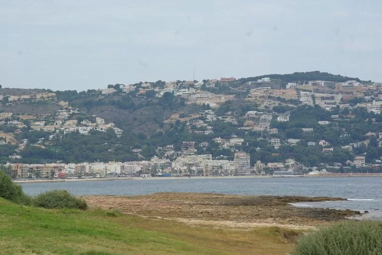
The Arenal is Xàbia’s only sandy beach, about 480 m of shallow water with a promenade, bars and the town’s assisted bathing point (Comunitat Valenciana tourism). South of it the coast rises to cliffs: Cala Barraca (Portitxol) faces the Illa del Portitxol below the Creu del Portitxol viewpoint, and Cala Granadella (see also our Granadella guide) is 160 m of pebbles under pine woods. Wecamp Jávea is the campsite here.
El Poble Nou de Benitatxell
Benitatxell’s coast is all cliffs, protected with Xàbia’s and Moraira’s as the Penya-segats de la Marina; it is one of the best places for the endemic Silene hifacensis (Comunitat Valenciana tourism). Cala del Moraig, behind the Puig de la Llorença, has a Blue Flag; Cala Testos is reached only by sea or a path, and Cala Llebeig, with old fishermen’s houses, only on foot along the cliff route (SL-CV 50) or by boat (Comunitat Valenciana tourism).
Teulada and Moraira
The municipality has two halves: Teulada, a Gothic walled town inland with the fortified church of Santa Catalina, and Moraira on the coast, with about 8 km of Blue Flag beaches and coves (Comunitat Valenciana tourism). Moraira’s castle, an 18th-century fort against pirates restored in the 1980s, holds an audiovisual museum on the sea and piracy; L’Ampolla beach, 250 m of sand at its foot, is accessible (Comunitat Valenciana tourism). El Portet, 300 m long under the Cap d’Or, starts a coastal walk past viewpoints (Comunitat Valenciana tourism). More in our Moraira guide.
Benissa
Benissa‘s old town stands back from the sea: its town hall of 1790 was first the hospital, and the Casa Museo Abargues shows an 18th- and 19th-century noble home (Comunitat Valenciana tourism). Its coast is followed by the Paseo Ecológico Litoral, an easy linear path with 93 m of climbing from the Benissa Playa tourist office to Cala Advocat (Comunitat Valenciana tourism). On the way is Cala de la Fustera. See also our Benissa place page.
Calp: the old town
Calp (Calpe) has an old town ringed by walls built against pirate raids, next to the old Moorish quarter, with the tower of La Peça; spain.info describes the 15th-century parish church of the Virgin of the Snow as the only Gothic-Mudéjar church in the Region of Valencia (spain.info). Local dishes include arròs del senyoret and llauna de Calp fish stew.
Calp: the beaches, the salt flats and the Peñón
Below the old town lie two sandy bays: Arenal-Bol, 1.2 km long with a full adapted bathing area (Comunitat Valenciana tourism), and La Fossa (Levante), more than a kilometre long facing the north side of the rock (Comunitat Valenciana tourism). Between them are the Salinas de Calp, a former salt lagoon with flamingos, and on the seafront the Roman Baños de la Reina. The Peñón de Ifach, 332 m high and about a kilometre long, is a natural park; the summit path needs a booking (Calp town council). More in our Peñón de Ifach guide; the port of Calp sits at its foot.
Inland: Pego, Xaló and the Vall de Laguar
Behind Dénia, Pego keeps its medieval street plan and pieces of its walls, and its natural park, the Marjal de Pego-Oliva, is a wetland of rice fields and springs called ullals, rich in water birds (Comunitat Valenciana tourism). In the Jalón valley, Camper Park Xaló is a base for the vineyards, and in the Vall de Laguar the Barranc de l’Infern is a demanding gorge walk.
Beaches and coves
Sand in the north (Dénia, Els Poblets) and in Calp; pebbles, rock and cliff coves in between. Lengths are as the tourist board or the town gives them.
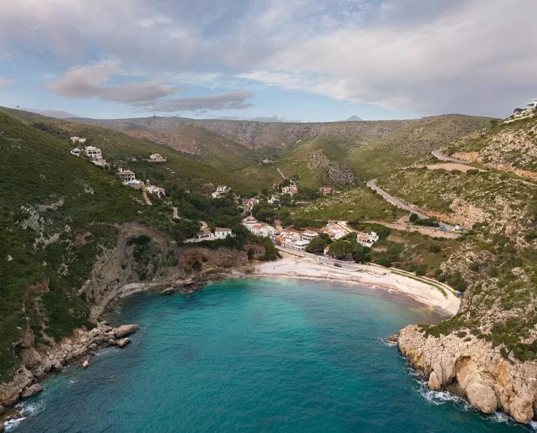
Cala Granadella
160 m of gravel and pebbles with clear water for diving, lifeguards all summer and a path to the Granadella castle. In 2026 cars were regulated from June to mid-October, the 130-space car park cost €9 a day in summer, and a tourist train ran from La Guàrdia car park from 3 July to 13 September (Xàbia tourism, checked November 2026).
See the Granadella guide →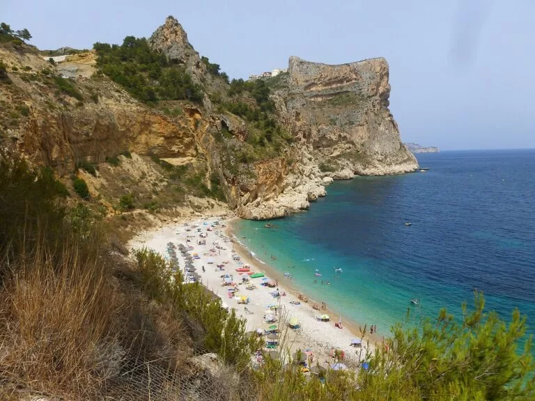
Cala del Moraig
A Blue Flag cove hidden behind the Puig de la Llorença, with a special mention for its lifeguard service; snorkelling and diving are popular (Comunitat Valenciana tourism).
See the Moraig guide →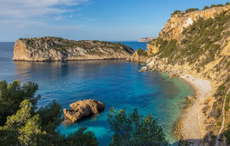
Cala Barraca (Portitxol)
About 900 m of gravel and pebbles with fishermen’s houses, facing an island 300 m offshore; 59 paid spaces in summer and no public transport (Comunitat Valenciana tourism; Xàbia tourism). Photo: nearby Ambolo.
See the Portitxol guide →- Les Marines and Els Molins (Dénia) – almost 3 km and 2,700 m of fine sand, with lifeguards and adapted bathing at Les Marines and windsurfing at Els Molins.
- El Arenal (Xàbia) – 480 m of coarse sand and shallow water, the town’s assisted bathing point.
- L’Ampolla and El Portet (Moraira) – 250 m and 300 m of sand, both with lifeguards in summer.
- L’Andragó (Moraira) – a 150 m rocky cove with deep, clear water for snorkelling, under a viewpoint on the coastal route (Comunitat Valenciana tourism).
Things to do
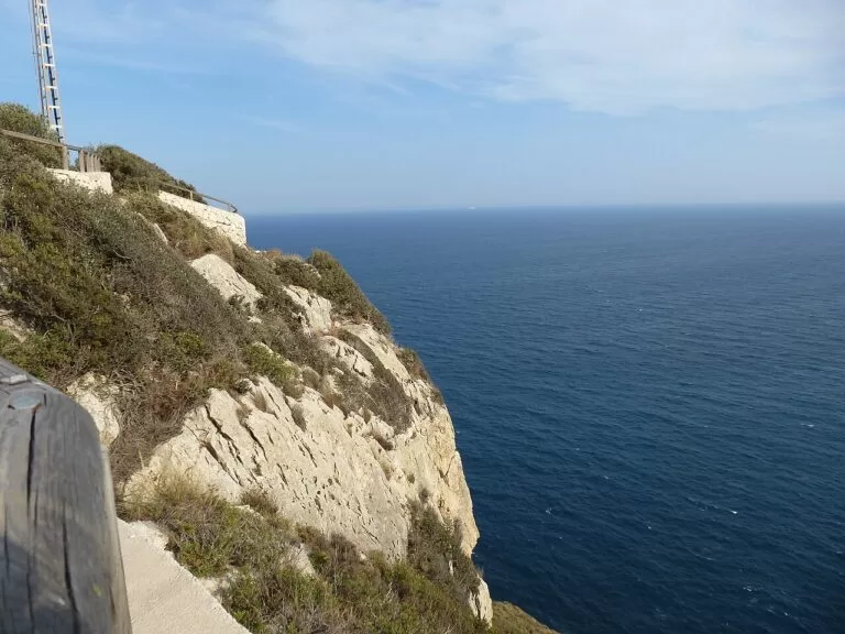
Nature: the Montgó, capes and cliff paths
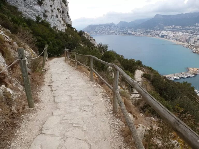
The Montgó natural park spreads between Dénia and Xàbia, with trails past chapels, windmills, viewpoints and Roman inscriptions, and birds of prey, foxes and badgers (Comunitat Valenciana tourism). The lighthouse on the Cap de Sant Antoni stands on a cliff 163 m high (spain.info). Harder walks include the Peñón de Ifach summit, 4.6 km with a roped final section (Comunitat Valenciana tourism), and the Barranc de l’Infern.
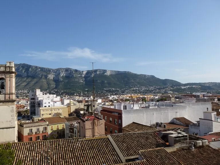
History: castles, Romans and watchtowers
Roman sites line the shore: the Almadrava pottery in Els Poblets, the Baños de la Reina fish-salting basin on Xàbia’s Primer Muntanyar (Xàbia tourism) and the Roman pools of the same name in Calp, with the 19th-century Molí del Morelló beside them (Comunitat Valenciana tourism). Moraira’s castle tells the story of the pirate raids.
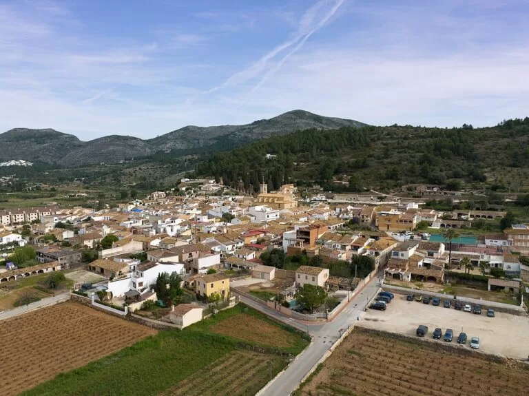
Food, wine and festivals
Dénia’s red prawns and rice dishes are the headline; Teulada-Moraira is known for muscatel wine and holds a muscatel festival, Moors and Christians and Holy Week (Comunitat Valenciana tourism). Xàbia burns its Hogueras de San Juan in June, and Calp celebrates the Virgen de las Nieves on 5 August and Moors and Christians in October (spain.info).
Where to stay by town
North to south. We name no hotels; compare locations on the map.
Dénia
The most to do without a car: castle, port, restaurants, the greenway and long sandy beaches at Les Marines, with the train from Alicante.
Food, families, no car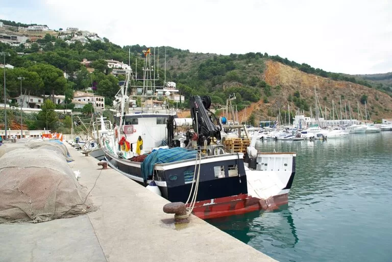
Xàbia: Arenal or the port
The Arenal for sand and evenings out, the port for a quieter fishing-town feel; both are close to the capes and coves. A car helps.
Coves, snorkellingMoraira and Benitatxell
Small beaches, cliff paths and villas; quiet and best with a car.
Couples, walkers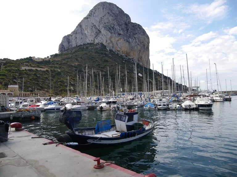
Calp
Two sandy bays, the Peñón and the salt flats in walking distance, plus the train. Paraiso Camper and the Mediterráneo Camper Area are near the salt flats.
Beach week, motorhomesGetting there and around
By air
Alicante–Elche airport is about 68 km from Calp and 85 km from Dénia; Valencia airport is about 88 km from Dénia, all in a straight line (OpenStreetMap).
By train
The regional tourist board lists Calp, Benissa and Dénia among the coastal towns you can reach by train from Alicante. (Comunitat Valenciana tourism). We could not confirm current timetables or stations.
By car and bus
Dénia’s northern beaches are reached from the AP-7 motorway and the CV-725 (Comunitat Valenciana tourism). Coves such as Granadella and Barraca have summer access limits and paid parking, and Barraca has no public transport. A car makes the coves and inland villages much easier.
A two-day route
Based in Xàbia or Dénia, with a car.
Day 1
Dénia castle, Les Rotes and the capes of Xàbia
Climb to Dénia’s castle in the morning and walk down through Les Roques and Baix la Mar to the port. Drive out to Les Rotes to snorkel, then over the Cap de Sant Antoni to Xàbia. Watch the sunset from the Creu del Portitxol or the Cap de la Nau.
Day 2
Moraira, Benissa’s coast and the Peñón de Ifach
Start early at Granadella or the Moraig, then see Moraira’s castle. Walk a stretch of Benissa’s coastal path to Cala de la Fustera, and finish in Calp: the Peñón if you booked the summit, otherwise the salt flats and the Baños de la Reina at dusk.
FAQ
Which towns are on the Marina Alta coast?
From north to south: Els Poblets, Dénia, Xàbia (Jávea), El Poble Nou de Benitatxell, Teulada-Moraira, Benissa and Calp (Calpe). Pego, Xaló and the Vall de Laguar are inland in the same comarca.
Dénia, Xàbia or Calp: where should I stay?
Dénia has the most going on and the train; Xàbia is best for coves and capes; Calp has two sandy bays, the Peñón and the train. Moraira is the quietest.
Do you need to book to climb the Peñón de Ifach?
Yes. Calp town council says an appointment is mandatory, and the regional tourist board notes a daily limit on walkers.
How do you get to Cala Granadella in summer?
In 2026 access was regulated from 2 June (daily to 13 September, then weekends to 12 October), with 130 paid spaces at €9 a day and a tourist train from La Guàrdia car park from 3 July to 13 September (Xàbia tourism). Arrive early.
Can you get from Alicante to Dénia by train?
Yes. The regional tourist board lists Dénia, Calp and Benissa as train trips from Alicante along the coast.
Which Marina Alta beaches are best for children?
The sandy ones: Les Marines in Dénia, the Arenal in Xàbia, L’Ampolla in Moraira and Arenal-Bol and La Fossa in Calp, all with lifeguards in summer and adapted bathing at several.
Other areas of the Costa Blanca
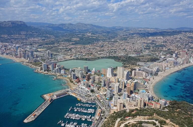
Costa Blanca
The whole coast of Alicante province, with the map, best beaches, itineraries and practical tips.
Costa Blanca guide →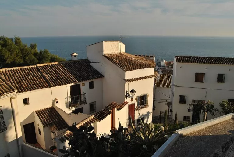
Marina Baixa: Altea, Benidorm and Villajoyosa
Altea’s white old town, Benidorm’s two bays and the Serra Gelada, and Villajoyosa’s painted houses.
Marina Baixa guide →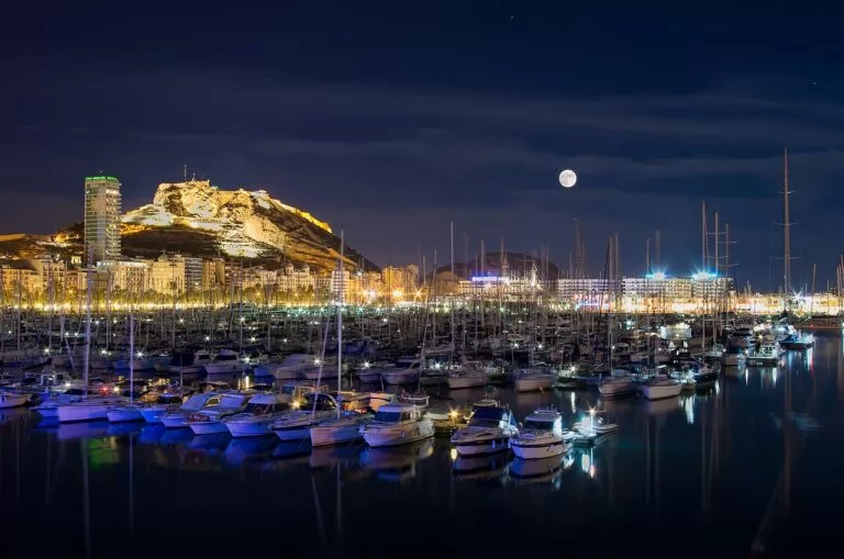
Alicante and Tabarca
The city, its castle and beaches from Postiguet to San Juan, and boats to Tabarca island.
Alicante and Tabarca guide →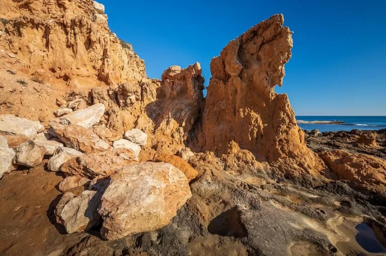
Santa Pola, Torrevieja and Orihuela Costa
Salt lagoons, the Guardamar dunes and long sandy beaches down to Pilar de la Horadada.
South Costa Blanca guide →North of Els Poblets and Pego the coast continues into Valencia province as La Safor; Oliva is the next town.
Sources and freshness
Checked 9 November 2026. Official: Comunitat Valenciana tourism pages on each town (Dénia, Els Poblets, Xàbia, Benitatxell, Teulada-Moraira, Benissa, Calp, Pego) and the beaches, monuments and natural areas linked above; Xàbia tourism (old town, port, beaches, 2026 cove access); Calp town council (Peñón de Ifach, salt flats); spain.info on Dénia and Calp. Distances: OpenStreetMap. Photos: Wikimedia Commons, as credited on the Costa Blanca guide. Not confirmed: train timetables and stations, ferry routes from Dénia, 2027 cove access rules, museum hours; the Dénia and Teulada-Moraira tourism sites and costablanca.org could not be reached from here.
Every place we have mapped on the Marina Alta
26 towns, beaches, coves and landmarks, kept up to date automatically.
- Barranc de l'Infern (Vall de Laguar)
- Benissa
- Cabo de la Nao (Cap de la Nau), Jávea
- Cala de la Fustera (Benissa)
- Cala del Moraig (El Poble Nou de Benitatxell)
- Cala del Portitxol (Jávea)
- Cala Granadella (Jávea)
- Cap de Sant Antoni (Jávea)
- Cova Tallada (Dénia)
- Dénia
- Dénia Castle
- El Arenal beach (Xàbia/Jávea)
- Illa del Portitxol (Jávea)
- Jávea (Xàbia)
- Les Rotes coves (Dénia)
- Les Rotes to Torre del Gerro walk (Dénia)
- Marina de Dénia (Dénia)
- Mediterráneo Camper Area
- Mirador de la Creu del Portitxol (Jávea)
- Montgó (Dénia and Xàbia)
- Moraira (Teulada)
- Paraiso Camper
- Peñón de Ifach (Calpe)
- Port of Calpe and Real Club Náutico (Calp)
- Salinas de Calp (Calpe salt flats)
- Wecamp Jávea