
Balearic Islands · Mallorca
Mallorca travel guide: Palma, the Tramuntana, Alcúdia and the calas
The largest Balearic island: a capital with a Gothic cathedral and old fishing quarters, a World Heritage mountain coast, two great northern bays, small coves on the east coast and long white beaches in the south.
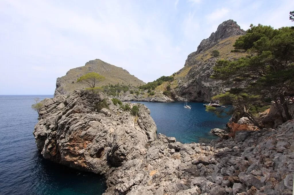
Sa Calobra at the mouth of the Torrent de Pareis · Photo: Harald Hoyer, CC BY-SA 2.0
Part of the Balearic Islands guide · Island 1: Mallorca
Mallorca is the largest of the Balearic Islands, in the western Mediterranean; its capital Palma lies on the bay of the same name in the south-west, about 8 km from the island’s airport. The Serra de Tramuntana runs along the north-west coast from Andratx to Cape Formentor, the bays of Pollença and Alcúdia open to the north-east, the east coast is a chain of small coves, and the south has long, low beaches such as Es Trenc (spain.info).
At a glance
- Where the whole island: Palma and its bay, the Tramuntana coast from Sant Elm to Cape Formentor, the bays of Pollença and Alcúdia, the east coast from Cala Ratjada to Cala d’Or, and the south from Colònia de Sant Jordi to S’Arenal.
- Towns Palma; Calvià and Andratx; Valldemossa, Deià and Sóller; Pollença and Alcúdia; Artà and Cala Ratjada; Porto Cristo; Santanyí and Colònia de Sant Jordi.
- Best for a city break with beaches, mountain walking on the GR 221, sheltered family beaches in the north, coves for snorkelling, caves, and a boat trip to Cabrera.
- Getting there Palma airport is about 8 km from the city on the Ma-19, with direct flights to many European cities; ferries link Palma with the other islands, Barcelona, Valencia, Alicante and Dénia (spain.info).
Map of Mallorca
The map shows the places on Mallorca that have a CostaMap page. Tick a place type to filter, and click a marker to see the place in the panel.
Place type
Area · next level
 Island map
Mallorca
Click a marker to see the place here. Palma and its bay, the Tramuntana coast, the bays of Pollença and Alcúdia, the east-coast calas and the sandy south.
Towns and districtsTowns and districts
We go round the island clockwise from Palma: the city and its bay, the Tramuntana coast, the northern bays, the east coast and the south. Descriptions are from spain.info, Spain’s official tourism site, and its beach sheets; distances are in a straight line from OpenStreetMap.
Palma old town
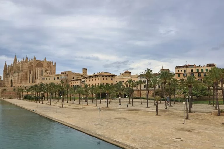
Spain.info names the Cathedral, the Almudaina Palace, the Llotja and the main square as the sights not to miss. The cathedral stands on the old city walls, with an interior reworked by Gaudí and a ceramic chapel by Miquel Barceló (spain.info); the Almudaina was built in 1305–1314 as the palace of the kings of Mallorca (spain.info). Shops line the Passeig del Born. See our Palma Cathedral guide and the Palma page.
Santa Catalina
Santa Catalina is the old quarter just west of the walled town. It grew from the fishermen’s settlement of El Jonquet, whose windmills still stand, and keeps low houses with Mallorcan shutters, a covered market selling local produce and the restored Mar i Terra theatre of 1898 (Catalan Wikipedia). Its streets are full of restaurants, and spain.info lists Porta de Santa Catalina among Palma’s eating areas.
Portixol and El Molinar
East of the cathedral, the promenade and cycle lane pass Can Pere Antoni, Palma’s 750 m town beach (spain.info), then reach the old fishing harbour of Es Portixol and El Molinar, a seafaring and working-class quarter about 4 km from the centre, named after the windmills that stood here in the 19th century (Catalan Wikipedia). Ciudad Jardín, further east, has a 450 m beach suited to small children (spain.info).
Bellver, Cala Major and the western bay
West of the centre, the round Bellver Castle that King James II built as a royal residence stands on a wooded hill (spain.info): see our new Bellver Castle guide. Below it, Cala Major has a 200 m town beach (spain.info) and the Pilar and Joan Miró Foundation, where Miró worked from 1956 until 1983 (spain.info).
S’Arenal and the eastern bay
The bay continues south-east past the airport to the Platja de Palma and S’Arenal, where the town of Llucmajor has a marina (spain.info). Families come for Aqualand El Arenal, a seasonal water park.
Calvià: Portals Nous, Magaluf, Santa Ponça and Peguera
Calvià has more than 50 km of coast: exclusive hotels at Illetes, one of the island’s most exclusive marinas at Portals Nous, water sports on the beaches of Palmanova, Magaluf and Santa Ponça, and a quieter Peguera among pines (spain.info). Magaluf’s 950 m beach faces the islet of Sa Porrassa (spain.info). See our Puerto Portals and Western Water Park guides and the Calvià page.
Andratx, Port d’Andratx and Sant Elm
Andratx, 28 km from Palma, lies among pines and almond trees below the Galatzó peak, with watchtowers built against Berber raids. Off Sant Elm, with its 200 m beach (spain.info), lies Sa Dragonera, a nature reserve with more than twenty endemic species (spain.info). See our Port d’Andratx and Sa Dragonera guides and the Andratx page.
Banyalbufar and Estellencs
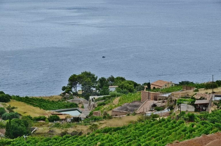
Here begins the Serra de Tramuntana, a UNESCO cultural landscape of terraces and medieval water systems, with Estellencs and Deià among its historic villages (spain.info). Banyalbufar’s terraced fields drop to the sea, and the Ses Ànimes watchtower is its viewpoint (spain.info). See our Mirador de Ses Ànimes and Serra de Tramuntana guides and the Banyalbufar page.
Valldemossa
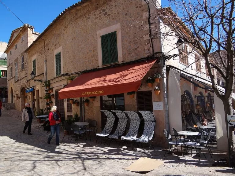
Valldemossa, 17 km from Palma, is a village of steep streets and stone houses with green shutters (spain.info). Its Charterhouse, a royal palace of 1309, housed Carthusian monks from 1399 to 1835; Chopin composed his Preludes Op. 28 here and George Sand wrote A Winter in Majorca (spain.info). A road drops to the fishing harbour of Port de Valldemossa. See the Valldemossa page.
Deià and Son Marroig
Deià climbs a hill above the sea and has long drawn painters and writers. Nearby are the monastery of Miramar, where Ramon Llull taught, and Son Marroig, the Archduke Ludwig Salvator’s house and museum (spain.info). For Cala Deià, a cove of rock and gravel, you leave the car about 300 m away (spain.info). See our Mirador de Sa Foradada guide and the Deià page.
Sóller and Port de Sóller
Sóller fills a valley of citrus and olive groves, reached from Palma on the historic train, and has the church of Sant Bartomeu and the Modernista Can Prunera (spain.info); an old tram runs on to Port de Sóller (spain.info). See our Port de Sóller guide and the Sóller and Fornalutx pages.
Sa Calobra, Cala Tuent and Escorca
Below Puig Major (1,445 m), the Ma-2141 winds down to Sa Calobra, a pebble cove with restaurants and a pier for tourist boats (spain.info); Cala Tuent next door is quieter (spain.info). Sa Calobra is the end of the Torrent de Pareis gorge walk.
Pollença, Port de Pollença and Formentor
In Pollença, 365 steps climb the Calvari to a chapel and a Roman bridge crosses the Sant Jordi stream (spain.info). Port de Pollença, about 6 km east, starts the 13.5 km road to Cape Formentor (Wikipedia); Formentor beach has 840 m of white sand (spain.info). See our Mirador Es Colomer and Talaia d’Albercutx guides and the Pollença page.
Alcúdia and Port d’Alcúdia
Alcúdia keeps two gates of its medieval walls and, beside them, the remains of the Roman city of Pollentia, with houses, a theatre and the forum (spain.info). Below the town, Alcúdia beach runs 3,400 m along the bay, backed by pines, with calm water and the Alcudiamar marina (spain.info).
Platja de Muro, S’Albufera and Can Picafort
Platja de Muro has a little under 6 km of white sand and shallow water; its central stretch lies inside S’Albufera natural park, the largest wetland in the Balearics, and lifeguards work in high season (spain.info). More than two hundred bird species can be seen in S’Albufera (spain.info). Can Picafort has a 1,300 m beach (spain.info). See the Muro and Santa Margalida pages.
Artà, Capdepera and Cala Ratjada
Artà is crowned by the walled enclosure of Sant Salvador, with the talaiotic village of Ses Païsses close by (spain.info). Cala Ratjada keeps a fishing-village feel; from its lighthouse you can see Menorca on clear days (spain.info). Its main beach is Cala Agulla (spain.info), and Cala Torta, towards Artà, is wholly unbuilt (spain.info). See the Artà and Capdepera pages.
Cala Millor and Sa Coma
Cala Millor, shared by Son Servera and Sant Llorenç des Cardassar, is the largest resort on the east coast, with a 1.8 km beach (Wikipedia). Sa Coma, just south, has 890 m of fine sand and access for wheelchair users (spain.info). See the Son Servera and Sant Llorenç pages.
Porto Cristo and the Manacor coast
Manacor is the island’s second town; around Porto Cristo, on its coast, are the caves of Drac, Hams and Pirata (spain.info). The Drach Caves tour ends at Lake Martel, one of the largest underground lakes in the world, with a short concert from boats (spain.info). See our Cala Varques guide and the Manacor page.
Cala d’Or, Mondragó and Santanyí
Santanyí has the resort of Cala d’Or, with a small white-sand cove among pines (spain.info), and the Mondragó natural park of dunes, woods and wetland birds, with a visitor centre by the Ses Fonts de n’Alis car park (spain.info). Further south are Cala Llombards (spain.info) and the tiny Caló des Moro. See the Santanyí page.
Colònia de Sant Jordi, Es Trenc and Cabrera
Colònia de Sant Jordi, in Ses Salines, began as a fishing village and became an agricultural colony in 1879 (Catalan Wikipedia). Es Carbó looks out to Cabrera (spain.info), and to the north-west lies Es Trenc, the last undeveloped sandy beach of Mallorca: see our new Es Trenc guide. Boats from the village reach the Cabrera national park. See the Ses Salines and Campos pages.
The Llucmajor coast: Cala Pi and S’Estanyol
Llucmajor has a cliff coast with the coves of Cala Mosques and Cala Pi, a marina at S’Estanyol, 16th-century watchtowers and the prehistoric village of Capocorb Vell (spain.info). See the Llucmajor page.
Inland, the towns of the Pla de Mallorca make easy day trips: see our pages on Petra, Sineu, Algaida, Alaró, Bunyola, Esporles, Felanitx and Porreres.
Beaches and coves
Long sandy bays in the north and south, small calas on the east coast, pebble coves in the mountains (sizes from spain.info).
Es Trenc
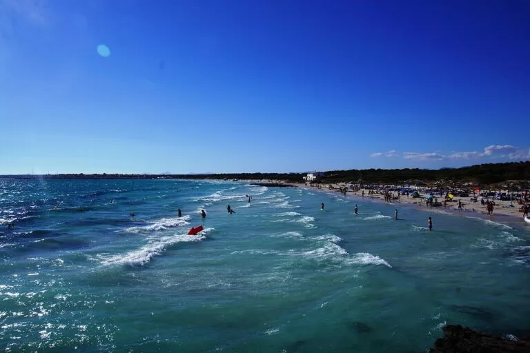
3,000 m of white sand with calm water, the last unbuilt beach of the island, in a 1,492 ha protected area; nudism in one part (spain.info).
See the Es Trenc guide →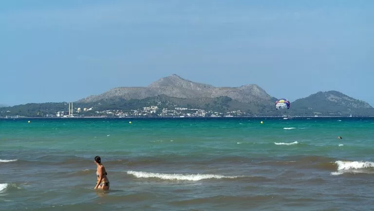
Platja de Muro
Almost 6 km of shallow water and white sand, with lifeguards in high season and boardwalks for wheelchair users (spain.info).
See the Muro page →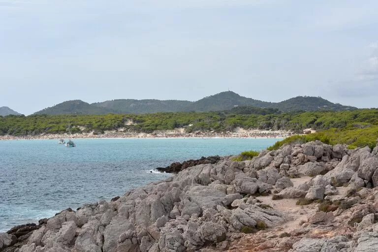
Cala Agulla
520 m of white sand facing the open sea near Cala Ratjada, with sunbed and boat hire (spain.info).
See the Capdepera page →- Caló des Moro and Cala Varques – small, unbuilt coves on the south-east and east coasts, reached on foot: see the Caló des Moro and Cala Varques guides.
- Formentor – 840 m of white sand with calm water at the foot of the Formentor peninsula, reached by road or boat (spain.info).
- Es Caragol – 500 m of white sand near Cap de ses Salines, reached only on foot or by boat (spain.info).
Things to do
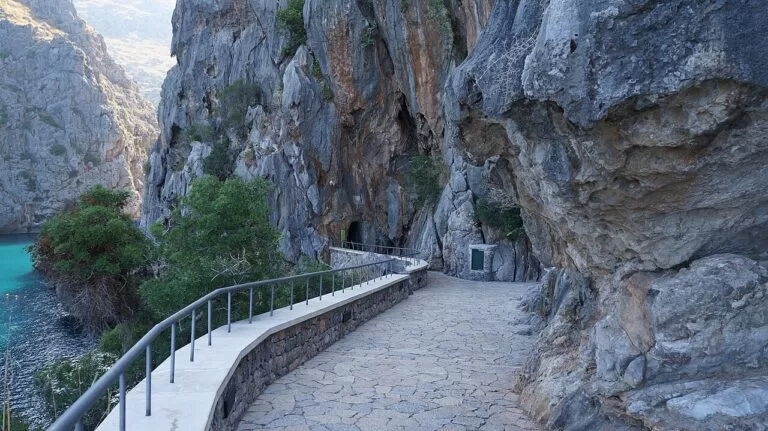
Nature: mountains, wetlands and islands
The Tramuntana is the island’s main water reserve, home of the black vulture and the osprey, crossed by the Dry Stone Route (GR 221) (spain.info). S’Albufera has marshes, canals and a small bird museum (spain.info). Offshore, the 19 islands and islets of Cabrera form a national park one hour by boat from Mallorca, with nine walking routes (spain.info).
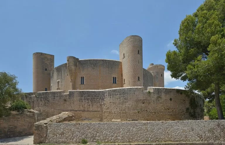
History: talaiots, Romans and kings
Prehistoric Mallorca survives at Ses Païsses near Artà and Capocorb Vell near Llucmajor; the Romans founded Pollentia beside Alcúdia; the kings of Mallorca built the Almudaina, Bellver Castle and the Valldemossa palace in the early 14th century. Palma’s Art Nouveau route runs from the Balearic Parliament to Plaça Weyler and Gaudí’s work in the cathedral (spain.info).
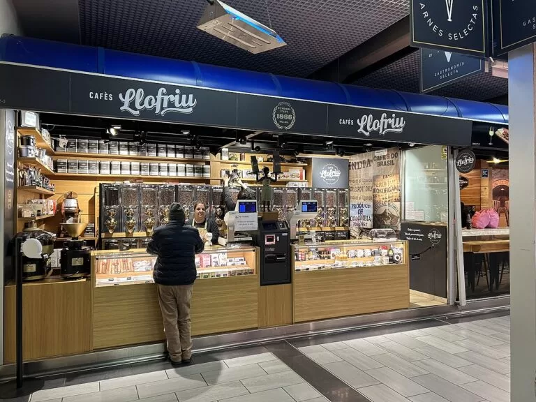
Food and markets
Mallorcan cooking means soups, tumbet (potatoes, peppers and aubergine with tomato), sobrassada, a pork and paprika spread, and cheese with a designation of origin (spain.info). In Palma, the Santa Catalina market still sells local produce, and spain.info recommends the restaurants of the Llotja quarter and the Born.
Where to stay by town
The bases we would choose, by part of the island.
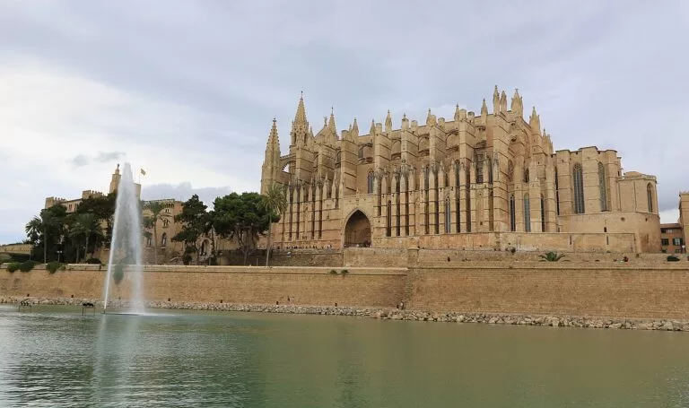
Palma
The old town, Santa Catalina or Portixol for museums, restaurants and the airport 8 km away; buses and the train reach most of the island. Best without a car.
City and culture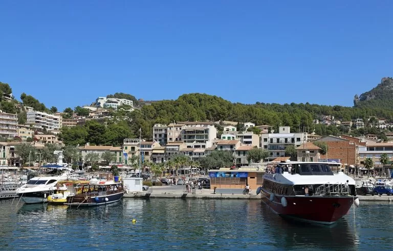
Sóller and Port de Sóller
The best base for the Tramuntana: walks, the historic train to Palma, boats along the coast and a sheltered bay for swimming.
Walkers and couples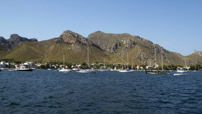
Pollença and Alcúdia
An old town or a port on two big, calm bays, with Formentor, S’Albufera and Pollentia close by. Good for families and cyclists.
Families and beaches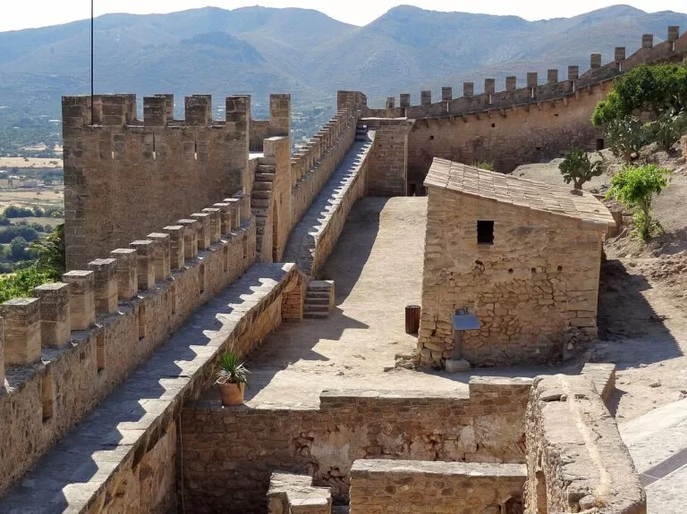
The east: Cala Ratjada to Cala d’Or
Resorts and villages close to small calas, the caves of Porto Cristo and Mondragó. Busy in summer; book early.
Coves and snorkellingColònia de Sant Jordi
A small resort between Es Trenc and Es Carbó, with the boats to Cabrera.
Beaches and natureGetting there and around
By air and sea
Palma airport is about 8 km from the city; bus line 1 runs to the centre and the port, A2 to S’Arenal (spain.info). Ferries link Palma with the other islands, Barcelona, Valencia, Alicante and Dénia (spain.info).
By train and bus
Island trains run from Palma to Inca, Sa Pobla and Manacor, and the heritage train climbs to Sóller (spain.info). Intercity buses serve the resorts; we could not open the TIB timetables.
By car
A car makes the coves, the Tramuntana villages and the lighthouses much easier. The Ma-10 serves the Tramuntana coast at Deià and Banyalbufar, and the Ma-19 motorway links the airport with Palma.
A two-day route
By car, with a night in Palma or Sóller.
Day 1
Palma: cathedral, old town, Santa Catalina and Bellver
Start at the cathedral and the Almudaina, lunch in Santa Catalina, go up to Bellver Castle in the afternoon and end with a seafront walk to Portixol and El Molinar.
Day 2
Valldemossa, Deià and Sóller
Drive to Valldemossa for the Charterhouse, stop at Son Marroig for Sa Foradada, continue through Deià to Sóller and take the tram to Port de Sóller.
FAQ
What is the best part of Mallorca to stay in?
Palma without a car; Sóller for walking; the bays of Pollença and Alcúdia for families; the east coast for coves; Colònia de Sant Jordi for Es Trenc and Cabrera.
How far is Palma airport from the city?
About 8 km. Bus line 1 runs from the terminal to the centre and the port, and taxis wait on level 0 of the arrivals area (spain.info).
Can you get around Mallorca without a car?
Partly. Trains run from Palma to Inca, Sa Pobla, Manacor and Sóller, and buses serve the resorts, but the coves and mountain villages are much easier by car.
Which is the longest beach in Mallorca?
Among the beaches spain.info lists, Platja de Muro on the Bay of Alcúdia, at a little under 6 km, and the neighbouring beach of Alcúdia, 3,400 m. In the south, Es Trenc is the longest unbuilt beach.
How do you get to the Serra de Tramuntana from Palma?
By car on the roads to Valldemossa, Sóller or Andratx, or on the heritage train from Palma to Sóller. The GR 221 Dry Stone Route crosses the range on foot.
Can you visit Cabrera from Mallorca?
Yes, only by boat; spain.info puts it about one hour from Mallorca. Private boats need prior permission. See our Cabrera guide.
Other areas of the Balearic Islands
Balearic Islands
Mallorca, Menorca, Ibiza and Formentera, with the map and the inland towns of Mallorca.
Balearic Islands guide →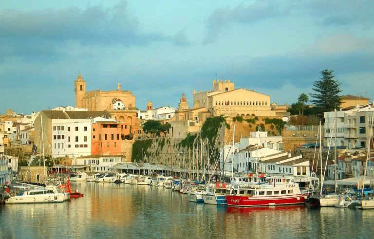
Menorca
Maó’s great harbour, the old town of Ciutadella and the calas of the north and south coasts.
Menorca guide →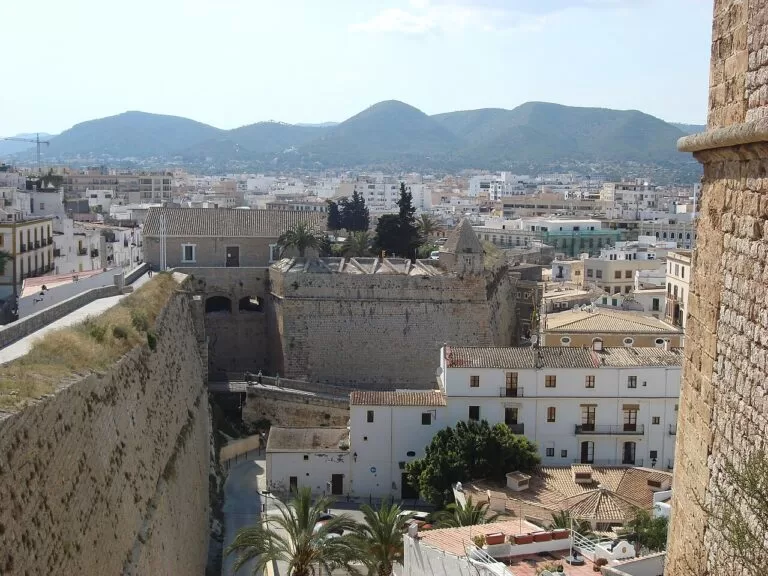
Ibiza
The walled upper town of Dalt Vila, Sant Antoni, Santa Eulària and the quiet north.
Ibiza guide →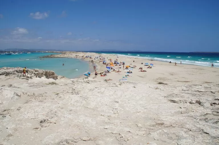
Formentera
The smallest island, reached only by boat, with the shallow water of Ses Illetes.
Formentera guide →Sources and freshness
Checked 7 November 2026. Spain.info (Turespaña): the destination pages for Palma, Calvià, Andratx, Banyalbufar, Valldemossa, Deià, Sóller, Pollença, Alcúdia, Artà, Cala Ratjada, Manacor and Llucmajor; the pages on Palma airport, the cathedral, the Almudaina, Bellver Castle, the Miró Foundation, the Valldemossa Charterhouse, Art Nouveau Palma, the Serra de Tramuntana, S’Albufera, Mondragó, Cabrera and the Drach Caves; and its beach sheets, linked in the text. Background: Wikipedia on Santa Catalina, El Molinar, Colònia de Sant Jordi, Port de Pollença and Cala Millor. Map data and distances: OpenStreetMap (ODbL). The Balearic tourist board returned server errors and the Consell de Mallorca, Palma city and TIB sites could not be reached, so timetables and opening hours are not given. Photos from Wikimedia Commons: Harald Hoyer (CC BY-SA 2.0); Fedoce1 (CC BY-SA 4.0); King Otto, trolvag, Isiwal, Wolfgang Moroder, Foto Fitti and LANOEL (CC BY-SA 3.0); Nikolai Bakhmarov, Marc Ryckaert, Olaf Tausch, anibal amaro and Emanuela Meme Giudici (CC BY 3.0); MARIA ROSA FERRE (CC BY-SA 2.0); Fullet (CC0).
Every place we have mapped on the Mallorca
19 towns, beaches, coves and landmarks, kept up to date automatically.
- Aqualand El Arenal (Mallorca)
- Bellver Castle (Palma, Mallorca)
- Cabrera Island (Cabrera Archipelago National Park)
- Cala Varques (Manacor, Mallorca)
- Caló des Moro (Santanyí, Mallorca)
- Cuevas del Drach (Caves of Drach, Porto Cristo, Mallorca)
- Es Trenc beach (Campos, Mallorca)
- Mirador de Sa Foradada (Son Marroig, Deià)
- Mirador de Ses Ànimes (Banyalbufar, Mallorca)
- Mirador Es Colomer (Formentor, Pollença)
- Palma Cathedral (La Seu)
- Port d'Andratx (Andratx, Mallorca)
- Port de Sóller (Sóller, Mallorca)
- Puerto Portals (Portals Nous, Calvià)
- Sa Dragonera (Sant Elm, Andratx)
- Serra de Tramuntana (Mallorca)
- Talaia d'Albercutx walk (Formentor, Mallorca)
- Torrent de Pareis (Escorca, Mallorca)
- Western Water Park (Magaluf, Mallorca)